Near Empire in Leelanau County, Michigan — The American Midwest (Great Lakes)
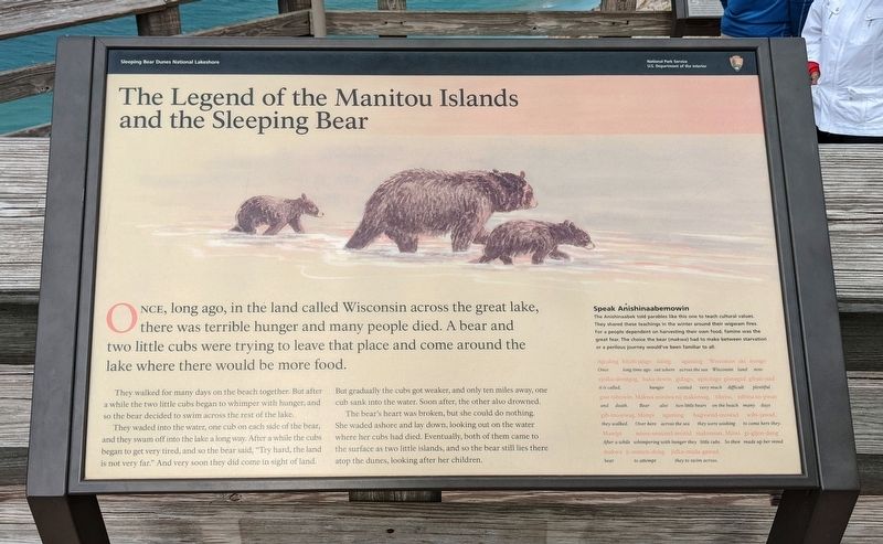
The Legend of the Manitou Islands and the Sleeping Bear
Sleeping Bear Dunes National Lakeshore
— National Park Service, U.S. Department of the Interior —
Once, long ago, in the land called Wisconsin across the great lake, there was terrible hunger and many people died. A bear and two little cubs were trying to leave that place and come around the lake where there would be more food.
They walked for many days on the beach together. But after a while the two little cubs began to whimper with hunger, and so the bear decided to swim across the rest of the lake.
They waded into the water, one cub on each side of the bear, and they swam off into the lake a long way. After a while the cubs began to get very tired, and so the bear said, "Try hard, the land is not very far." And very soon they did come in sight of land. But gradually the cubs got weaker, and only ten miles away one cub sank into the water. Soon after, the other also drowned.
The bear's heart was broken, but she could do nothing. She waded ashore and lay down, looking out on the water where her cubs had died. Eventually, both of them came to the surface as two little islands, and so the bear still lies there atop the dunes, looking after her children.
Speak Anishinaabemowin
The Anishinaabek told parables like this one to teach cultural values. They shared these teachings in the winter around their wigwam fires. For a people dependent on harvesting their own food, famine was the great fear. The choice the bear (makwa) had to make between starvation or a perilous journey would've been familiar to all.
Agoding kitchi jajigo iiaing agaming Wisconsin adki nongo
Once long time ago out where across the sea Wisconsin land now
ejnika-demigog, baka dewin gidago, apitchigo gisnagad gibati-nad
it is called, hunger existed very much difficult plentiful
gaie nibowin. Makwa miniwa nij makonsa, tibeiw, nibina so-gwan
and death. Bear also two little bears on the beach many days
gib-mosewag. Manpi agaming bagosend-mowad wibi-jawad.
they walked. Over here across the sea they were wishing to come here they.
Mawipi mises-sesnand-monid makonsan. Miiwi gi-gijen-dang
After a while whimpering with hunger they little cubs. So then made up her mind
makwa ji-manen-dong jidka-mada-gawad.
bear to attempt they to swim across.
Erected by National Park Service, U.S. Department of the Interior.
Topics. This historical marker is listed in these topic lists: Anthropology & Archaeology
• Communications • Landmarks • Native Americans • Natural Features.
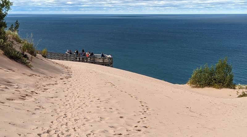
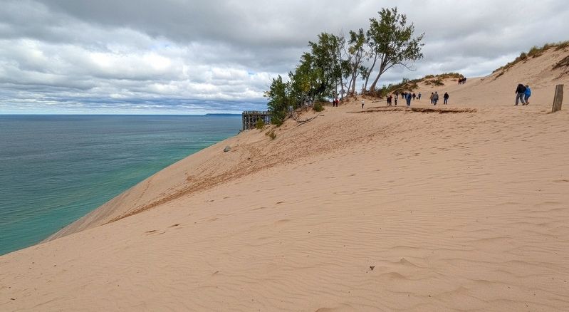
Location. 44° 51.504′ N, 86° 4.022′ W. Marker is near Empire, Michigan, in Leelanau County. Marker can be reached from Pierce Stocking Scenic Drive, 2.1 miles west of South Dune Highway, on the right when traveling west. Marker is a wayside exhibit on the viewing platform at Lake Michigan Overlook, which is stop #9 on Pierce Stocking Scenic Drive. Touch for map. Marker is in this post office area: Empire MI 49630, United States of America. Touch for directions.
Other nearby markers. At least 8 other markers are within 11 miles of this marker, measured as the crow flies. Of Wrecks and Water Trails (here, next to this marker); Mother Bear Is Migrating (here, next to this marker); Pierce Stocking (approx. 1.4 miles away); Sand and Ice (approx. 2 miles away); The Moving Dune (approx. 2.1 miles away); Empire Methodist Church (approx. 3.3 miles away); Sleeping Bear Point Life Saving Station. (approx. 3.8 miles away); North Unity (approx. 10½ miles away). Touch for a list and map of all markers in Empire.
Credits. This page was last revised on October 23, 2022. It was originally submitted on October 16, 2022. This page has been viewed 237 times since then and 68 times this year. Photos: 1, 2, 3. submitted on October 16, 2022. • Devry Becker Jones was the editor who published this page.


