Riverview in St. Louis, Missouri — The American Midwest (Upper Plains)
North Riverfront Park
Mississippi Greenway
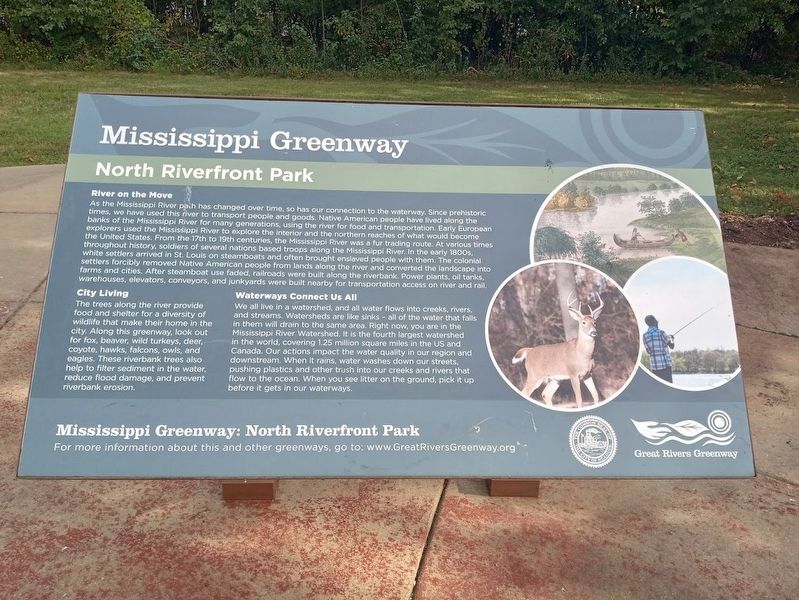
River on the Move
As the Mississippi River path has changed over time, so has our connection to the waterway. Since prehistoric times, we have used this river to transport people and goods. Native American people have lived along the banks of the Mississippi River for many generations, using the river for food and transportation. Early European explorers used the Mississippi River to explore the interior and the northern reaches of what would become the United States. From the 17th to 19th centuries, the Mississippi River was a fur trading route. At various times throughout history, soldiers of several nations based troops along the Mississippi River. In the early 1800s, white settlers arrived in St. Louis on steamboats and often brought enslaved people with them. The colonial settlers forcibly removed Native American people from lands along the river and converted the landscape into farms and cities. After steamboat use faded, railroads were built along the riverbank. Power plants, oil tanks, farms and cities. After steamboat use faded, railroads were built along the riverbank. Power plants, oil tanks, warehouses, elevators, conveyors, and junkyards were built nearby for transportation access on river and rail.
City Living
The trees along the river provide food and shelter for a diversity of wildlife that make their home in the city. Along this greenway, look out for fox, beaver, wild turkeys, deer, coyote, hawks, falcons, owls, and eagles. These riverbank trees also help to filter sediment in the water, reduce flood damage, and prevent riverbank erosion.
Waterways Connect Us All
We all live in a watershed, and all water flows into creeks, rivers, and streams. Watersheds are like sinks - all of the water that falls in them will drain to the same area. Right now, you are in the Mississippi River Watershed. It is the fourth largest watershed in the world, covering 1.25 million square miles in the US and Canada. Our actions impact the water quality in our region and downstream. When it rains, water washes down our streets, pushing plastics and other trash into our creeks and rivers that flow to the ocean. When you see litter on the ground, pick it up before it gets in our ways.
Erected by the City of St. Louis and Great Rivers Greenway.
Topics. This historical marker is listed in these topic lists: Environment • Settlements & Settlers • Waterways & Vessels.
Location. 38° 44.057′ N, 90° 12.651′ W. Marker is in St. Louis, Missouri. It is in Riverview. Marker is on Riverview Drive (State Highway H) south of
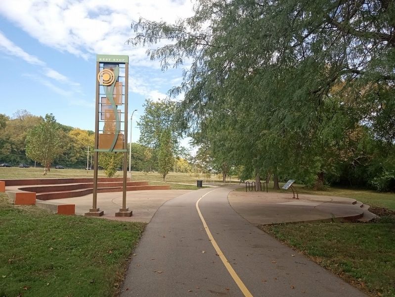
Scranton Avenue. Marker can be accessed from the south entrance of North Riverfront Park, and is located off of Riverfront Trail. Touch for map. Marker is at or near this postal address: 9400 Riverview Dr, Saint Louis MO 63137, United States of America. Touch for directions.
Other nearby markers. At least 8 other markers are within 3 miles of this marker, measured as the crow flies. Nimíipuu (Nez Perce) (approx. 2.4 miles away); Founders of Saint Louis, Missouri (approx. 2.4 miles away); Rev. A. [Aloys] V. Garthoeffner (approx. 2.4 miles away); Rev. John C. Granville (approx. 2½ miles away); Rev. James J. Toomey (approx. 2½ miles away); Father Thomas Ambrose Butler (approx. 2½ miles away); Rev. Ambrose J. Heim (approx. 2½ miles away); Rev. Constantine P. Smith (approx. 2½ miles away). Touch for a list and map of all markers in St. Louis.
Regarding North Riverfront Park. Sometime after 2020, this marker replaced a similar Great Rivers Greenway one with the former "red format" that had more historical text on it but a lot of it was omitted on this newer one.
Also see . . .
1. Mississippi Greenway. From the Great Rivers Greenway website, there is some information about the 15-mile trail that starts at the Riverfront Trail lot (at Biddle and Leonor K Sullivan) and goes to North Riverfront Park (near the Old Chain of Rocks Bridge). (Submitted on October 17, 2022, by Jason Voigt of Glen Carbon, Illinois.)
2. North Riverfront Park on Wikipedia. (Submitted on October 17, 2022, by Jason Voigt of Glen Carbon, Illinois.)
Credits. This page was last revised on January 30, 2023. It was originally submitted on October 17, 2022, by Jason Voigt of Glen Carbon, Illinois. This page has been viewed 76 times since then and 15 times this year. Photos: 1, 2. submitted on October 17, 2022, by Jason Voigt of Glen Carbon, Illinois.

