St. Augustine in St. Johns County, Florida — The American South (South Atlantic)
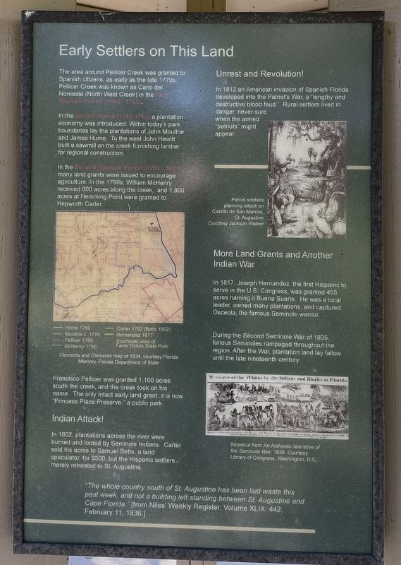
Early Settlers on This Land
Faver-Dykes State Park
In the British Period (1763 - 1783) a plantation economy was introduced. Within today's park boundaries lay the plantations of John Moultrie and James Hume. To the west John Hewitt built a sawmill on the creek furnishing lumber for regional construction.
In the Second Spanish Period (1783 - 1821) many land grants were issued to encourage agriculture. In the 1790s, William McHenry received 800 acres along the creek, and 1,800 acres at Hemming Point were granted to Hepworth Carter.
Francisco Pellicer was granted 1,100 acres south the creek, and the creek took on his name. The only intact early land grant, it is now "Princess Place Preserve," a public park.
Indian Attack!
In 1802, plantations across the river were burned and looted by Seminole Indians. Carter sold his acres to Samuel Betts, a land speculator, for $500, but the Hispanic settlers merely retreated to St. Augustine.
Unrest and Revolution!
In 1812 an American invasion of Spanish Florida developed into the Patriot's War, a "lengthy and destructive blood feud." Rural settlers lived in danger, never sure when the armed "patriots" might appear.
More Land Grants and Another Indian War
In 1817, Joseph Hernandez, the first Hispanic to serve in the U.S. Congress, was granted 455 acres naming it Buena Suerte. He was a local leader, owned many plantations, and captured Osceola, the famous Seminole warrior.
During the Second Seminole War of 1835, furious Seminoles rampaged throughout the region. After the War, plantation land lay fallow until the late nineteenth century.
"The whole country south of St. Augustine has been laid waste this past week, and not a building left standing between St. Augustine and Cape Florida." [from Niles' Weekly Register, Volume XLIX: 442, February 11, 1836.]
(captions)
Clements and Clements map of 1834, courtesy Florida Memory, Florida Department of State
Patriot soldiers planning attack on Castillo de San Marcos, St. Augustine. Courtesy Jackson Walker
Woodcut from An Authentic Narrative of the Seminole War, 1936. Courtesy Library of Congress, Washington, D.C.
Erected by Faver-Dykes State Park.
Topics. This historical marker is listed in these topic lists: Exploration • Native Americans • Parks & Recreational Areas • Wars, US Indian. A significant historical year for this entry is 1565.
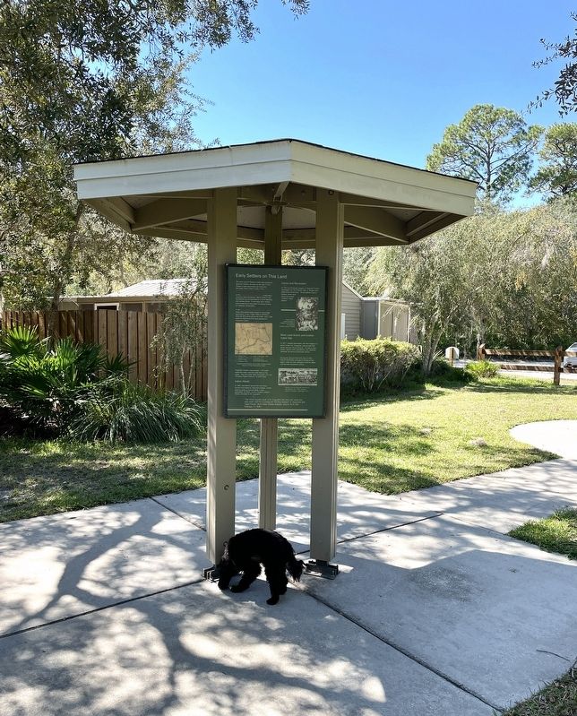
Location. 29° 40.22′ N, 81° 15.113′ W. Marker is in St. Augustine, Florida, in St. Johns County. Marker can be reached from Faver Dykes Road, 3 miles east of Dixie Highway (U.S. 1). Located on the grounds of Faver-Dykes State Park adjacent to the ranger station. Touch for map. Marker is at or near this postal address: 1000 Faver Dykes Rd, Saint Augustine FL 32086, United States of America. Touch for directions.
Other nearby markers. At least 8 other markers are within 3 miles of this marker, measured as the crow flies. People Have Been in Northeast Florida for 7,500 years (here, next to this marker); Welcome to Hiram Faver Trail (here, next to this marker); Princess Place Estate (approx. 1.2 miles away); Marineland-The World’s First Oceanarium (approx. 2.3 miles away); Marineland (approx. 2.3 miles away); Submarine Hill (approx. 2.4 miles away); Middens And Mounds (approx. 2˝ miles away); Coquina (approx. 2˝ miles away). Touch for a list and map of all markers in St. Augustine.
Also see . . . Florida State Parks. (Submitted on October 17, 2022, by Brandon D Cross of Flagler Beach, Florida.)
Credits. This page was last revised on October 17, 2022. It was originally submitted on October 17, 2022, by Brandon D Cross of Flagler Beach, Florida. This page has been viewed 232 times since then and 68 times this year. Photos: 1, 2. submitted on October 17, 2022, by Brandon D Cross of Flagler Beach, Florida. • Bernard Fisher was the editor who published this page.

