Sandy Hook in Middletown Township in Monmouth County, New Jersey — The American Northeast (Mid-Atlantic)
Discover Sandy Hook
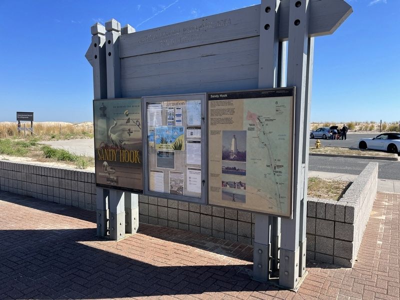
Go Beyond The Beach
| — | Gateway National Recreation Area | — |

Find a prickly pear cactus. 🌵 Bike or walk a park trail. Search for an egret as you explore the salt marsh. Count the butterflies. 🦋 Go birdwatching. 🐦 Look for holly in our coastal forests.
See how America's oldest lighthouse helped ships navigate the New York Harbor. Meet the people who defended our nation and its coastline. Learn about innovation at the U.S. Army's first weapons proving ground.
Erected by National Park Service, U.S. Department of the Interior.
Topics and series. This historical marker is listed in these topic lists: Colonial Era • Communications • Forts and Castles • Waterways & Vessels. In addition, it is included in the Lighthouses series list. A significant historical year for this entry is 1764.
Location. 40° 25.763′ N, 73° 59.052′ W. Marker is in Middletown Township, New Jersey, in Monmouth County. It is in Sandy Hook. It can be reached from Hartshorne Drive 3.4 miles north of New Jersey Route 36, on the right when traveling north. Touch for map. Marker is in this post office area: Highlands NJ 07732, United States of America. Touch for directions.

Regionally,
this page online
Other nearby markers. At least 8 other markers are within 2 miles of this marker, measured as the crow flies: Sandy Hook (here, next to this marker); a different marker also named Sandy Hook (approx. 0.2 miles away); U.S. Life-Saving Station / Spermaceti Cove - Holly Forest (approx. 0.2 miles away); Spermaceti Cove Station No. 2 (approx. 0.2 miles away); Nike Missile Site (approx. 0.3 miles away); a different marker also named Sandy Hook (approx. 0.9 miles away); a different marker also named Nike Missile Site (approx. 1.4 miles away); British Embarkation (approx. 1.4 miles away). Touch for a list and map of all markers in Middletown Township.
Credits. This page was last revised on February 7, 2023. It was originally submitted on October 18, 2022, by Devry Becker Jones of Washington, District of Columbia. This page has been viewed 184 times since then and 26 times this year. Photos: 1, 2. submitted on October 18, 2022, by Devry Becker Jones of Washington, District of Columbia.
