Southside in San Antonio in Bexar County, Texas — The American South (West South Central)
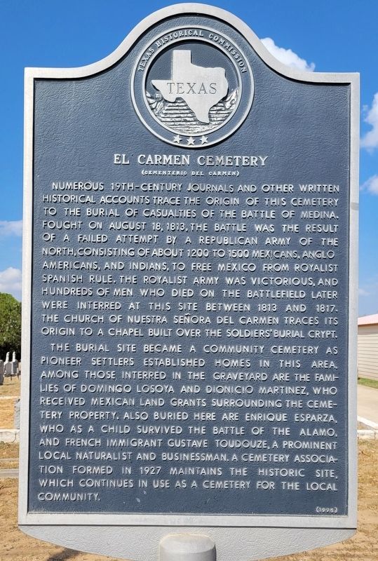
El Carmen Cemetery
(Cementerio del Carmen)
Photographed by James Hulse, October 9, 2022
1. El Carmen Cemetery Marker
The burial site became a community cemetery as pioneer settlers established homes in this area. Among those interred in the graveyard are the families of Domingo Losoya and Dionicio Martinez, who received Mexican land grants surrounding the cemetery property. Also buried here are Enrique Esparza, who as a child survived the Battle of the Alamo, and French immigrant Gustave Toudouze, a prominent local naturalist and businessman. A cemetery association formed in 1927 maintains the historic site, which continues in use as a cemetery for the local community.
Erected 1995 by Texas Historical Commission. (Marker Number 1413.)
Topics. This historical marker is listed in these topic lists: Cemeteries & Burial Sites • Hispanic Americans • Settlements & Settlers • Wars, Non-US. A significant historical date for this entry is August 18, 1813.
Location. 29° 14.398′ N, 98° 28.007′ W. Marker is in San Antonio, Texas, in Bexar County. It is in Southside. It is on Leal Road 0.1 miles north of Martinez Losoya Road, on the left when traveling north. The marker is located at the northeastern entrance to the cemetery. Touch for map. Marker is at or near this postal address: 18555 Leal Road, San Antonio
this page online

Regionally, this marker is in South Texas. It is also in the American South. Globally, it is in North America, a Gulf of Mexico state, the Western Hemisphere, the Western World, and the Anglosphere. Historically, it finds itself in what was once New Spain, the Republic of Texas, and one of the Confederate States of America.
Other nearby markers. At least 8 other markers are within 6 miles of this marker, measured as the crow flies: Enrique Esparza (a few steps from this marker); The Battle of the Medina (approx. 0.4 miles away); Kings Highway Camino Real — Old San Antonio Road (approx. 2.2 miles away); a different marker also named Kings Highway Camino Real — Old San Antonio Road (approx. 4.1 miles away); San Antonio Missions (approx. 5.4 miles away); Mastering New Mysteries (approx. 5½ miles away); a different marker also named Kings Highway Camino Real — Old San Antonio Road (approx. 5½ miles away); Granary (approx. 5½ miles away). Touch for a list and map of all markers in San Antonio.
Also see . . . Battle of Medina. Texas State Historical Association
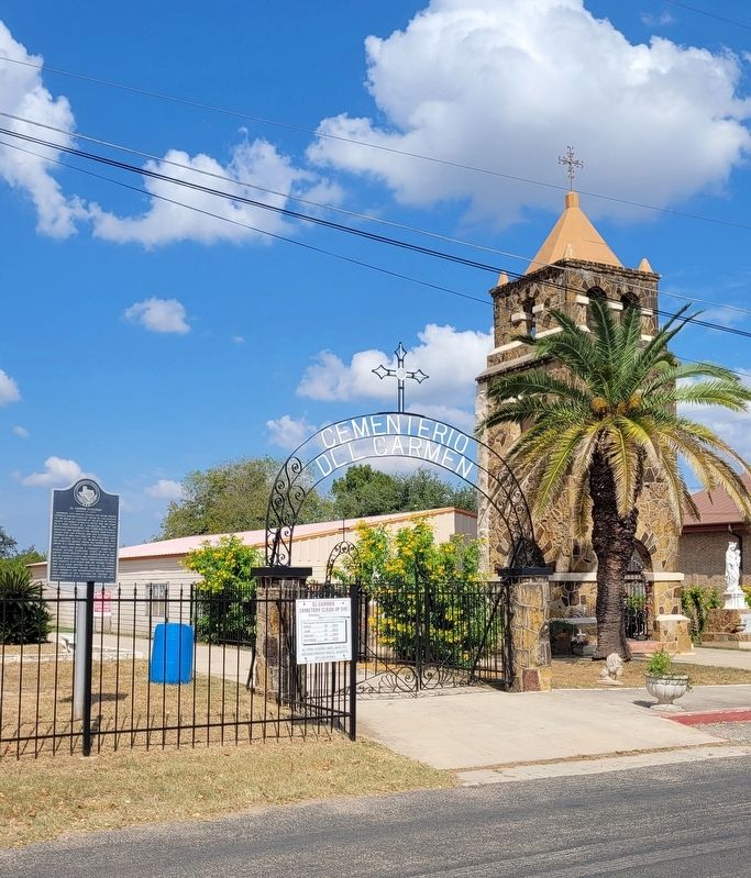
The(Submitted on October 19, 2022, by James Hulse of Medina, Texas.)battle of Medina was fought on August 18, 1813, between the republican forces of the Gutiérrez-Magee expedition under Gen. José Álvarez de Toledo y Dubois and a Spanish royalist army under Gen. Joaquín de Arredondo. This bloodiest battle ever fought on Texas soil took place twenty miles south of San Antonio in a sandy oak forest region then called el encinal de Medina.Photographed by James Hulse, October 9, 20222. The view of the El Carmen Cemetery, Marker and Church
Credits. This page was last revised on August 13, 2025. It was originally submitted on October 19, 2022, by James Hulse of Medina, Texas. This page has been viewed 1,481 times since then and 160 times this year. Photos: 1, 2. submitted on October 19, 2022, by James Hulse of Medina, Texas.
