Greenville in Wayne County, Missouri — The American Midwest (Upper Plains)
The Upper Greenville Bridge, 1906-1947
Greenville Recreation Area
— Wappapello Lake —
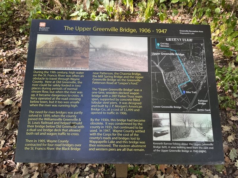
The need for river bridges was partly solved in 1899, when the county joined the Williamsville Greenville & St. Louis Railroad and helped rebuild their bridge below Old Greenville with a dual-use bridge deck that allowed both rail and wagon traffic to cross.
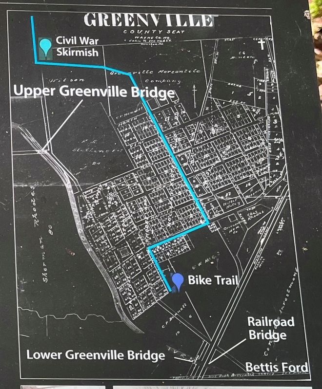
Then in 1905, Wayne County contracted four road bridges over the St. Francis River: the Black Bridge near Patterson, the Chaonia Bridge, the Mill Spring Bridge and the Upper Greenville Bridge on the Greenville-Patterson Road at "Leeper's Ford."
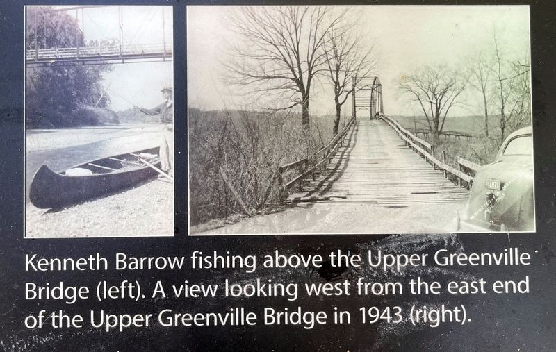
The "Upper Greenville Bridge" was a one-lane, wooden-decked wagon bridge with a 200' Parker Truss main span, supported by concrete filled tubular steel piers. It was designed and built by J.P. Morgan's American Bridge Co., at a cost of $3,499 and opened to traffic in 1906.
By the 1930s, this bridge had become obsolete. It was condemned by the county in 1935, but continued to be used. In 1947, Wayne County settled with the Corps for the cost of the county's roads and bridges lost to Wappapello Lake and this bridge was then removed. The eastern abutment and western piers are all that remain.
Erected by U.S. Army Corps of Engineers, St. Louis District.
Topics. This historical marker is listed in this topic list: Roads & Vehicles. A significant historical year for this entry is 1899.
Location. 37° 6.378′ N, 90° 27.619′ W. Marker is in Greenville, Missouri, in Wayne County. Marker can be reached from U.S. 67, on the right when traveling south. Located along the Greenville Bike Trail, just north of the camping area, in the Greenville Recreation Area of Wappapello Lake. Touch for map. Marker is in this post office area: Greenville MO 63944, United States of America. Touch for directions.
Other nearby markers. At least 8 other markers are within walking distance of this marker. The Civil War in the Missouri - Arkansas Borderlands, 1862-1865 (here, next to this marker); The "Surprise at Greenville," July 20, 1862 (here, next to this marker); Greenville School (approx. 0.4 miles away); Tie-Hacking (approx. 0.4 miles away); Sam Brown (approx. 0.4 miles away); Greenville Jailhouse (approx. 0.4 miles away); The Wayne County Courthouse At Old Greenville (approx. half a mile away); Harry S. Truman (approx. half a mile away). Touch for a list and map of all markers in Greenville.
Photographed By Craig Swain, September 28, 2022
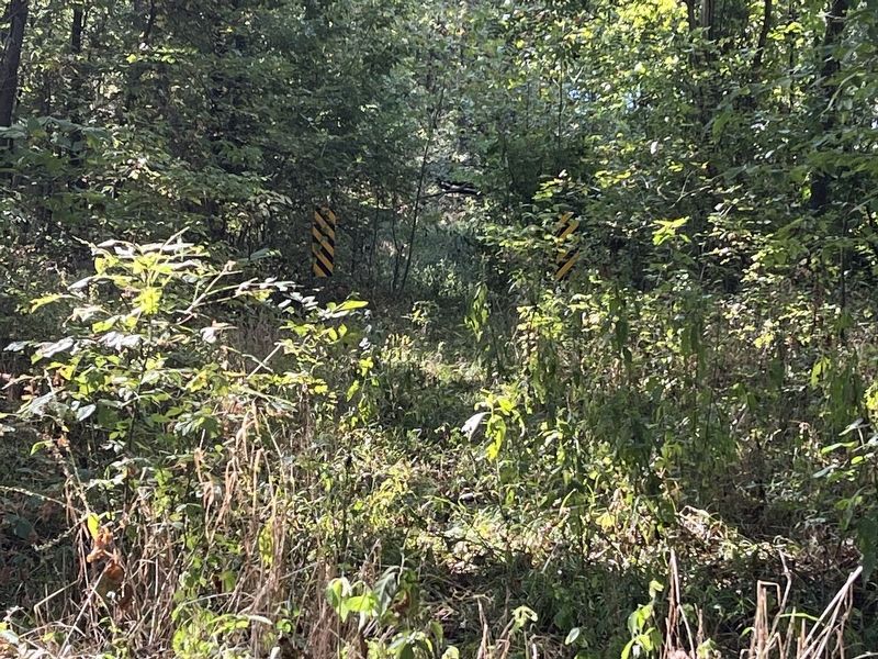
6. Barricades near Bridge Site
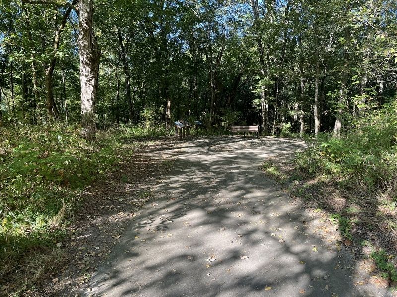
Visible beyond the marker are the traces of the old road bed leading to the bridge. All that remains along the old trace are two barricade warning signs. Somewhere just beyond are the remains of bridge piers mentioned on the marker.
Credits. This page was last revised on October 30, 2022. It was originally submitted on October 30, 2022, by Craig Swain of Leesburg, Virginia. This page has been viewed 99 times since then and 19 times this year. Photos: 1, 2, 3, 4, 5, 6. submitted on October 30, 2022, by Craig Swain of Leesburg, Virginia.
Editor’s want-list for this marker. Photos of the eastern and western pier remains. • Can you help?
