Manassas, Virginia — The American South (Mid-Atlantic)
Liberia
Host of Presidents
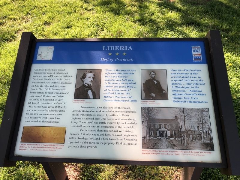
Countless people have passed through the doors of Liberia, but none were as well-known as Jefferson Davis and Abraham Lincoln. Davis watched the First Battle of Manassas on July 21, 1861, and then came here to Gen. P.G.T. Beauregard's headquarters to meet with him and Gen. Joseph E. Johnston before returning to Richmond on July 23. Lincoln came here on June 19, 1862, to visit Gen. Irvin McDowell, who was recovering after his horse fell on him. Ice cream—a scarce and expensive treat—may have been served on the back porch.
Lesser-known men also have left their mark, literally. Restoration work revealed numerous signatures on the walls upstairs, written by soldiers in Union regiments stationed here. This desire to be remembered, to say "I was here," was partly inspired by the knowledge that death was a constant companion on the battlefield.
Liberia is more than just its Civil War history. A family was raised here, enslaved people were held in bondage here, and a beer baron from Alexandria operated a dairy farm on the property. Find out more as you walk these grounds.
"General Beauregard was informed that President Davis and General Johnston had both gone to Manassas. He repaired thither and found them … at their headquarters."
—Alfred Roman, The Military Operations of General Beauregard (1884)
Click or scan to see
this page online
"June 19.—The President and Secretary of War arrived about 2 p.m. in a special train to see the general. … They returned to Washington in the afternoon."
Assistant Adjutant-General's Office journal, Gen. Irvin McDowell's Headquarters
Erected by Virginia Civil War Trails.
Topics and series. This historical marker is listed in this topic list: War, US Civil. In addition, it is included in the Former U.S. Presidents: #16 Abraham Lincoln, and the Virginia Civil War Trails series lists. A significant historical date for this entry is June 19, 1862.
Location. 38° 46.008′ N, 77° 27.664′ W. Marker is in Manassas, Virginia. It is on Portner Avenue just south of Princeton Park Drive, on the right when traveling north. Touch for map. Marker is at or near this postal address: 8653 Portner Ave, Manassas VA 20110, United States of America. Touch for directions.

Regionally, this marker is in the Washington Metropolitan Area and in Northern Virginia. It is also in the American South, specifically in the Upper South, and in the Mid-Atlantic. Globally, it is in North America,
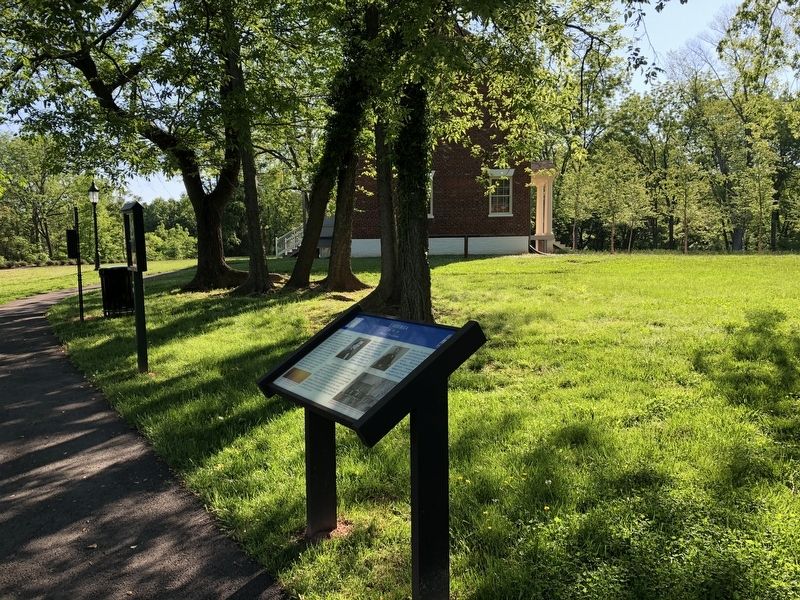
Other nearby markers. At least 8 other markers are within walking distance of this marker: Creating a Garden (within shouting distance of this marker); a different marker also named Liberia (within shouting distance of this marker); a different marker also named Liberia and the Weirs (within shouting distance of this marker); Enslaved of Liberia (within shouting distance of this marker); Weir Family Cemetery (about 400 feet away, measured in a direct line); Liberia Apiary Buzz (about 400 feet away); Manassas 1825 (approx. 0.2 miles away); Conner House (approx. 0.9 miles away). Touch for a list and map of all markers in Manassas.
Other markers no longer nearby. Turberville Memorial Garden (was within shouting distance of this marker but has been replaced with another marker now near it); Liberia and the Weirs (was within shouting distance of this marker but has been replaced with another marker now near it); a different marker also named Enslaved of Liberia (was within shouting distance of this marker but has been replaced with another marker now near it); Battle of Bull Run Bridge (was about 700 feet away but has been permanently removed).
Credits. This page was last revised on October 31, 2022. It was originally submitted on May 15, 2021, by Devry Becker Jones of Washington, District of Columbia. This page has been viewed 514 times since then and 26 times this year. Last updated on October 31, 2022, by Carl Gordon Moore Jr. of North East, Maryland. Photos: 1, 2. submitted on May 15, 2021, by Devry Becker Jones of Washington, District of Columbia. • Bernard Fisher was the editor who published this page.
