Toms River in Ocean County, New Jersey — The American Northeast (Mid-Atlantic)
More Maritime Legacies
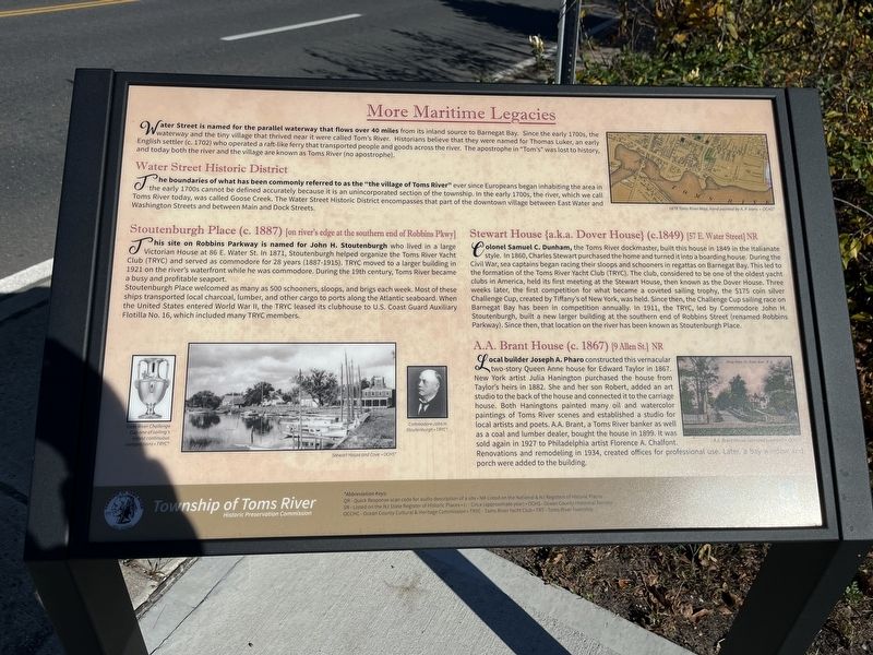
Water Street is named for the parallel waterway that flows of 40 miles from its inland source to Barnegat Bay. Since the early 1700s, the waterway and the tiny village that thrived near it were called Tom's River. Historians believe that they were named for Thomas Luker, an early English settler (c. 1702) who operated the a raft-like ferry that transported people and goods across the river. The apostrophe in "Tom's" was lost to history, and today both the river and the village are known as Toms River (no apostrophe).
Water Street Historic District
The boundaries of what has been commonly referred to as the "the village of Toms River" ever since Europeans began inhabiting the area in the early 1700s cannot be defined accurately because it is an unincorporated section of the township. In the early 1700s, the river, which we call Toms River today, was called Goose Creek. The Water Street Historic District encompasses that part of the downtown village between East Water and Washington Streets and between Main and Dock Streets.
Stoutenburgh Place (c. 1887) [on river's edge at the southern end of Robbins Pkwy]
This site on Robbins Parkway is named for John H. Stoutenburgh who lived in a large Victorian House at 86 E. Water St. In 1871, Stoutenburgh helped organize the Toms River Yacht Club (TRYC) and served as commodore for 28 years (1887-1915). TRYC moved to a larger building in 1921 on the river's waterfront while he was commodore. During the 19th century, Toms River became a busy and profitable seaport.
Stoutenburgh Place welcomed as many as 500 schooners, sloops, and brigs each week. Most of these ships transported local charcoal, lumber, and other cargo to ports along the Atlantic seaboard. When the United States entered World War II, the TRYC leased its clubhouse to the U.S. Coast Guard Auxiliary Flotilla No. 16, which included many TRYC members.
Stewart House {a.k.a. Dover House} (c. 1849) 57 E. Water Street] NR
Colonel Samuel C. Dunham, the Toms River dockmaster, built this house in 1849 in the Italianate style. In 1860, Charles Stewart purchased the home and turned it into a boarding house. During the Civil War, sea captains began racing their sloops and schooners in regattas on Barnegat Bay. This led to the formation of the Toms River Yacht Club (TRYC). The club, considered to be one of the oldest yacht clubs in America, held its first meeting at the Stewart House, then known as the Dover House. Three weeks later, the first competition for what became a coveted sailing trophy, the $175 coin silver Challenge Cup, created by Tiffany's of New York, was held. Since then, the Challenge Cup sailing race
A.A. Brant House (c. 1867) [9 Allen St.] NR
Local builder Joseph A. Pharo constructed this vernacular two-story Queen Anne house for Edward Taylor in 1867. New York artist Julia Hanington purchased the house from Taylor's heirs in 1882. She and her son Robert, added an art studio to the back of the house and connected it to the carriage house. Both Haningtons painted many oil and watercolor paintings of Toms River scenes and established a studio for local artists and poets. A.A. Brant, a Toms River banker as well as a coal and lumber dealer, bought the house in 1899. It was sold again in 1927 to Philadelphia artist Florence A. Chalfont. Renovations and remodeling in 1934, created offices for professional use. Later, a bya window and porch were added to the building.
Erected 2019 by Township of Toms River Historic Preservation Commission.
Topics. This historical marker is listed in these topic lists: Architecture • Fraternal or Sororal Organizations • Roads & Vehicles • Sports • War, World II • Waterways & Vessels. A significant historical year for this entry is 1871.
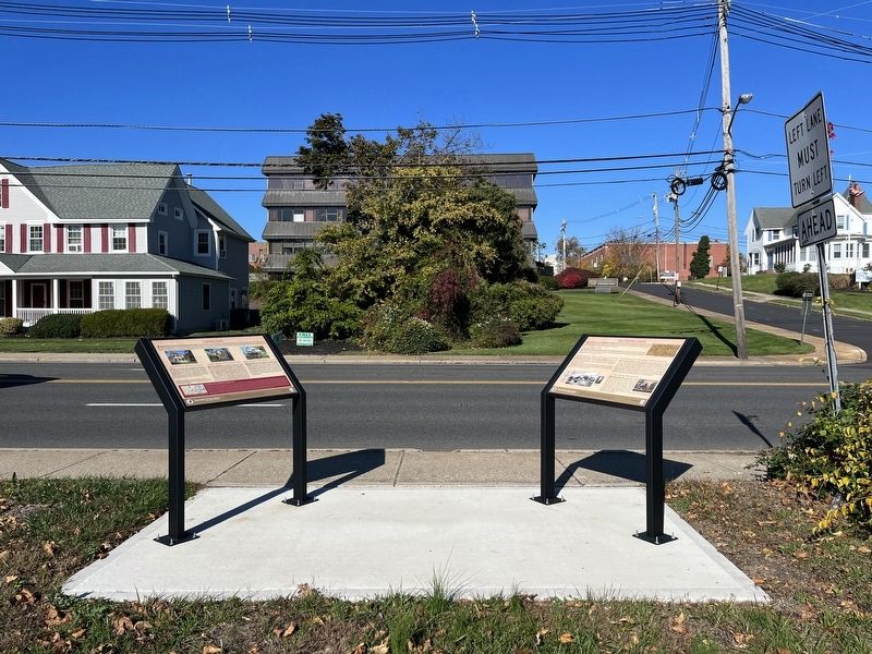
Location. 39° 57.051′ N, 74° 11.747′ W. Marker is in Toms River, New Jersey, in Ocean County. Marker is at the intersection of East Water Street and Allen Street, on the right when traveling east on East Water Street. Touch for map. Marker is at or near this postal address: 67 E Water St, Toms River NJ 08753, United States of America. Touch for directions.
Other nearby markers. At least 8 other markers are within walking distance of this marker. Captains' Row (here, next to this marker); Anchor from the Aircraft Carrier USS Randolph CV-15 (about 400 feet away, measured in a direct line); Captain Joshua Huddy (about 500 feet away); Historic Site (about 500 feet away); Toms River Block House (about 500 feet away); The Industrial Age Transforms the Colonial Village (about 500 feet away); Preserving Baymen Heritage (about 600 feet away); Welcome to Joshua Huddy Park (about 600 feet away). Touch for a list and map of all markers in Toms River.
Credits. This page was last revised on November 2, 2022. It was originally submitted on November 2, 2022, by Devry Becker Jones of Washington, District of Columbia. This page has been viewed 59 times since then and 5 times this year. Photos: 1, 2. submitted on November 2, 2022, by Devry Becker Jones of Washington, District of Columbia.

