Montgomery in Montgomery County, Alabama — The American South (East South Central)
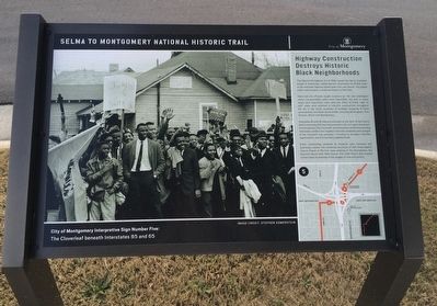
Highway Construction Destroys Historic Black Neighborhoods
The Cloverleaf beneath Interstates 65 and 85
— Selma to Montgomery National Historic Trail —
Inscription.
The Federal-Aid Highway Act of 1956, signed into law by President Dwight D. Eisenhower, authorized the construction of 41,000 miles of the Interstate Highway System over a ten year period - the largest public works project in American history to that time.
State and city officials sought locations for the new interstates where transportation paths were reasonable, but also in areas where land acquisition costs were low. Many of these "right of way" areas were selected in minority communities throughout the US. In the South, examples of strategic targeting of black communities have been documented, including Birmingham, New Orleans, Miami and Montgomery.
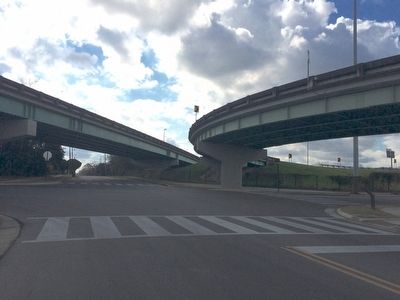
Interstates 85 and 65 intersect precisely at the heart of the historic black community that was instrumental in the civil rights movement. Known today as "The Cloverleaf," this intersection and the surrounding interstates construction targeted where the leadership and strength of the movement was grounded including its strongest churches, organizations, and thriving black neighborhoods.
Entire communities vanished as residents were relocated and businesses closed. The remaining structures of Holt Street Baptist Church (home of the first mass meeting of the Montgomery Bus Boycott), Mount Zion AME Church, First CME Church and Loveless School stand as sentinels of the ravages of time and politics.
Erected 2015 by the City of Montgomery. (Marker Number 5.)
Topics and series. This historical marker is listed in these topic lists: African Americans • Roads & Vehicles. In addition, it is included in the African Methodist Episcopal (AME) Church, the Christian Methodist Episcopal (CME) Church, and the Former U.S. Presidents: #34 Dwight D. Eisenhower series lists. A significant historical year for this entry is 1956.
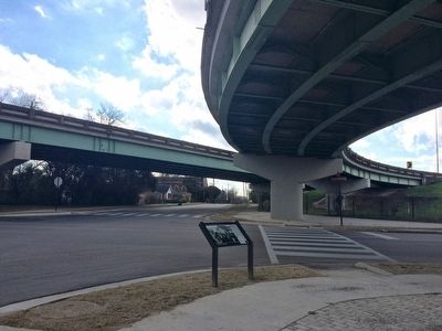
Location. 32° 21.96′ N, 86° 19.234′ W. Marker is in Montgomery, Alabama, in Montgomery County. Marker is at the intersection of West Jeff Davis Avenue and South Holt Street, on the right when traveling east on West Jeff Davis Avenue. Marker located underneath the south direction ramp of Interstate 65, Exit 171. Touch for map. Marker is at or near this postal address: West Jeff Davis Avenue, Montgomery AL 36108, United States of America. Touch for directions.
Other nearby markers. At least 8 other markers are within walking distance of this marker. Sherman W. White, Jr. (about 300 feet away, measured in a direct line); Holt Street Baptist Church (about 400 feet away); Mount Zion African Methodist Episcopal AME Zion Church (approx. 0.2 miles away); Black Churches Provide Significant Support for the March and Voting (approx. 0.2 miles away); Loveless School / Henry Allen Loveless
(approx. 0.2 miles away); From Bus Boycott to Voting Rights: Community Activism 1955-65 (approx. 0.2 miles away); Day Street Baptist Church (approx. 0.3 miles away); Trinity Evangelical Lutheran Church (approx. 0.3 miles away). Touch for a list and map of all markers in Montgomery.
Credits. This page was last revised on November 27, 2022. It was originally submitted on December 11, 2015, by Mark Hilton of Montgomery, Alabama. This page has been viewed 782 times since then and 30 times this year. Last updated on November 12, 2022, by Carl Gordon Moore Jr. of North East, Maryland. Photos: 1, 2, 3. submitted on December 11, 2015, by Mark Hilton of Montgomery, Alabama. • Devry Becker Jones was the editor who published this page.


