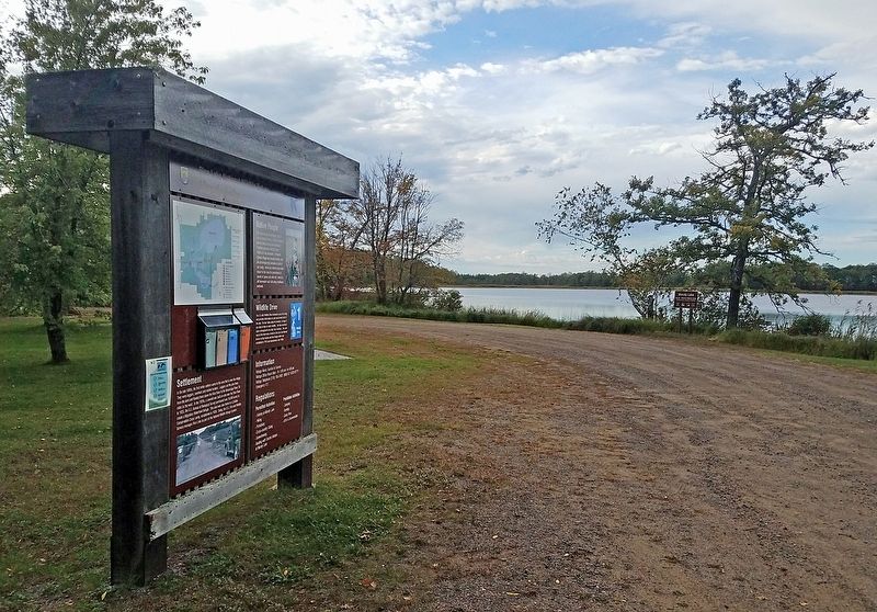
Near East Lake in Aitkin County, Minnesota — The American Midwest (Upper Plains)
Mandy Lake
Rice Lake National Wildlife Refuge
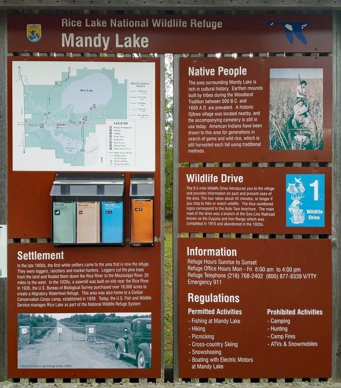
Settlement
In the late 1800s, the first white settlers came to the area that is now the refuge. They were loggers, ranchers and market hunters. Loggers cut the pine trees from the land and floated them down the Rice River to the Mississippi River, 20 miles to the west. In the 1920s, a sawmill was built on-site near the Rice River. In 1935, the U.S. Bureau of Biological Survey purchased over 18,000 acres to create a Migratory Waterfowl Refuge. This area was also home to a Civilian Conservation Corps camp, established in 1939. Today, the U.S. Fish and Wildlife Service manages Rice Lake as part of the National Wildlife Refuge System.
Native People
The area surrounding Many Lake is rich in cultural history. Earthen mounds built by tribes during the Woodland Tradition between 500 B.C. and 1650 A.D. are prevalent. A historic Ojibwe village was located nearby, and the accompanying cemetery is still in use today. American Indians have been drawn to this area for generations in search of game and wild rice, which is still harvested each fall using traditional methods.
Wildlife Drive
The 9.5-mile Wildlife Drive introduces you to the refuge and provides information on past and present uses of the area. The tour takes about 45 minutes, or longer if you stop to hike or watch wildlife. The blue numbered signs correspond to the Auto Tour brochure. The main road of the drive was a branch of the Soo Line Railroad known as the Cuyuna and Iron Range which was completed in 1910 and abandoned in the 1920s.
Erected by Fish and Wildlife Service, U.S. Department of the Interior.
Topics. This historical marker is listed in these topic lists: Native Americans • Parks & Recreational Areas • Railroads & Streetcars • Settlements & Settlers. A significant historical year for this entry is 1935.
Location. 46° 32.358′ N, 93° 20.247′ W. Marker is near East Lake, Minnesota, in Aitkin County. Marker is at the intersection of Mandy Lake Access and 363rd Lane, on the left when traveling west on Mandy Lake Access. The marker stands in Rice Lake National Wildlife Refuge, at the Mandy Lake pullout. Touch for map. Marker is at or near this postal address: 36289 State Highway 65, McGregor MN 55760, United States of America. Touch for directions.
Other nearby markers. At least 3 other markers are within 5 miles of this marker, measured as the crow flies. CCC Camp 2705 (approx. 0.6 miles away); From Railroad Tracks to Refuge Road (approx. 2˝ miles away); Glacial Lake Aitkin / Peat (approx. 5 miles away).
Credits. This page was last revised on November 15, 2022. It was originally submitted on November 13, 2022, by McGhiever of Minneapolis, Minnesota. This page has been viewed 133 times since then and 22 times this year. Photos: 1, 2. submitted on November 13, 2022, by McGhiever of Minneapolis, Minnesota. • Devry Becker Jones was the editor who published this page.

