Morganton in Burke County, North Carolina — The American South (South Atlantic)
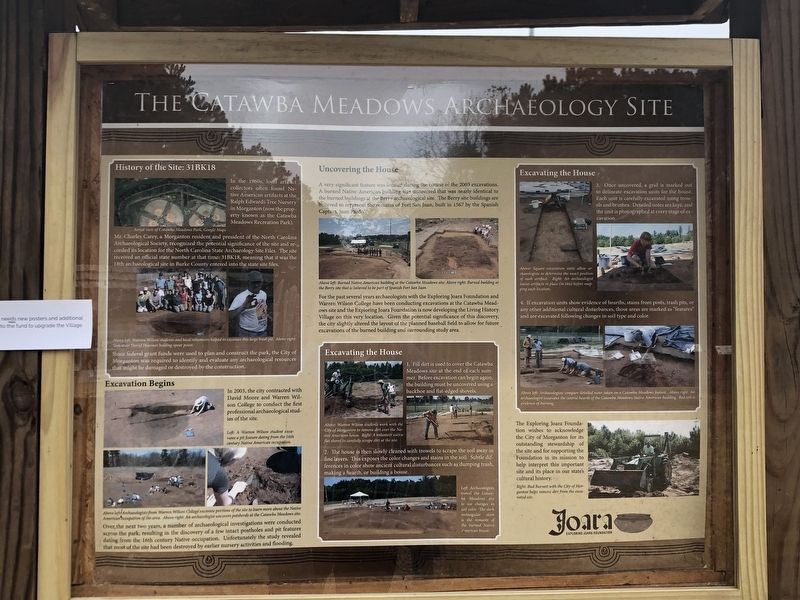
The Catawba Meadows Archaeology Site
Inscription.
History of the Site: 31BK18 In the 1960s, local artifact collectors often found Native American artifacts at the Ralph Edwards Tree Nursery in Morganton (now the property known as the Catawba Meadows Recreation Park).
Mr. Charles Carey, a Morganton resident and president of the North Carolina Archaeological Society, recognized the potential significance of the site and recorded its location for the North Carolina State Archaeology Site Files. The site received an official state number at that time: 31BK18, meaning that it was the 18th archaeological site in Burke County entered into the state site files.
Since federal grant funds were used to plan and construct the park, the City of Morganton was required to identify and evaluate any archaeological resources that might be damaged or destroyed by the construction.
[Captions] Top: Aerial view of Catawba Meadows Park, Google Maps. Bottom: Above left: Warren Wilson students and local volunteers helped to excavate this large trash pit. Above right: Volunteer David Heavner holding spear point.
Excavation Begins In 2003, the City contracted with David Moore and Warren Wilson College to conduct the first professional archaeological studies of the site. Over the next two years, a number of archaeological investigations were conducted across the park, resulting in the discovery of a few intact postholes and pit features dating from the 16th century Native occupation. Unfortunately, the study revealed that most of the site had been destroyed by earlier nursery activities and flooding.
[Captions] (Top) Left: A Warren Wilson student excavates a pit feature dating from the 16th century Native American occupation. (Bottom) Above left: Archaeologists from Warren Wilson College excavate portion of the site to learn more about the Native American occupation of the area. Above right: An archaeologist uncovers potsherds at the Catawba Meadows site.
Uncovering the House A very significant feature was located during the course of the 2003 excavations. A burned Native American building was uncovered that was nearly identical to the burned buildings at the Berry archaeological site. The Berry site buildings are believed to represent the remains of Fort San Juan built in 1567 by the Spanish Captain Juan Pardo.
For the past several years archaeologists with the Exploring Joara Foundation and Warren Wilson College have been conducting excavations at the Catawba Meadows site and the Exploring Joara Foundation is now developing the Living History Village on this very location. Given the potential significance of this discovery; the city slightly
altered the layout of the planned baseball field to allow for future excavations of the burned building and surrounding study area.
[Captions] Above left: Burned Native American building at the Catawba Meadows site. Above right: Burned building at the Berry site that is believed to be part of Spanish Fort San Juan.
Excavating the House 1. Fill dirt is used to cover the Catawba Meadows site at the end of each summer. Before excavation can begin again, the building must be uncovered using a backhoe and flat-edged shovels.
2. The house is then slowly cleaned with trowels to scrape the soil away in fine layers. This exposes the color changes and stains in the soil. Subtle differences in color show ancient cultural disturbances such as dumping trash, making a hearth, or building a house.
[Captions] Above: Warren Wilson students work with the City of Morganton to remove dirt over the Native American house. Right: A volunteer uses a flat shovel to carefully scrape dirt at the site. Left: Archaeologists trowel the Catawba Meadows site to see changes in soil color. The dark rectangular stain is the remains of the burned Native American house.
Excavating the House 3. Once uncovered, a gird is marked out to delineate excavation units for the house. Each unit is carefully excavated using trowels and brushes. Detailed notes are kept, and the unit is photographed at every stage of excavation.
4. If excavation units show evidence of hearths, stains from posts, trash pits, or any other additional cultural disturbances, those areas are marked as “features” and are excavated following changes in soil type and color.
[Captions] (Top) Above: Square excavation units allow archaeologists to determine the exact position of each artifact. Right: An archaeologist leaves artifacts in place (in situ) before mapping each location. (Bottom) Above left: Archaeologists compare detailed notes taken on a Catawba Meadows feature. Above right: An archaeologist excavates the central hearth of the Catawba Meadows Native American building. Red soil is evidence of burning.
The Exploring Joara Foundation wishes to acknowledge the City of Morganton for its outstanding stewardship of the site and for supporting the Foundation in its mission to help interpret this important site and its place in our state's cultural history.
[Caption] Right: Red Burnett with the City of Morganton helps remove dirt from the excavated site.
Erected by Exploring Joara Foundation.
Topics. This historical marker is listed in these topic lists: Anthropology & Archaeology • Native Americans. A significant historical year for this entry is 2003.
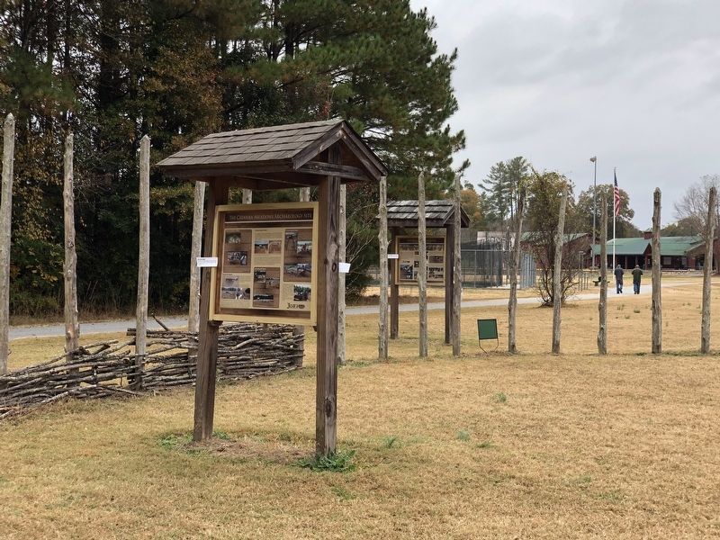
Location. 35° 45.781′ N, 81° 42.338′ W. Marker is in Morganton, North Carolina, in Burke County. Marker is on Catawba Meadows Drive, 0.3 miles north of Sanford Drive (Business U.S. 64), on the right when traveling north. Marker is at the Native American Living History exhibit in Catawba Meadows Park. Touch for map. Marker is at or near this postal address: 701 Sanford Dr, Morganton NC 28655, United States of America. Touch for directions.
Other nearby markers. At least 8 other markers are within walking distance of this marker. Native Americans in North Carolina's Western Piedmont (within shouting distance of this marker); Fort San Juan (approx. 0.9 miles away); Council Oak (approx. 0.9 miles away); Waightstill Avery (approx. 0.9 miles away); André Michaux (approx. 0.9 miles away); Quaker Meadows (approx. 0.9 miles away); Morganton (approx. one mile away); Stoneman's Raid (approx. one mile away). Touch for a list and map of all markers in Morganton.
Credits. This page was last revised on November 14, 2022. It was originally submitted on November 14, 2022, by Duane and Tracy Marsteller of Murfreesboro, Tennessee. This page has been viewed 200 times since then and 46 times this year. Photos: 1, 2. submitted on November 14, 2022, by Duane and Tracy Marsteller of Murfreesboro, Tennessee.

