Near Palm Springs in Riverside County, California — The American West (Pacific Coastal)
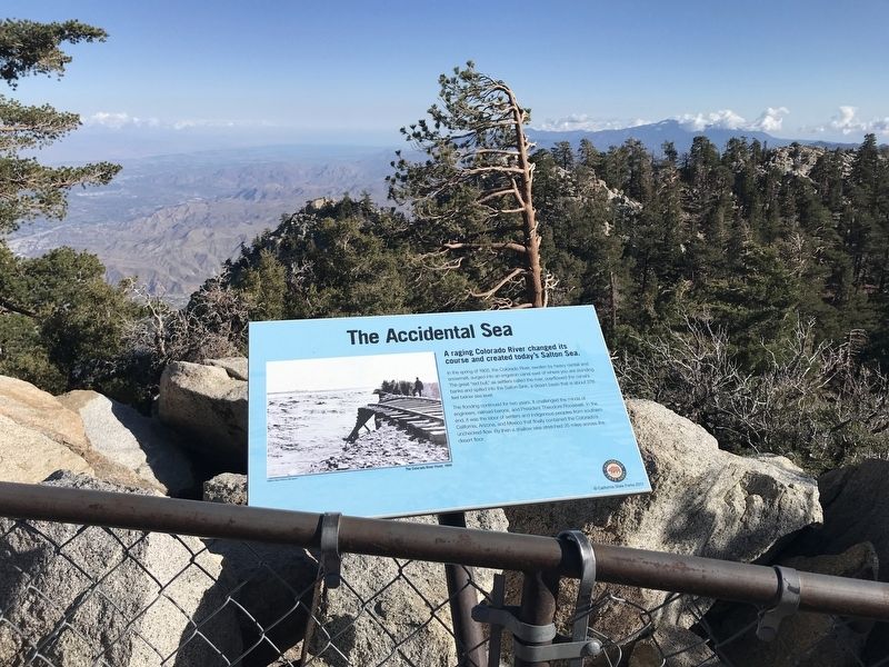
The Accidental Sea
The flooding continued for two years. It challenged the minds of engineers, railroad barons and President Theodore Roosevelt. In the end, it was the labor of settlers and indigenous people from Southern California, Arizona and Mexico that finally contained the Colorado unchecked flow. By then a shallow lake stretched 35 miles across the desert floor.
Erected 2012 by California State Parks.
Topics. This historical marker is listed in these topic lists: Disasters • Environment • Industry & Commerce • Parks & Recreational Areas. A significant historical year for this entry is 1905.
Location. 33° 48.757′ N, 116° 38.268′ W. Marker is near Palm Springs, California, in Riverside County. Marker can be reached from Tram Way. Touch for map. Marker is at or near this postal address: 1 Tram Way, Palm Springs CA 92262, United States of America. Touch for directions.
Other nearby markers. At least 8 other markers are within 5 miles of this marker, measured as the crow flies. The Wilderness Before You (here, next to this marker); The Mountain Rocks (within shouting distance of this marker); The Valley's Faults (within shouting distance of this marker); Wilderness Preservation (about 300 feet away, measured in a direct line); Palm Springs Aerial Tramway Valley Station (approx. 2.2 miles away); Original Cabin #2 (approx. 2.2 miles away); Tahquitz Rock History (approx. 4.3 miles away); The Willows (approx. 5.1 miles away). Touch for a list and map of all markers in Palm Springs.
Credits. This page was last revised on December 6, 2022. It was originally submitted on November 19, 2022, by Adam Margolis of Mission Viejo, California. This page has been viewed 121 times since then and 14 times this year. Photos: 1, 2. submitted on November 19, 2022, by Adam Margolis of Mission Viejo, California. • Bill Pfingsten was the editor who published this page.

