Near Garfield in Benton County, Arkansas — The American South (West South Central)
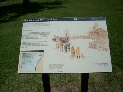
Pea Ridge and the Trail of Tears
Trail of Tears National Historic Trail
— National Trails System —
"Decr 23rd 1837, Buried Rainfrogs daughter. Marched at 8 o'c A.M. halted at Reddix, 3 o'c. P.M. encamped and issued corn & fodder & beef, 16 miles today.
-B.B. Cannon, Detachment Leader
Not Far to Go
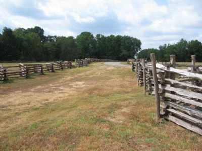
Here, members of William Ruddick's family witnessed more than 11,000 Cherokee people passing by between 1837 and 1839 on their forced removal to Oklahoma. About 356 Cherokee in the detachment led by B.B. Cannon, camped near here on December 23, 1837 - the first removal contingent to travel through the area.
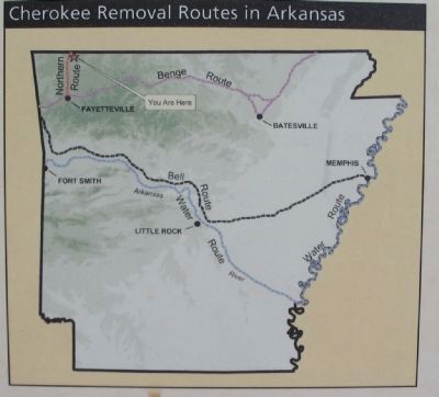
Ruddick's farm was a regular supply depot on the Northern Route of the Trail of Tears. From here, the detachments would branch out on several different trails - all leading to Indian Territory, over 30 miles to the west.
"...Fine day Monday 18th March. Clear & warm... crossed the line of Arkansas & Missouri near... Meeks on Sugar Creek 7 miles North East of Pratts Monday night, hail, rain wind & thunder."
-Dr. W. I. I. Morrow,
March 18, 1838
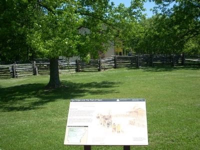
The house you see before you looked different in 1837. It was a one-story log cabin - the home of William Ruddick (Reddix)
Illustration of the Ruddick cabin with a group of Cherokee going by. Illustration by Cherokee artist Sam Watts - Scott 2005
Erected by Department of Arkansas Heritage, Arkansas State Parks & National Park Service.
Topics and series. This historical marker is listed in these topic lists: Native Americans • Notable Events. In addition, it is included in the Trail of Tears series list. A significant historical date for this entry is December 23, 1837.
Location. 36° 27.199′ N, 94° 0.967′ W. Marker is near Garfield, Arkansas, in Benton County. Marker is on Military Park Road (County Road 65), on the left when traveling south. Located at stop eight, Elkhorn Tavern, on the driving tour of Pea Ridge National Military Park. Touch for map. Marker is in this post office area: Garfield AR 72732, United States of America. Touch for directions.
Other nearby markers. At least 8 other markers are within walking distance of this marker. Lifeline for Two Armies (within shouting distance of this marker); Remembrance and Reunion (within shouting distance of this marker); Pea Ridge Confederate Monument (within shouting distance of this marker); A Reunited Soldiery Monument (within shouting distance of this marker); Vulnerable in Victory (within shouting distance of this marker); Disastrous Retreat (within shouting distance of this marker); Elkhorn Tavern Taken (about 300 feet away, measured in a direct line); The Butterfield Overland Mail Route (about 400 feet away). Touch for a list and map of all markers in Garfield.
Also see . . .
1. The Cherokee Trail of Tears. Legends of America website link (Submitted on July 25, 2009, by Thomas Onions of Olathe, Kansas.)
2. Trail of Tears National Historic Trail. National Park Service website entry (Submitted on September 12, 2010, by Craig Swain of Leesburg, Virginia.)
3. Pea Ridge National Military Park. NPS website entry (Submitted on July 25, 2009, by Thomas Onions of Olathe, Kansas.)
Additional keywords. Cherokee Trail of Tears
Credits. This page was last revised on September 27, 2021. It was originally submitted on July 25, 2009, by Thomas Onions of Olathe, Kansas. This page has been viewed 3,105 times since then and 55 times this year. Photos: 1. submitted on July 26, 2009, by Thomas Onions of Olathe, Kansas. 2. submitted on September 12, 2010, by Craig Swain of Leesburg, Virginia. 3. submitted on July 26, 2009, by Thomas Onions of Olathe, Kansas. 4, 5. submitted on September 12, 2010, by Craig Swain of Leesburg, Virginia. • Craig Swain was the editor who published this page.
