Near Baxter Springs in Cherokee County, Kansas — The American Midwest (Upper Plains)
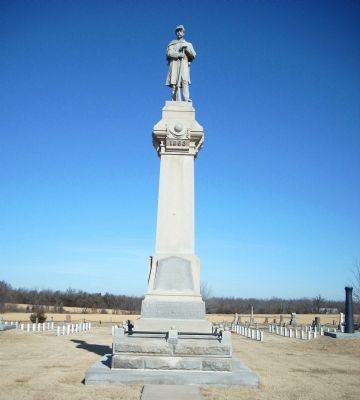
Baxter Springs Civil War Memorial
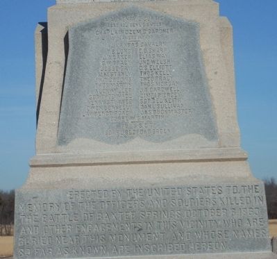
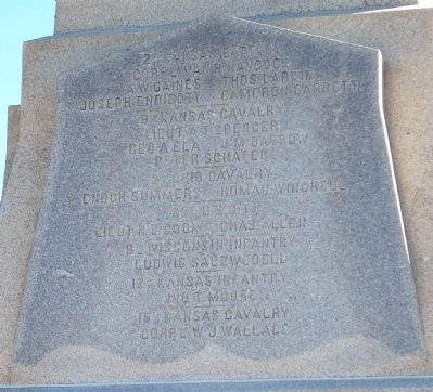
Erected by the United States to the Memory of the Officers and Soldiers Killed in the Battle of Baxter Springs October 8, 1863, and Other Engagements in this Vicinity who are Buried near this Monument, and Whose Names are Known, are Inscribed Hereon.
Maj. Henry Z. Curtis Asst. Adj. Genl. U.S. Vols. Chaplain Ozem B. Gardner 13th Kansas Infantry
14 Kansas Cavalry
T. B. Long E. B. Sharp J. A. Baker Elias Way G. W. Tracy Jno. Welsh Jesse Gay D. S. Elliott M. M. Stanly Thos. Kelly W. T. Collins Theo Tracy Thos. Martin Thos. Morgan Alex Miller J. T. Cardwell Sgt. Theo Wade Zimri Piercey Henry Stuttee Sgt. Geo. Keith Owen Donnelly Danl. Sullivan Lawrence Roach Jas. Buckmaster Corpl. W. G. Martin
79 U.S.C.T.
Corpl. Bedford Green
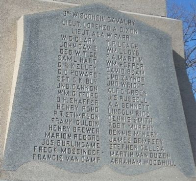
3rd Wisconsin Cavalry
Lieut. Lorenzo A. Dixon Lieut. Asa W. Farr W.C. Clark T.P. Leach John Davis Wm. Lloyd Geo. W. Tige F.A. Martin Sam'l Hart Wm. Hopper G.R. Kelley David Beam C.O. Howard Jno. Zaynor Sgt. C.K. Bly Jno. Wright Jno. Cannon Alf'd Green Wm. Gifford J.S. Russell O.H. Shaffer A.A. Bennett Henry Pond Lincoln Rice P.T. Stimpson Dennis Smith Frank Guldin Rob't Murphy Henry Brewer Dennis McNary Marion Record James Dempsey Jos. Burlingame Stephen Gallea Fred'k Mossinger Martin Van Duzen Francis Van Camp Abraham Woodhull
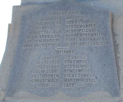
Brigade Band
M. Mumser Jno. Fritz Swartk Ouis Sgt. T. L. Davis Frank LaRue Geo. Gemunder Franz Balloun Henry Pellage Sgt. Henry Bulow Frank Rossmainth Sgt. J.P.M. Madison Corp'l Nathan Nott Corp'l Fred'k Simon Corp'l Theo. Luscher
Civilians
John Fry J.R. O'Neill Jos. Regner Chas. Wood Thos. Clary Geo. Holman Jno. McClure Remel Wood J.C. Lowbower Holas Cowery Henry Remble Martin Housle Jack ______ Zack _______
2nd Kansas Battery
Corp'l Van R. Hancock A.W. Gaines Thos. Larkin Joseph Endicott Cameron Garrett
9th Kansas Cavalry
Lieut. A.T. Spencer Geo. A. Ela J.M. Barrow Peter Schafer
2nd Ohio Cavalry
Enoch Summers Roman Wenchell
83rd U.S.C.T.
Lieut. R.L. Cook Chas. Allen
9th Wisconsin Infantry
Ludwig Salzweoell
12th Kansas Infantry
Jno. T. Moore
15th Kansas Cavalry
Corp'l W.
J. Wallace
Erected 1886 by United States.
Topics and series. This memorial is listed in these topic lists: Cemeteries & Burial Sites • War, US Civil. In addition, it is included in the National Cemeteries series list.
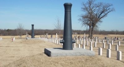
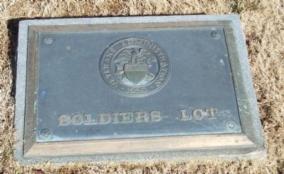
Location. 37° 1.937′ N, 94° 46.24′ W. Marker is near Baxter Springs, Kansas, in Cherokee County. Memorial can be reached from West Avenue (U.S. 166). Memorial is located in the Soldiers' Lot at Baxter Springs Cemetery. Touch for map. Marker is at or near this postal address: 166 West Ave, Baxter Springs KS 66713, United States of America. Touch for directions.
Other nearby markers. At least 8 other markers are within 2 miles of this marker, measured as the crow flies. Baxter Springs Soldiers' Lot (a few steps from this marker); Civil War Tour (a few steps from this marker); Tbe Economic Engines (approx. 1.7 miles away); Baxter Springs: from Fort to Town (approx. 1.7 miles away); The Earliest Residents (approx. 1.7 miles away); a different marker also named Civil War Tour (approx. 1.7 miles away); Johnston Public Library (approx. 1.9 miles away); Baxter Springs Massacre (approx. 1.9 miles away). Touch for a list and map of all markers in Baxter Springs.
More about this memorial. This Memorial is located within Soldier's Lot - part of the National Cemetery System (known as National Cemetery
#2). The Soldier's Lot is located within the Baxter Springs City Cemetery 1 miles west of town on US-166.
Also see . . .
1. Baxter Springs' Soldier's Lot. Department of Veterans' Affairs website for the Soldier's Lot (Submitted on July 26, 2009, by Thomas Onions of Olathe, Kansas.)
2. Baxter Springs, Ks. Link for the City of Baxter Springs - this includes information on the history of the battle and the Soldier's Lot. (Submitted on July 26, 2009, by Thomas Onions of Olathe, Kansas.)
3. CWSAC Battle Summary. The NPS link to information on the Battle of Baxter Springs. (Submitted on July 26, 2009, by Thomas Onions of Olathe, Kansas.)
Credits. This page was last revised on March 6, 2024. It was originally submitted on July 26, 2009, by Thomas Onions of Olathe, Kansas. This page has been viewed 2,470 times since then and 38 times this year. Photos: 1, 2, 3, 4, 5, 6, 7. submitted on July 26, 2009, by Thomas Onions of Olathe, Kansas. • Craig Swain was the editor who published this page.
