Near Cabot in Lonoke County, Arkansas — The American South (West South Central)
Camp Nelson
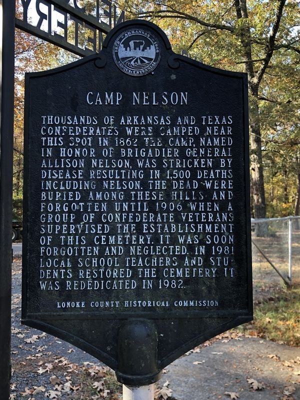
Photographed by Duane and Tracy Marsteller, November 6, 2022
1. Camp Nelson Marker
Erected by Lonoke County Historical Commission.
Topics. This historical marker is listed in these topic lists: Cemeteries & Burial Sites • War, US Civil. A significant historical year for this entry is 1862.
Location. 34° 56.758′ N, 91° 58.827′ W. Marker is near Cabot, Arkansas, in Lonoke County. It is on Rye Drive 0.1 miles east of Lonoke County 267, on the left when traveling east. Touch for map. Marker is at or near this postal address: 141 Rye Dr, Cabot AR 72023, United States of America. Touch for directions.

Regionally, this marker is in the Little Rock Metropolitan Area. It is also in the American South and specifically
this page online
Other nearby markers. At least 8 other markers are within 9 miles of this marker, measured as the crow flies: Camp Nelson Confederate Cemetery (a few steps from this marker); World War II Memorial (approx. 2.6 miles away); Oakland Grove (Old Austin) (approx. 2.8 miles away); Austin (approx. 2.8 miles away); Austin in the Civil War (approx. 2.8 miles away); C-130E (approx. 8.1 miles away); Civil War Soldiers Buried at Bayou Meto Cemetery (approx. 8½ miles away); Bayou Meto Historic Site (approx. 8.6 miles away). Touch for a list and map of all markers in Cabot.
Also see . . . Camp Nelson Confederate Cemetery. During the fall of 1862, the camp was stricken by measles, typhoid, mumps, and a variety of other diseases that proved fatal to as many as 1,500 soldiers, who were buried in graves throughout the countryside.
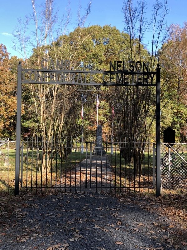
Photographed by Duane and Tracy Marsteller, November 6, 2022
2. Camp Nelson Marker
Credits. This page was last revised on November 29, 2022. It was originally submitted on November 29, 2022, by Duane and Tracy Marsteller of Murfreesboro, Tennessee. This page has been viewed 726 times since then and 55 times this year. Photos: 1, 2. submitted on November 29, 2022, by Duane and Tracy Marsteller of Murfreesboro, Tennessee.
