Santa Cruz in Santa Cruz County, California — The American West (Pacific Coastal)
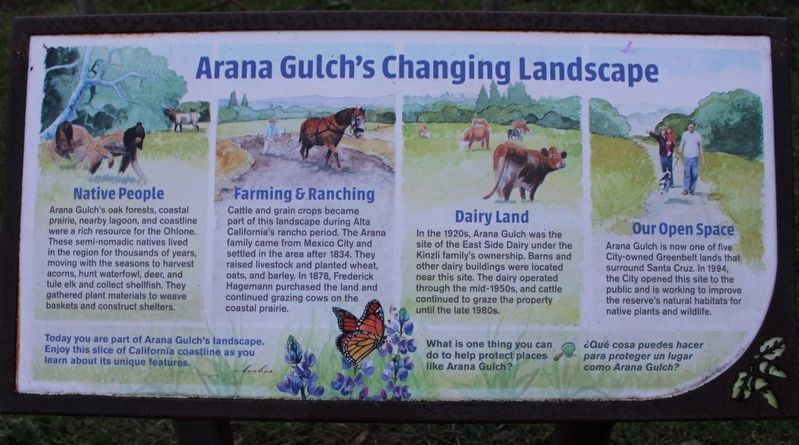
Arana Gulch's Changing Landscape
Photographed by Joseph Alvarado, December 9, 2022
1. Arana Gulch's Changing Landscape Marker
Arana Gulch’s oak forest, coastal prairie, nearby lagoon, and coastline were a rich source for the Ohlone. These semi-nomadic natives lived in the region for thousands of years, moving with the seasons to harvest acorns, hunt waterfowl, deer, and tule elk and collect shellfish. They gathered plant material to weave baskets and construct shelters.
Farming & Ranching
Cattle and grain crops became part of this landscape during Alta California’s rancho period. The Arana family came from Mexico City and settled in the area after 1834. They raised livestock and planted wheat, oats, and barley. In 1878, Fredrick Hagemann purchased the land and continued grazing cows on the coastal prairie.
Dairy Land
In the 1920s, Arana Gulch was the site of the East Side Dairy under the Kinzli family’s ownership. Barns and other dairy buildings were located near this site. The dairy operated through the mid-1950s, and cattle continued to graze the property until the late 1980s.
Our Open Space
Arana Gulch is now one of five City-owned Greenbelt lands that surround Santa Cruz. In 1994, the City opened this site to the public
this page online
Today you are part of Arana Gulch’s landscape. Enjoy this slice of California coastline as you learn about its unique features.
What is one thing you can do to help protect places like Arana Gulch?
¿Qué cosa puedes hacer para proteger un lugar como Arana Gulch?
Topics. This historical marker is listed in these topic lists: Agriculture • Animals • Indigenous Peoples and Communities • Settlements & Settlers. A significant historical year for this entry is 1834.
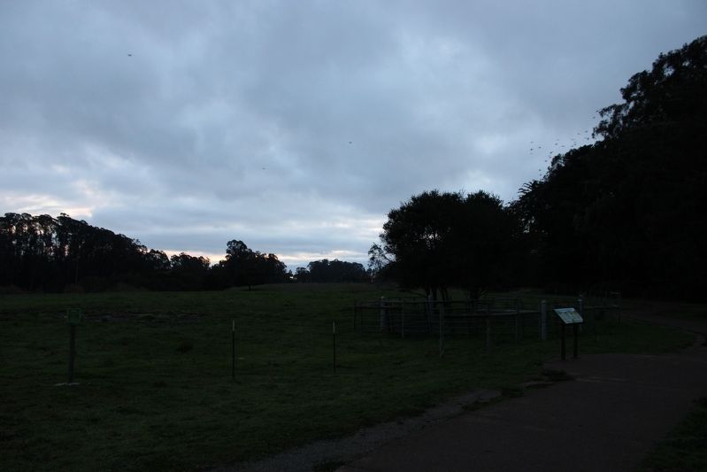
Location. 36° 58.741′ N, 121° 59.917′ W. Marker is in Santa Cruz, California, in Santa Cruz County. It is at the intersection of Agnes Street and Mentel Avenue, on the right when traveling east on Agnes Street. The resin marker is mounted to a metal stand on the Arana Gulch Trail. Touch for map. Marker is at or near this postal address: 101 Mentel Avenue, Santa Cruz CA 95062, United States of America. Touch for directions.

Regionally, this marker is on the Central Coast and specifically on the Coast Ranges. It is also on the American Pacific Coast. Globally, it is in North

Photographed by Joseph Alvarado, December 9, 2022
2. Arana Gulch's Changing Landscape Marker
Other nearby markers. At least 8 other markers are within walking distance of this marker: Old Holy Cross Cemetery (approx. 0.3 miles away); Gault School (approx. 0.6 miles away); The Antlers (approx. 0.7 miles away); First National Bank (approx. 0.7 miles away); Windham Grocery (approx. 0.8 miles away); William Wessell Home (approx. 0.9 miles away); Branciforte (approx. 0.9 miles away); E.E. Underwood House (approx. 0.9 miles away). Touch for a list and map of all markers in Santa Cruz.
Also see . . .
1. Friends of Arana Gulch.
"Originally part of the Mexican-Era land grant "Rancho Del Encenlatios", Arana Gulch was named after Juan Arana who lived in Live Oak in the mid-1800s. His was one of the first ranchos in the Santa Cruz area."(Submitted on December 19, 2022, by Joseph Alvarado of Livermore, California.)
2. City of Santa Cruz: Arana Gulch.
"Historically, the Santa Cruz tarplant was widespread throughout the property, however, with the loss of grazing the tarplant declined."
Photographed by Joseph Alvarado, December 9, 2022
3. Arana Gulch
Photographed by Joseph Alvarado, December 9, 2022
4. Arana Gulch Entrance Sign
Credits. This page was last revised on December 19, 2022. It was originally submitted on December 19, 2022, by Joseph Alvarado of Livermore, California. This page has been viewed 383 times since then and 26 times this year. Photos: 1, 2, 3, 4. submitted on December 19, 2022, by Joseph Alvarado of Livermore, California.
