Canton in Baltimore, Maryland — The American Northeast (Mid-Atlantic)
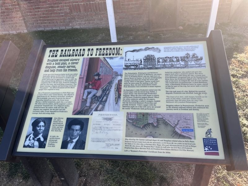
The Railroad to Freedom
Douglass escaped slavery with a bold plan, a clever disguise, steady nerves, and help from his friends.
At the age of 20, Frederick Bailey (as he was called) lived under slavery in Fell's Point, one mile west of this marker. He was determined to escape to the north, and he saw an opportunity when, in 1837, the first railroad linking Baltimore to Philadelphia was completed. But to ride the train, Frederick needed to pass as a free man, and avoid being recognized. That meant wearing a disguise and borrowing somebody's "free papers" -- the official documents all free Black people were required to carry.
One of Frederick's acquaintances in Fell's Point was a retired Black sailor named Stanley, who offered to lend Frederick his "Seaman's Protection" certificate. this is probably what gave Frederick the idea of disguising himself as a sailor. His friend Anna Murray, a skilled seamstress, made him a red shirt like those worn by sailors, and he acquired a sailor's waterproof "tarpaulin hat." As a shipyard worker, Frederick knew the sailors' walk and talk. His disguise was complete, but the plan was still extremely risky. It now depended on Frederick's courage, luck and acting skills.
The Philadelphia, Wilmington and Baltimore Railroad had two stations in Baltimore: one downtown on President Street, and one right here on Boston Street in Canton. In his last autobiography Douglass described his escape but never said exactly where it took place. Canton would have made far more sense for making a safe, fast getaway. Here, the slow horse-drawn trains from downtown were switched to steam engines.
On September 3, 1838, Frederick waited near the Canton depot with his friend Isaac Rolles, a wagon driver, who had brought Frederick's baggage. When the next train began to slowly roll forward, Frederick jumped aboard. When the white conductor asked for his papers, Frederick, imitating a sailor's swagger, handed him the borrowed Seaman's Protection and proudly declared, "I have a paper with the American eagle on it that will carry me around the world." Frederick's bold performance fooled the conductor, who smiled and gave the papers back after a moment's glance. But there were more close calls along the way: a young man from Baltimore recognized him on the Susquehanna River ferry, but Frederick slipped away. On the far side of the river, he dodged the eyes of a sea captain who would have recognized him. A third Baltimore man, a blacksmith Frederick knew by name, stared at him for part of the trip, but never said a word to betray him.
The trip took most of a day. Behind his nautical disguise, Frederick was terrified. Later he wrote,
"The heartof no deer, with hungry hounds on his trail, in full chase, could have beaten more anxiously than did mine from the time I left Baltimore till I reached Philadelphia.
Stepping ashore in Pennsylvania, Frederick went to the nearest railroad station and continued his journey north to freedom and destiny.
[Captions:]
Anna Murray, left, sold a feather bed to help Frederick buy his railroad ticket, and later married him in New York City.
At right, the earliest known photograph of Frederick Douglass, circa 1839.
A locomotive and cars, seen in an 1837 publication of Baltimore's Canton Company. American railroading was only eight years old when Frederick Bailey fled slavery on a similar train to Philadelphia.
Map showing the Canton railroad depot (A) and Douglass-related sites in Fell's Point. Frederick had previously lived with the Auld family on Fell Street (B). As a child, he had lived with the Aulds at two other sites, at Durham (then, Happy Alley) and Aliceanna Streets (C) and on Philpot Street (D). Also shown: (E) "Douglass Place" (homes he built after the Civil War); (F) Frederick Douglass/Isaac Mires Maritime Park; (G) President Street Station (Baltimore Civil War Museum).
Left: a "Seaman's Protection" Certificate from the 1850s.
Erected 2021 by Friends of President Street Station, the History Committee of the Canton Community Association, and the Baltimore National Heritage Area.
Topics. This historical marker is listed in these topic lists: Abolition & Underground RR • African Americans • Industry & Commerce • Railroads & Streetcars • Waterways & Vessels. A significant historical date for this entry is September 3, 1838.
Location. 39° 16.697′ N, 76° 34.579′ W. Marker is in Baltimore, Maryland. It is in Canton. Marker is on Boston Street just east of South Kenwood Street, on the right when traveling east. Touch for map. Marker is at or near this postal address: 2809 Boston St, Baltimore MD 21224, United States of America. Touch for directions.
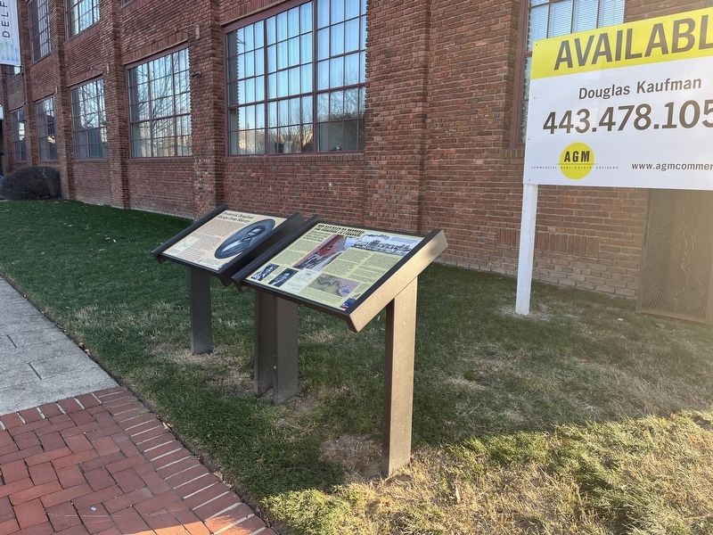
Other nearby markers. At least 8 other markers are within walking distance of this marker. Frederick Douglass' Escape from Slavery (here, next to this marker); Historic Canton (about 700 feet away, measured in a direct line); a different marker also named Historic Canton (about 700 feet away); a different marker also named Historic Canton (about 800 feet away); Korean War Memorial (approx. 0.2 miles away); a different marker also named Historic Canton (approx. 0.2 miles away); The Harris Creek Rain Garden (approx. 0.2 miles away); Baltimore Regional Trail (approx. ¼ mile away). Touch for a list and map of all markers in Baltimore.
Credits. This page was last revised on December 24, 2022. It was originally submitted on December 24, 2022, by Devry Becker Jones of Washington, District of Columbia. This page has been viewed 146 times since then and 37 times this year. Photos: 1, 2. submitted on December 24, 2022, by Devry Becker Jones of Washington, District of Columbia.

