Shakopee in Scott County, Minnesota — The American Midwest (Upper Plains)
On The River Bottoms
Pathways of Shakopee History
— A self-guided tour on the development of the City of Shakopee —
"The power of the Dakotas had always dwelt in the land, from the great forest to the open prairies. Long before the white man ever dreamed of our existence, the Dakota roamed this land."
—Waŋdbi Wakiya
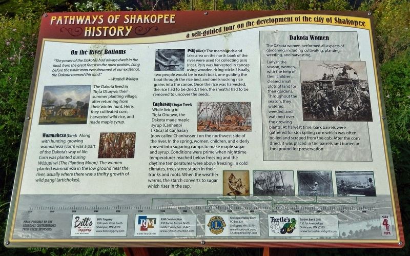
The Dakota lived in Tíŋta Otuŋwe, their summer planting village, after returning from their winter hunt. Here, they cultivated corn, harvested wild rice, and made maple syrup.
Wamnaheza (Corn): Along with hunting, growing wamnaheza (corn) was a part of the Dakota's way of life. Corn was planted during Wóżupi wi (The Planting Moon). The women planted wamnaheza in the low ground near the river, usually where there was a thrifty growth of wild paŋgi (artichokes).
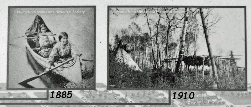
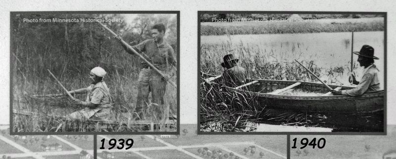
Psiŋ (Rice): The marshlands and lake area on the north bank of the river were used for collecting psiŋ (rice). Psiŋ was harvested in canoes using wooden ricing sticks. Usually, two people would be in each boat, one guiding the boat through the rice bed, and one knocking rice grains into the canoe. Once the rice was harvested, the rice had to be dried. Then, the sheaths had to be removed to uncover the seeds.
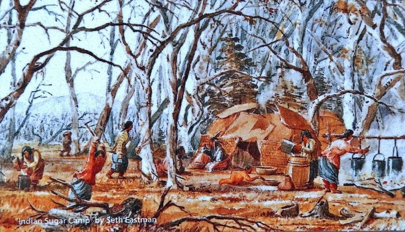
Caŋhasaŋ (Sugar Tree): While living in Tíŋta Otuŋwe, the Dakota made maple syrup (Caŋhaŋpi tiktica) at Caŋhasaŋ (now called Chanhassen) on the northwest side of the river. In the spring, women, children, and elderly moved into sugaring camps to make maple sugar and syrup. Conditions were prime when nighttime temperatures reached below freezing and the daytime temperatures were above freezing. In cold climates, trees store starch in their trunks and roots. When the weather warms, the starch converts to sugar which rises in the sap.
Dakota Women
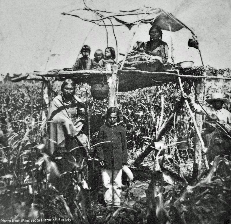
The Dakota women performed all aspects of gardening, including cultivating, planting, weeding, and harvesting.
Early in the season, women, with the help of their children, cleared small plots of land for their gardens. Throughout the season, they watered, weeded, and watched over the growing plants. At harvest time, bark barrels were gathered for stockpiling corn which was often boiled and scraped from the cob. After the corn dried, it was placed in the barrels and buried in the ground for preservation.
Erected by Pathways of Shakopee History; Bill's Toggery; RJM Construction; Shakopee Valley Lions; and Turtles Bar & Grill. (Marker Number 4.)
Topics. This historical marker is listed in these topic lists: Agriculture • Native Americans • Settlements & Settlers • Women.
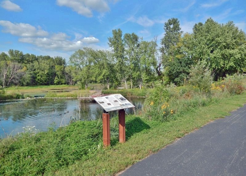
Location. 44° 48.098′ N, 93° 30.269′ W. Marker is in Shakopee, Minnesota, in Scott County. Marker can be reached from the intersection of County Road 101 (Business U.S. 169) and Sarazin Street, on the right when traveling west. Marker is located along the Pathways of Shakopee History Trail, which begins near the west end of Memorial Park. Touch for map. Marker is at or near this postal address: 1801 County Road 101, Shakopee MN 55379, United States of America. Touch for directions.
Other nearby markers. At least 8 other markers are within walking distance of this marker. Betting, Booze & Speakeasies • 1920-1940 (within shouting distance of this marker); Rollin' Down the River 1842 (within shouting distance of this marker); Powerful Names (within shouting distance of this marker); Stagecoaches to Shakopee (within shouting distance of this marker); Pond Mission (within shouting distance of this marker); The Springs (within shouting distance of this marker); Who Else Was Here (within shouting distance of this marker); The Railroad to Shakopee 1865 (about 300 feet away, measured in a direct line). Touch for a list and map of all markers in Shakopee.
Related markers. Click here for a list of markers that are related to this marker. Pathways of Shakopee History Trail
Also see . . . Minnesota’s Early Farmers.
The Dakota settled in the prairie areas in southern Minnesota. Their villages dotted the Mississippi, Minnesota, St. Croix, and Cannon River banks. Dakota men were hunters and warriors; Dakota women were farmers. They grew corn, beans, and squash, a crop trio called the Three Sisters in native lore. Today, Native Americans honor their agricultural heritage by growing and harvesting traditional crops like hominy (a type of white corn), wild rice, wild berries, maple syrup, buffalo meat products, and use birchbark to make baskets and crafts.(Submitted on December 29, 2022, by Cosmos Mariner of Cape Canaveral, Florida.)
Credits. This page was last revised on December 30, 2022. It was originally submitted on December 28, 2022, by Cosmos Mariner of Cape Canaveral, Florida. This page has been viewed 146 times since then and 26 times this year. Photos: 1, 2, 3, 4, 5, 6. submitted on December 29, 2022, by Cosmos Mariner of Cape Canaveral, Florida.
