Village De L'Est in New Orleans in Orleans Parish, Louisiana — The American South (West South Central)
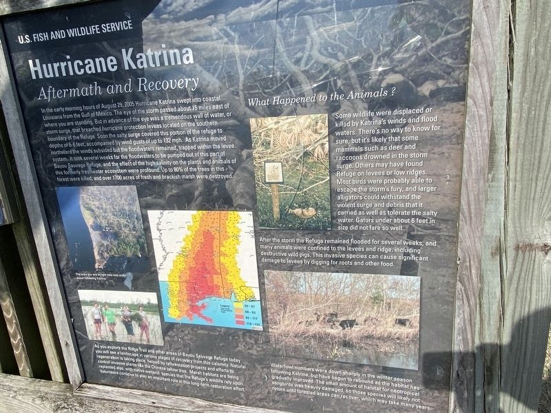
Hurricane Katrina
Aftermath and Recovery
In the early morning hours of August 29, 2005 Hurricane Katrina swept into coastal Louisiana from the Gulf of Mexico. The eye of the storm passed about 15 miles east of where you are standing. But in advance of the eye was a tremendous wall of water, or storm surge, that breached hurricane protection levees located on the southern boundary of the Refuge. Soon the salty surge covered this portion of the refuge to depths of 6-8 feet, accompanied by wind gusts of up to 132 mph. As Katrina moved northward the winds subsided but the floodwaters remained, trapped within the levee system. It took several weeks for the floodwaters to be pumped out of this part of Bayou Sauvage Refuge, and the effect of the high salinity on the plants and animals of this formerly freshwater ecosystem were profound. Up to 80% of the trees in this forest were killed, and over 1700 acres of fresh and brackish marsh were destroyed.
What Happened To The Animals?
Some wildlife were displaced or killed by Katrina's winds and flood waters. There's no way to know for sure, but it's likely that some mammals such as deer and raccoons drowned in the storm surge. Others may have found refuge on levees or low ridges. Most birds were probably able to escape the storm's fury, and larger alligators could withstand the violent surge and debris that it carried as well as tolerate the salty water. Gators under about 6 feet in size did not fare so well.
After the storm the Refuge remained flooded for several weeks, and many animals were confined to the levees and ridge, including destructive wild pigs. This invasive species can cause significant damage to levees by digging for roots and other food. Waterfowl numbers were down sharply in the winter season following Katrina, but have begun to rebound as the habitat has gradually improved The small amount of habitat for neotropical songbirds was heavily damaged, so those species will likely not return until forested areas can recover, which may take many years .
As you explore the Ridge Trail and other areas of Bayou Sauvage Refuge today you will see landscape in various stages of recovery from this calamity. Natural regeneration is taking place, helped by reforestation projects and efforts to control invasive plants like the Chinese tallow trees. Marsh habitats are being related also, with native wetland species that the Refuge's wildlife rely upon. Volunteers continue to play an important role in this long-term restoration effort.
Erected by U.S. Fish and Wildlife Service.
Topics. This historical marker is listed in these topic lists: Animals • Disasters • Notable Events • Parks & Recreational Areas. A significant historical date for this entry is August 29, 2005.
Location. 30° 3.218′ N, 89° 52.836′ W. Marker is in New Orleans, Louisiana, in Orleans Parish. It is in Village De L'Est. Marker can be reached from Chef Menteur Highway (U.S. 90) near Recovery Drive, on the right when traveling west. Touch for map. Marker is at or near this postal address: 20876 Chef Menteur Hwy, New Orleans LA 70129, United States of America. Touch for directions.
Other nearby markers. At least 8 other markers are within 10 miles of this marker, measured as the crow flies. Bayou Sauvage Ridge (about 600 feet away, measured in a direct line); Prehistoric Inhabitants of Bayou Sauvage (approx. 0.2 miles away); Henriette Delille (approx. 8.1 miles away); Jumonville Plantation (approx. 9 miles away); Plantation of Jacques Philippe Villere (approx. 9.4 miles away); Denis de La Ronde Site (approx. 9.6 miles away); The Chalmette Plantations (approx. 9.6 miles away); Plantation of Pierre Denis De La Ronde (approx. 9.6 miles away). Touch for a list and map of all markers in New Orleans.
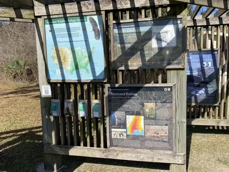
More about this marker. Located at the Bayou Sauvage boardwalk trailhead.
Credits. This page was last revised on February 12, 2023. It was originally submitted on December 30, 2022, by Cajun Scrambler of Assumption, Louisiana. This page has been viewed 138 times since then and 18 times this year. Photos: 1, 2. submitted on December 30, 2022, by Cajun Scrambler of Assumption, Louisiana.

