Southside in San Antonio in Bexar County, Texas — The American South (West South Central)
Bridging the Gulch
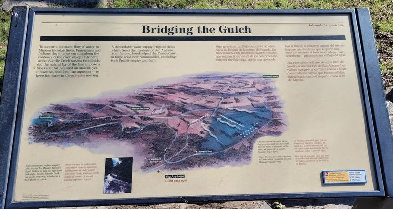
A dependable water supply irrigated fields which freed the missions of San Antonio from famine. Food helped the Franciscans to forge solid new communities, extending both Spain's empire and faith.
Captions
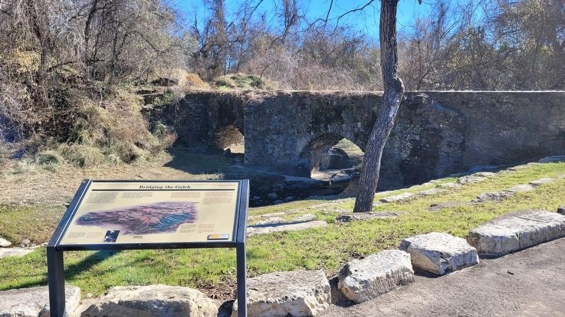
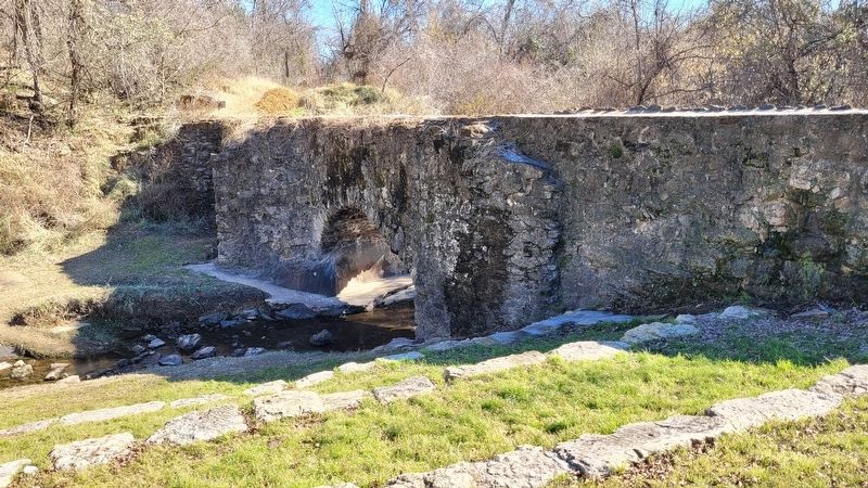
1. Stout limestone arches support the channel for Mission Espada's liquid lifeline at just the right level and angle. Below, Sixmile Creek can go its own way, whether at a flash-flood or trickle.
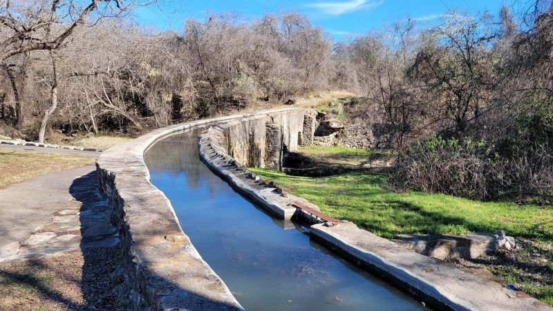
2. Gravity moves the water along the acequias, and into the fields. Excess water is returned to the river, as required by ancient Spanish water laws.
Water flowing over this aqueduct still nourishes croplands around Mission Espada today.
[Spanish Text]
Para garantizar un flujo constante de agua hacia las labores de la misión de Espada, los franciscanos y los indígenas cavaron canales que seguían la curvatura de los contornos del valle del río. Sólo aquí, donde una quebrada taja la ladera, el contorno natural del terreno impuso un obstáculo que requirió una solución antigua, si bien innovadora - un acueducto - para mantener el flujo del agua.
Una provisión confiable de agua libró del hambre a las misiones de San Antonio, Los víveres ayudaron a los franciscanos a forjar comunidades nuevas que fueron sólidas, extendiende tanto el imperio como la fe de España.
Subtítulos
1. Arcos macizos de piedra caliza sostienen el cauce de agua vital precisamente al nivel y ángulo adecuado. Abajo, el arroyo puede seguir su camino, ya sea un torrente repentino o goteo.
2. La gravedad mueve el agua por las acequias y hacia los campos. El agua que sobra es devuelta al río, tal como exigen los antiguos fueros españoles sobre el uso del agua.
Hoy día, el agua que pasa por este acueducto aún alimenta las terras de cultivo alrededor de la misión de Espada.
Erected by San Antonio Missions, Southwestern Bell Foundation, Los Compadres and Southwest Parks & Monuments Association.
Topics. This historical marker is listed in these topic lists: Churches & Religion
• Colonial Era • Native Americans • Waterways & Vessels.
Location. 29° 19.96′ N, 98° 27.685′ W. Marker is in San Antonio, Texas, in Bexar County. It is in Southside. Marker is at the intersection of Espada Road and East Ashley Road, on the left when traveling south on Espada Road. The marker is located down the trail near the Espada Aqueduct. Touch for map. Marker is at or near this postal address: 9045 Espada Road, San Antonio TX 78214, United States of America. Touch for directions.
Other nearby markers. At least 8 other markers are within walking distance of this marker. Espada Aqueduct (within shouting distance of this marker); Mission San Francisco de la Espada Dam, Ditch and Aqueduct (within shouting distance of this marker); Berg's Mill (approx. 0.3 miles away); Berg's Mill Community (approx. 0.3 miles away); Mission San Juan Capistrano (approx. 0.3 miles away); The San Antonio Missions World Heritage Site (approx. 0.3 miles away); Permission to Enter (approx. 0.4 miles away); Bergs Mill Veterans Memorial Bridge (approx. 0.4 miles away). Touch for a list and map of all markers in San Antonio.
Also see . . . The Acequias and River Systems. San Antonio Missions - World Heritage
Espada Dam, Acequia and Aqueduct— The Espada Aqueduct was constructed in 1745 to serve the mission lands of Espada. Espada Dam is the city’s only Spanish Colonial dam that still functions. Built of limestone and lime mortar, the dam has a unique reverse curve design. The aqueduct was built to carry water over Piedras Creek, 1.5 miles from the dam. The aqueduct also still exists and is considered the system’s most remarkable feature. You can access the dam, acequia and aqueduct in San Antonio Missions National Historical Park.(Submitted on January 7, 2023, by James Hulse of Medina, Texas.)
Credits. This page was last revised on February 2, 2023. It was originally submitted on January 7, 2023, by James Hulse of Medina, Texas. This page has been viewed 92 times since then and 27 times this year. Photos: 1, 2, 3, 4. submitted on January 7, 2023, by James Hulse of Medina, Texas.


