Theodore Roosevelt Island in Northwest Washington in Washington, District of Columbia — The American Northeast (Mid-Atlantic)
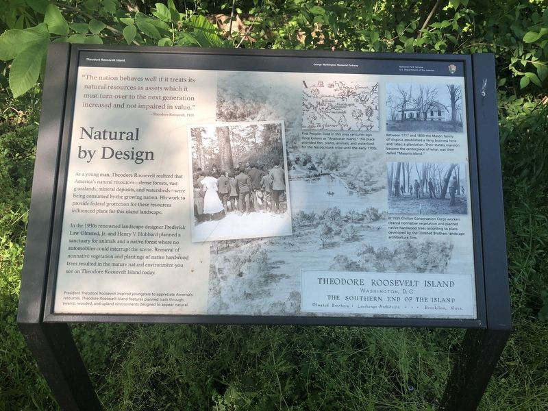
Natural by Design
Theodore Roosevelt Island
— George Washington Memorial Parkway, National Park Service, U.S. Department of the Interior —
"The nation behaves well if it treats its natural resources as assets which it must turn over to the next generation increased and not impaired in value."
—Theodore Roosevelt, 1910
As a young man, Theodore Roosevelt realized that America's natural resources—dense forests, vast grasslands, mineral deposits, and watersheds—were being consumed by the growing nation. His work to provide federal protection for these resources influenced plans for this island landscape.
In the 1930s renowned landscape designer Frederick, Law Olmsted, Jr. and Henry V. Hubbard planned a sanctuary for animals and native forest where no automobiles could interrupt the scene. Removal of nonnative vegetation and plantings of native hardwood trees resulted in the mature natural environment you see on Theodore Roosevelt Island today.
[Captions:]
President Theodore Roosevelt inspired youngsters to appreciate America's resources. Theodore Roosevelt Island features planned trails through swamp, wooded, and upland environments designed to appear natural.
First Peoples lived in this area centuries ago. Once known as "Analostan Island," this place provided fish, animals, and waterfowl for the Nacotchtank tribe until the early 1700s.
Between 1717 and 1833 the Mason family of Virginia established a ferry business here and, later, a plantation. Their stately mansion became the centerpiece of what was then called "Mason's Island."
In 1935 Civilian Conservation Corps workers cleared nonnative vegetation and planted native hardwood trees according to plans developed by the Olmsted Brothers landscape architecture firm.
Erected by National Park Service, U.S. Department of the Interior.
Topics and series. This historical marker is listed in these topic lists: Charity & Public Work • Environment • Native Americans • Parks & Recreational Areas. In addition, it is included in the Civilian Conservation Corps (CCC), and the Former U.S. Presidents: #26 Theodore Roosevelt series lists. A significant historical year for this entry is 1910.
Location. 38° 53.574′ N, 77° 3.723′ W. Marker is in Northwest Washington in Washington, District of Columbia. It is on Theodore Roosevelt Island. Marker is on Swamp Trail just north of Upland Trail, on the right when traveling north. Touch for map. Marker is in this post office area: Washington DC 20007, United States of America. Touch for directions.
Other nearby markers. At least 8 other markers are within walking distance of this marker. The Mason Estate (within shouting distance of this marker); Urban Wilderness (about 400 feet away, measured in a direct line); Mason Mansion (about 500 feet away); Naturalist
Credits. This page was last revised on January 30, 2023. It was originally submitted on May 15, 2020, by Devry Becker Jones of Washington, District of Columbia. This page has been viewed 216 times since then and 102 times this year. Last updated on January 7, 2023, by Bruce Guthrie of Silver Spring, Maryland. Photos: 1, 2. submitted on May 15, 2020, by Devry Becker Jones of Washington, District of Columbia. • J. Makali Bruton was the editor who published this page.

