Near Manassas in Prince William County, Virginia — The American South (Mid-Atlantic)
Dogan Ridge
Manassas National Battlefield Park
— National Park Service, U.S. Department of the Interior —
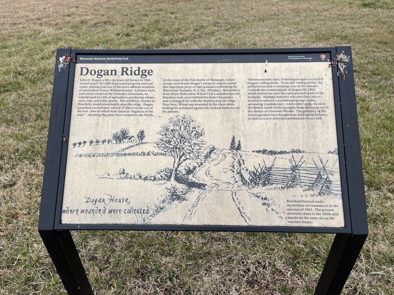
John d. Dogan, a fifty-six-year-old farmer in 1860, owned nearly $21,000 of personal property and real estate, making him one of the more affluent residents of antebellum Prince William County. A former store and tavern owner at the Groveton crossroads, he transitioned to a life of agriculture, producing wheat, corn, oats, and other grains. His residence, known as Rosefield, stood prominently atop this ridge. Dogan, an ardent secessionist, owned 19 slaves on the eve of the war — tow of which were listed as "fugitives of the state" — may have escaped to the North.
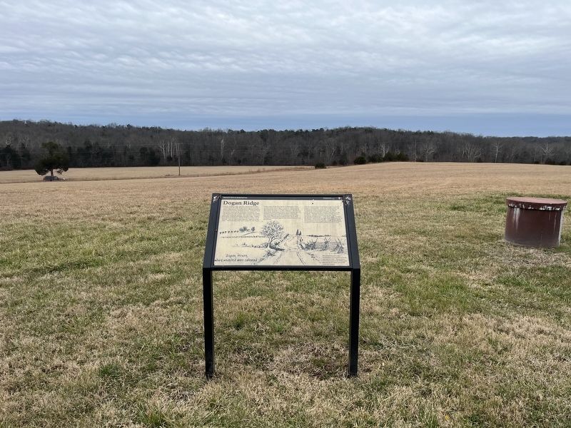
At the onset of the First Battle of Manassas, Union troops veered onto Dogan's property and occupied this important piece of high ground overlooking the Warrenton Turnpike (U.S. Rte. 29 today). Skirmishers from Major Roberdeau Wheat's 1st Louisiana Special Battalion took cover behind the farm's haystacks and exchanged fire with the Yankees atop the ridge. Near here, Wheat was wounded in the chest while leading his command against the Federal batteries on the plateau.
Thirteen months later, Federal guns again occupied Dogan's rolling fields. From this vantage point, the artillerymen had a sweeping view of the massive Confederate counterattack of August 30, 1862, which boiled out onto the open ground south of the turnpike. Multiple batteries wheeled their pieces around to unleash a punishing barrage on the advancing Confederates — while other guns checked the Rebels north of the turnpike from emerging out of the shelter of Groveton Woods. The gallantry of the Union gunners here bought time for the Federal infantry to shift to a new defensive position on Henry Hill.
Rosefield burned under mysterious circumstances in the autumn of 1862. The present structure dates to the 1880s and stands on the same site as the wartime house.
[Caption:]
Dogan House, where wounded were collected
Erected by National Park Service, U.S. Department of the Interior.
Topics. This historical marker is listed in these topic lists: African Americans • Agriculture • Industry & Commerce • War, US Civil. A significant historical date for this entry is August 30, 1862.
Location. 38° 49.05′ N, 77° 32.085′ W. Marker is near Manassas, Virginia, in Prince William County. Marker is on Lee Highway (U.S. 29) half a mile south of Sudley Road (Virginia Route 234), on the right when traveling south. Touch for map. Marker is at or near this postal address: 11108 Lee Hwy, Manassas VA 20109, United States of America. Touch for directions.
Other nearby markers. At least 8 other markers are within walking distance of this marker. Federal Artillery Positions (approx. 0.3 miles away); Retreat from Chinn Ridge (approx. 0.4 miles away); a different marker also
Related marker. Click here for another marker that is related to this marker. This marker has replaced the linked marker.
Credits. This page was last revised on January 8, 2023. It was originally submitted on January 8, 2023, by Devry Becker Jones of Washington, District of Columbia. This page has been viewed 87 times since then and 27 times this year. Photos: 1, 2. submitted on January 8, 2023, by Devry Becker Jones of Washington, District of Columbia.

