
Lamar in Prowers County, Colorado — The American Mountains (Southwest)
Santa Fe Trail, 1821-1880
Photographed by Cosmos Mariner, August 16, 2022
1. Santa Fe Trail, 1821-1880 Marker
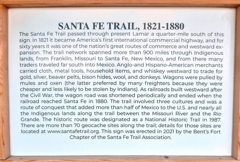
The Santa Fe Trail passed through present Lamar a quarter-mile south of this sign. In 1821 it became America's first international commercial highway, and for sixty years it was one of the nation's great routes of commerce and westward expansion. The trail network spanned more than 900 miles through Indigenous lands, from Franklin, Missouri to Santa Fe, New Mexico, and from there many traders traveled far south into Mexico. Anglo- and Hispano-American merchants carried cloth, metal tools, household items, and whiskey westward to trade for gold, silver, beaver pelts, bison hides, wool, and donkeys. Wagons were pulled by mules and oxen (the latter preferred by many freighters because they were cheaper and less likely to be stolen by Indians). As railroads built westward after the Civil War, the wagon road was shortened periodically and ended when the railroad reached Santa Fe in 1880. The trail involved three cultures and was a route of conquest that added more than half of Mexico to the U.S. and nearly all the Indigenous lands along the trail between the Missouri River and the Rio Grande. The historic route was designated
this page online
Erected 2021 by Bent's Fort Chapter of the Santa Fe Trail Association.
Topics and series. This historical marker is listed in these topic lists: Indigenous Peoples and Communities • Industry & Commerce • Roads & Vehicles • Settlements & Settlers. In addition, it is included in the Santa Fe Trail series list. A significant historical year for this entry is 1821.
Location. 38° 6.928′ N, 102° 37.132′ W. Marker is in Lamar, Colorado, in Prowers County. It is at the intersection of Scenic U.S. 50/287 and State Highway 196, on the right when traveling west on U.S. 50/287Scenic . Marker kiosk is located at the Big Timbers Museum Interpretive Park, on the south side of the museum. Touch for map. Marker is at or near this postal address: 7515 US-50 Scenic Highway, Lamar CO 81052, United States of America. Touch for directions.

Regionally, this marker is in the Eastern Plains. It

Photographed by Cosmos Mariner, August 16, 2022
2. Santa Fe Trail Map (north side of kiosk)
Other nearby markers. At least 8 other markers are within 2 miles of this marker, measured as the crow flies: Iraqi Freedom Memorial (here, next to this marker); Explore Big Timbers Region (here, next to this marker); Big Timbers Museum Collection (a few steps from this marker); Santa Fe Trail Scenic and Historic Byway (a few steps from this marker); a different marker also named Santa Fe Trail (a few steps from this marker); Big Timbers (within shouting distance of this marker); Madonna of the Trail (within shouting distance of this marker); Lamar Railroad Depot (approx. 1.8 miles away). Touch for a list and map of all markers in Lamar.
Another marker is no longer nearby. Santa Fe Trail (was approx. 0.3 miles away but has been permanently removed).
Regarding Santa Fe Trail, 1821-1880. Communities

Photographed by Cosmos Mariner, August 16, 2022
3. Santa Fe Trail, 1821-1880 Marker Kiosk (south side)
• Lamar, which has a Madonna of the Trail Monument and Big Timbers Museum
• Las Animas, which has the historic Kit Carson Chapel at Fort Lyon and the historic 1889 Bent County Courthouse
•Boggsville Historic Site and the original grave site of William Bent at the Las Animas Cemetery.
• In La Junta, visit the Otero Museum, the Koshare Kiva and Museum, and Bent’s Old Fort on Hwy. 154.
• The Comanche National Grasslands has limestone markers on segments of the Santa Fe Trail
• In Trinidad, visit the 1870s Hough-Baca and Bloom Mansions and the Santa Fe Trail Museum operated by the Colorado Historical Society.
Related markers. Click here for a list of markers that are related to this marker.
Also see . . .
1. A History of the Santa Fe Trail. Santa Fe Trail Association website entry:
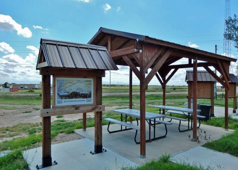
William Becknell started from Franklin, MO with five other men in September of 1821. It took them almost two and a half long, cold, worrisome months to reach New Mexico. Legend has it that when William Becknell rode into Franklin on his return in January 1822, a rawhide bag of silver coins was slashed open and spilled(Submitted on January 9, 2023, by Cosmos Mariner of Cape Canaveral, Florida.)to the cobblestone street, the profits of the meager goods taken to Santa Fe. This Missouri town, and indeed the whole state, caught the fever and the Santa Fe trade was off and running. Over the next twenty-four years, countless men from the Missouri frontier purchased goods, hired hands and headed for Santa Fe...Photographed by Cosmos Mariner, August 16, 20224. Santa Fe Trail, 1821-1880 Marker Kiosk (north side)(looking south • US 50/287 Scenic Highway in background)
2. The Santa Fe Trail in Colorado – The Mountain Route. Legends of America website entry (Submitted on January 5, 2024, by Larry Gertner of New York, New York.)
Credits. This page was last revised on January 5, 2024. It was originally submitted on January 8, 2023, by Cosmos Mariner of Cape Canaveral, Florida. This page has been viewed 377 times since then and 31 times this year. Photos: 1, 2, 3, 4. submitted on January 9, 2023, by Cosmos Mariner of Cape Canaveral, Florida.
