Bayside in Refugio County, Texas — The American South (West South Central)
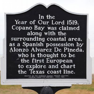
Copano Bay Claimed
Erected 1961 by The Governor Richard Preston Chapter, Colonial Dames XVII Century.
Topics and series. This historical marker is listed in these topic lists: Colonial Era • Exploration • Hispanic Americans • Settlements & Settlers. In addition, it is included in the The Colonial Dames XVII Century, National Society series list. A significant historical year for this entry is 1519.
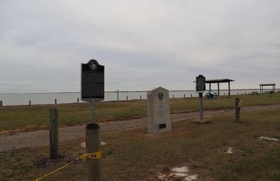
Location. 28° 5.491′ N, 97° 12.789′ W. Marker is in Bayside, Texas, in Refugio County. Marker is on Copano Bay Drive south of Wood, on the left when traveling south. Touch for map. Marker is at or near this postal address: 523 Copano Bay Dr, Bayside TX 78340, United States of America. Touch for directions.
Other nearby markers. At least 8 other markers are within 11 miles of this marker, measured as the crow flies. Birthplace of Clara Driscoll (a few steps from this marker); Site of the Town of Cópano (a few steps from this marker); John Howland Wood and Nancy Clark Wood House (about 300 feet away, measured in a direct line); Old St. Mary's Cemetery (approx. 1.8 miles away); Rincon Ranch (approx. 6.8 miles away); Port Bay Hunting and Fishing Club (approx. 7.6 miles away); McLester Family Cemetery (approx. 8½ miles away); Aransas County Airport (approx. 10.2 miles away). Touch for a list and map of all markers in Bayside.
Credits. This page was last revised on January 11, 2023. It was originally submitted on January 10, 2023, by Dave W of Co, Colorado. This page has been viewed 107 times since then and 32 times this year. Photos: 1, 2. submitted on January 10, 2023, by Dave W of Co, Colorado. • Devry Becker Jones was the editor who published this page.

