Alexandria West , Virginia — The American South (Mid-Atlantic)
An American Indian Camp in the Uplands
City of Alexandria, est. 1749
— Alexandria Heritage Trail —

Photographed By Devry Becker Jones (CC0), January 15, 2023
1. An American Indian Camp in the Uplands Marker
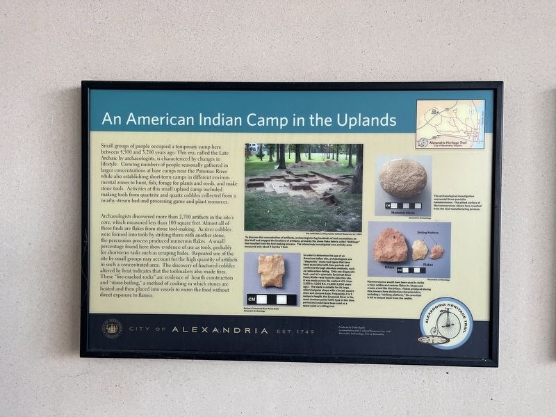
Small groups of people occupied a temporary camp here between 4,500 and 3,200 years ago. This era, called the Late Archaic by archaeologists, is characterized by changes in lifestyle. Growing numbers of people seasonally gathered in larger concentrations at base camps near the Potomac River while also establishing short-term camps in different environmental zones to hunt, fish, forage for plants and seeds, and make stone tools. Activities at this small upland camp included making tools from quartzite and quarts cobbles collected from a nearby stream bed and processing game and plant resources.
Archaeologists discovered more than 2,700 artifacts in the site's core, which measured less than 100 square feet. Almost all of these finds are flakes from stone tool-making. As river cobbles were formed into tools by striking them with another stone, the percussion process produced numerous flakes. A small percentage found here show evidence of use as tools, probably for short-term tasks such as scraping hides. Repeated use of the site by small groups may account for the high quantity of artifacts in such a concentrated area. The discovery of fractured cobbles altered by heat indicates that the toolmakers also made fires. These "fire-cracked rocks" are evidence of hearth-construction and "stone-boiling," a method of cooking in which stones are heated and then placed into vessels to warm the food without direct exposure to flames.
[Captions:]
To discover this concentration of artifacts, archaeologists dug hundreds of test excavations on this bluff and mapped the locations of artifacts, primarily the stone flake debris called "debitage" that resulted from the tool-making process. The intensively investigated core activity area measured only about 9 feet by 7 feet.
In order to determine the age of an American Indian site, archaeologists use "diagnostic" stone tool types that have been associated with time periods and confirmed through absolute methods, such as radiocarbon dating. Only one diagnostic tool—part of a quartzite Savannah River Point/Knife--was found to date at this site. It was made across the eastern U.S. from 2,500 to 1,200 B.C. (4,500 - 3,200 years ago). The blade is notable for its large wide triangular shape with a broad square stem and concave base. Frequently 2 to 5 inches in length, the Savannah River is the most common point/knife type in this time period and could have been used as a spear point or cutting tool.
The archeological investigation uncovered three quartzite hammerstones. The pitted surface of the hammerstones shown here resulted from the tool-manufacturing process.
Hammerstones would have been used

Photographed By Devry Becker Jones (CC0), January 15, 2023
2. An American Indian Camp in the Uplands Marker
Erected by City of Alexandria, Virginia.
Topics and series. This historical marker is listed in these topic lists: Anthropology & Archaeology • Native Americans. In addition, it is included in the Virginia, The City of Alexandria series list.
Location. 38° 49.876′ N, 77° 7.066′ W. Marker is in Alexandria, Virginia. It is in Alexandria West. Marker is at the intersection of Mark Center Avenue and Mark Center Drive, on the left when traveling west on Mark Center Avenue. Touch for map. Marker is at or near this postal address: 4800 Mark Center Dr, Alexandria VA 22311, United States of America. Touch for directions.
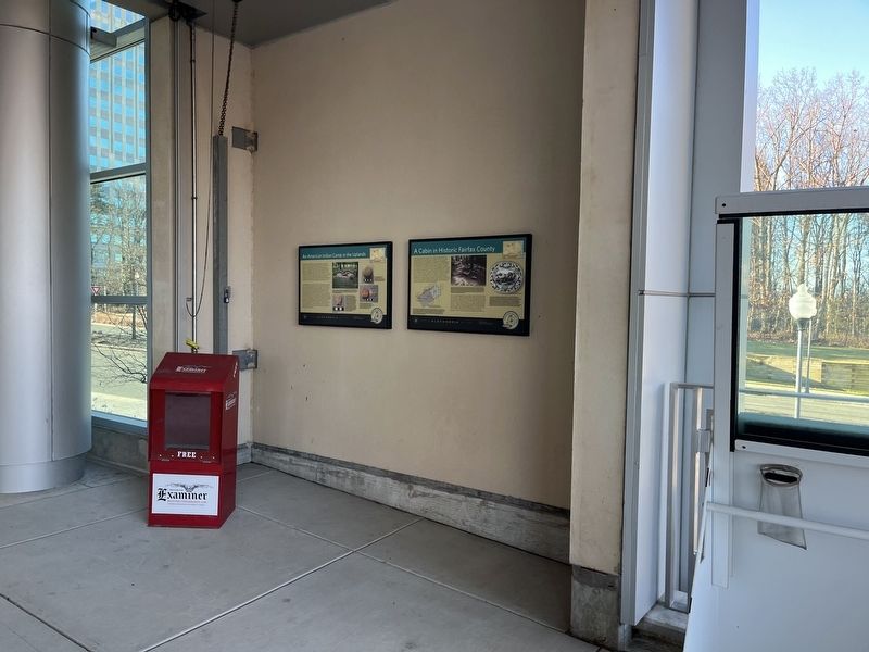
Other nearby markers. At least 8 other markers are within walking distance of this marker. Cabin in Historic Fairfax County (here, next to this marker); Outlying Gun Battery (approx. ¾ mile away); Southwest Bastion (approx. 0.8 miles away); Jackson Cemetery (approx. 0.8 miles away); Fort Ward (approx. 0.8 miles away); Powder Magazine and Filling Room (approx. 0.8 miles away); Northwest Bastion (approx. 0.8 miles away); Profile of Fort (approx. 0.8 miles away). Touch for a list and map of all markers in Alexandria.
Credits. This page was last revised on February 25, 2023. It was originally submitted on January 17, 2023, by Devry Becker Jones of Washington, District of Columbia. This page has been viewed 180 times since then and 26 times this year. Photos: 1, 2. submitted on January 17, 2023, by Devry Becker Jones of Washington, District of Columbia.