Frisco in Collin County, Texas — The American South (West South Central)
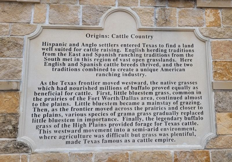
Origins: Cattle Country
Photographed by James Hulse, December 11, 2022
1. Origins: Cattle Country Marker
As the Texas frontier moved westward, the native grasses which had nourished millions of buffalo proved equally as beneficial for cattle. First, little bluestem grass, common in the prairies of the Fort Worth/Dallas area, continued almost to the plains. Little bluestem became a mainstay of grazing. Then, as the frontier moved across the prairies and closer to the plains, various species of grama grass gradually replaced little bluestem in importance. Finally, the legendary buffalo grass of the High Plains provided forage for Texas cattle. This westward movement into a semi-arid environment, where agriculture was difficult but grass was plentiful, made Texas famous as a cattle empire.
this page online
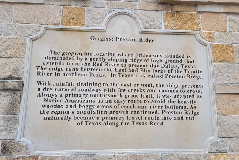
With rainfall draining to the east or west, the ridge presents a dry natural roadway with few creeks and ravines to cross. Always a primary north/south game trail, it was adapted by Native Americans as an easy route to avoid the heavily wooded and boggy areas of creek and river bottoms. As the region's population growth continued, Preston Ridge naturally became a primary travel route into and out of Texas along the Texas Road.
Photographed by James Hulse, December 11, 2022
2. Origins: Preston Ridge Side Panel
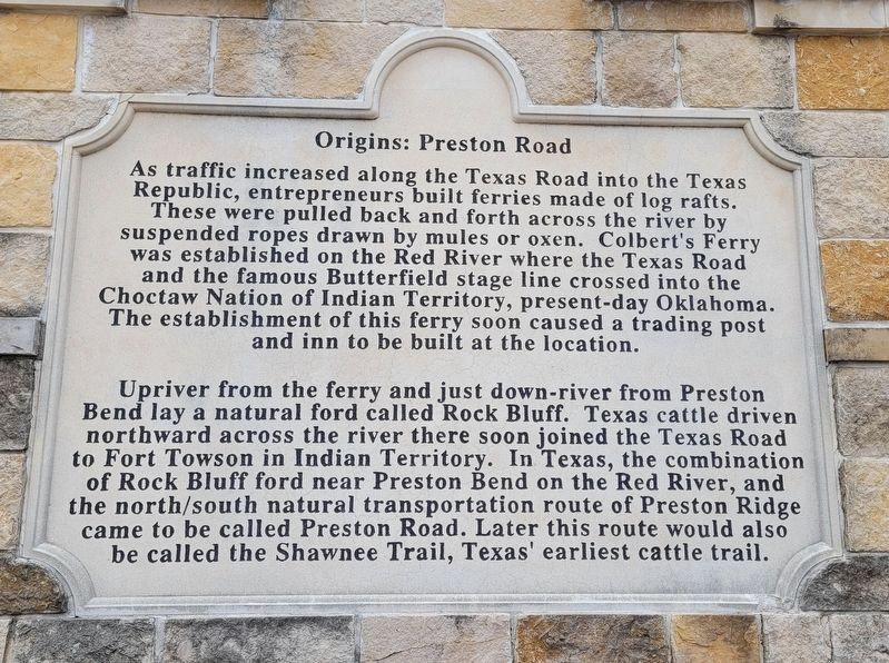
Upriver from the ferry and just down-river from Preston Bend lay a natural ford called Rock Bluff. Texas cattle driven northward across the river there soon joined the Texas Road to Fort Towson in Indian Territory. In Texas, the combination of Rock Bluff ford near Preston Bend on the Red River, and the north/south natural transportation route of Preston Ridge came to be called Preston Road. Later this route would also be called the Shawnee Trail, Texas' earliest cattle trail.
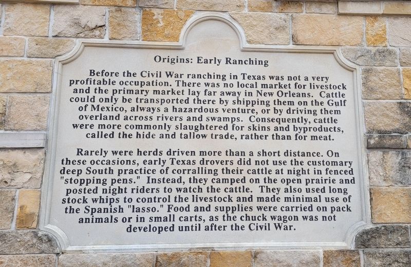
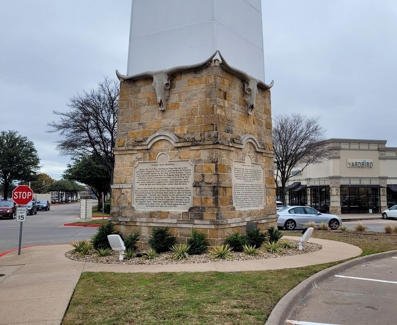
Rarely were herds driven more than a short distance. On these occasions, early Texas drovers did not use the customary deep South practice of corralling
Photographed by James Hulse, December 11, 2022
3. Origins: Preston Road Side Panel
Erected by City of Frisco.
Topics. This historical marker is listed in these topic lists: Animals • Indigenous Peoples and Communities • Roads & Vehicles.
Location. 33° 6.427′ N, 96° 48.481′ W. Marker is in Frisco, Texas, in Collin County. It can be reached from Mall Road F 0.1 miles north of Gaylord Parkway, on the left when traveling north. The marker is located in the shopping center parking area. Touch for map. Marker is in this post office area: Frisco TX 75034, United States of America. Touch for directions.

Regionally, this marker is in the Prairies & Lakes Region and in the Dallas-Fort Worth Metropolitan Area. Globally, it is in North America, a Gulf of Mexico state, the Western Hemisphere, the
Photographed by James Hulse, December 11, 2022
4. Origins: Early Ranching Side Panel
Other nearby markers. At least 8 other markers are within walking distance of this marker: Site of Lebanon (approx. 0.2 miles away); The Texas Longhorn (approx. 0.2 miles away); Trail Driving Prior to 1845 (approx. 0.2 miles away); Military Survey of Preston Road (approx. 0.2 miles away); The Cow Camp (approx. 0.2 miles away); The Trail Crew (approx. 0.2 miles away); American Bison (approx. ¼ mile away); The Trail Drive Company (approx. 0.4 miles away). Touch for a list and map of all markers in Frisco.
Photographed by James Hulse, December 11, 2022
5. The marker has four panels around it
Photographed by James Hulse, December 11, 2022
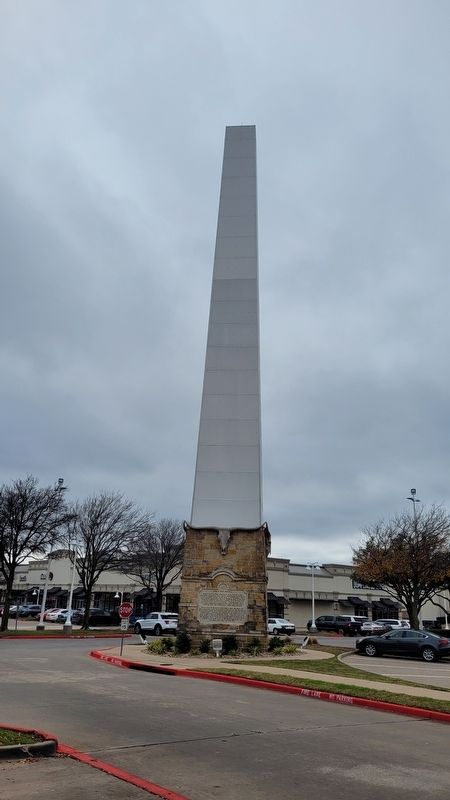
6. The view of the Marker from the shopping lot parking lot
Credits. This page was last revised on January 25, 2023. It was originally submitted on January 25, 2023, by James Hulse of Medina, Texas. This page has been viewed 472 times since then and 67 times this year. Photos: 1, 2, 3, 4, 5, 6. submitted on January 25, 2023, by James Hulse of Medina, Texas.
