Fairview Township near Lewisberry in York County, Pennsylvania — The American Northeast (Mid-Atlantic)
First Pinchot Road
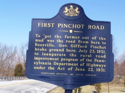
Photographed by William Pfingsten, March 1, 2008
1. First Pinchot Road Marker
Erected by Pennsylvania Historical and Museum Commission.
Topics and series. This historical marker is listed in these topic lists: Agriculture • Roads & Vehicles. In addition, it is included in the Pennsylvania Historical and Museum Commission (PHMC) series list. A significant historical date for this entry is July 23, 1931.
Location. 40° 6.948′ N, 76° 52.034′ W. Marker is near Lewisberry, Pennsylvania, in York County. It is in Fairview Township. It is at the intersection of Rosstown Road and Bull Road, on the right when traveling north on Rosstown Road. Touch for map. Marker is at or near this postal address: 1008 Rosstown Rd, Lewisberry PA 17339, United States of America. Touch for directions.

Regionally, this marker is in South-Central Pennsylvania, specifically in Pennsylvania Dutch Country, in the Susquehanna Valley, and in Greater Harrisburg. It is also in the American
this page online
Other nearby markers. At least 8 other markers are within 5 miles of this marker, measured as the crow flies: Dr. Homer C. Hetrick, M. D. (approx. 1.4 miles away); Veterans Memorial (approx. 1.4 miles away); World War II Honor Roll (approx. 1.4 miles away); Lewisberry (approx. 1½ miles away); Lewisberry High School (approx. 1½ miles away); a different marker also named Lewisberry (approx. 1.6 miles away); Newberrytown (approx. 3½ miles away); a different marker also named Newberrytown (approx. 4.2 miles away). Touch for a list and map of all markers in Lewisberry.
Also see . . .
1. First Pinchot Road - Behind the Marker. ExplorePAHistory.com (Submitted on July 21, 2011, by Mike Wintermantel of Pittsburgh, Pennsylvania.)
2. Gifford Pinchot at FindAGrave.com. (Submitted on July 21, 2011, by Mike Wintermantel of Pittsburgh, Pennsylvania.)
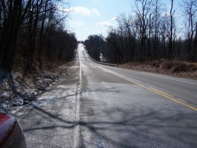
Photographed by William Pfingsten, March 1, 2008
2. Rosstown Road looking south.
Credits. This page was last revised on February 7, 2023. It was originally submitted on March 1, 2008, by Bill Pfingsten of Bel Air, Maryland. This page has been viewed 2,468 times since then and 82 times this year. Last updated on January 26, 2023, by Annette Fillmore of York, Pennsylvania. Photos: 1, 2. submitted on March 1, 2008, by Bill Pfingsten of Bel Air, Maryland.
