Bolton in Atlanta in Fulton County, Georgia — The American South (South Atlantic)
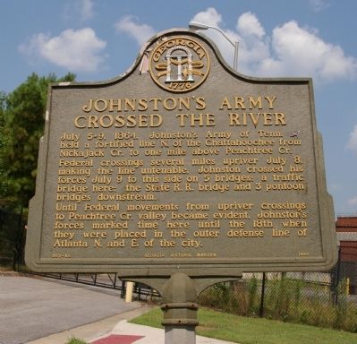
Johnston’s Army Crossed the River
Photographed by David Seibert, August 8, 2009
1. Johnston’s Army Crossed the River Marker
Federal crossings several miles upriver July 8, making the line untenable, Johnston crossed his forces July 9 to this side on 5 bridge: a traffic bridge here; the State R.R. bridge and 3 pontoon bridges downstream.
Until Federal movements from upriver crossing to Peachtree Cr. valley became evident, Johnston’s forces marked time here until the 18th when they were placed in the outer defense line of Atlanta N. and E. of the city.
Erected 1985 by Georgia Department of Natural Resources. (Marker Number 060-85.)
Topics and series. This historical marker is listed in this topic list: War, US Civil. In addition, it is included in the Georgia Historical Society series list. A significant historical year for this entry is 1864.
Location. 33° 49.27′ N, 84° 27.612′ W. Marker is in Atlanta, Georgia, in Fulton County. It is in Bolton. It is on Barnett Drive 0.1 miles west of Bolton Road NW, on the right when traveling west. The marker is at the end of Barnett Drive, which is now dead-end
this page online

Regionally, this marker is in Georgia’s Piedmont. It is also in the American South and specifically in the Deep South. Globally, it is in North America, the Western Hemisphere, the Western World, and the Anglosphere. Historically, it finds itself in what was once the territory of the Mississippian Culture, one of the original Thirteen Colonies, one of the Confederate States of America, and the Antebellum South.
Other nearby markers. At least 8 other markers are within 2 miles of this marker, measured as the crow flies: Montgomery Cemetery (approx. half a mile away); Montgomery's Ferry (approx. 0.6 miles away); Fort Peach Tree (approx. 0.6 miles away); Standing Peach Tree (approx. 0.6 miles away); Fort Peachtree, War of 1812 (approx. one mile away); Battle at Moore’s Mill (approx. 1.1 miles away); Moore's Mill (approx. 1.1 miles away); Casey's Hill (approx.
Photographed by David Seibert, August 8, 2009
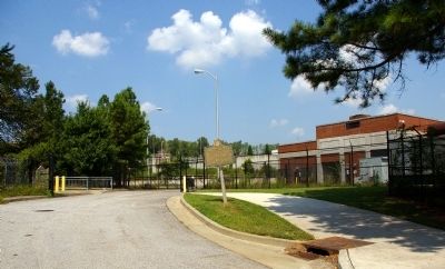
2. Johnston’s Army Crossed the River Marker
Looking west at the end of Barnett Drive, with the Atlanta Water Works to the right
Another marker is no longer nearby. Montgomery-DeFoor House Site (was approx. half a mile away but has been confirmed missing).
More about this marker. This marker replaced an earlier marker of the same title and text near this location erected by the Georgia Historical Commission.
Photographed by David Seibert, August 8, 2009
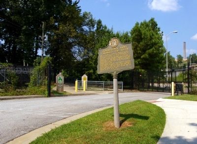
3. Johnston’s Army Crossed the River Marker
Showing the dead end of Barnett Drive at the Atlanta Water Works, and the entrance gate to the PATH Foundation trail
Photographed by David Seibert, August 8, 2009
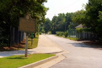
4. Johnston’s Army Crossed the River Marker
Looking east on Barnett Drive toward Bolton Road
Credits. This page was last revised on February 8, 2023. It was originally submitted on August 9, 2009, by David Seibert of Sandy Springs, Georgia. This page has been viewed 1,490 times since then and 36 times this year. Photos: 1, 2, 3, 4. submitted on August 9, 2009, by David Seibert of Sandy Springs, Georgia. • Craig Swain was the editor who published this page.
