
Near Telchaquillo in Tecoh, Yucatán, Mexico — The Southeast (Yucatan Peninsula)
Mayapan
Archeological Site
Photographed by James Hulse, February 1, 2023
1. Mayapan Marker

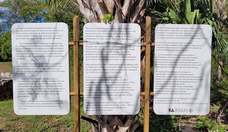
Es considerada como el centro más importante de la civilización maya del periodo Postclásico (1200 - 1441 d.C.) mencionada con frecuencia en la literatura Maya y Fuentes Hispanas. Durante este periodo, la gran capital maya alcanzó su esplendor y ejerció su dominio sobre las provincias del noreste y centro norte de la península de Yucatán.
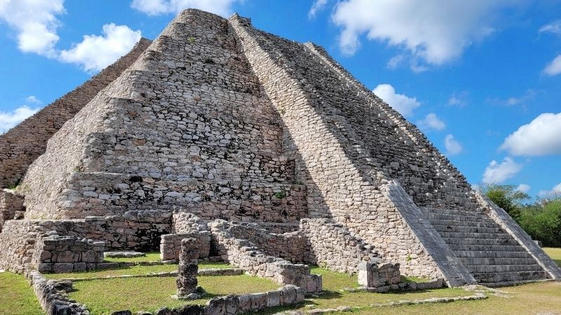
Su majestuosidad está plasmada en sus grandes edificios como "El Castillo de Kukulcán" el cual es una pequeña muestra de la influencia constructiva que Chichén-Itzá tuvo en Mayapán, aunque éste es de menor tamaño.
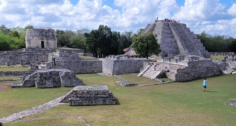
En la Plaza Central están los edificios cívicos, administrativos y religiosos, así como las residencias de la clase gobernante. Se trata de edificios construidos sobre basamentos con pasillos y columnas, formando templos y oratorios, con altares de fondo y banquetas a los lados. También son representativos
this page online
La zona habitacional se concentra principalmente al sureste del centro cívico, los patios de las viviendas están delimitadas por muros llamados localmente albarradas.
English:
The majesty of this site is evidenced by great buildings such as "Kukulcan's Castle"; constructive influences from Chichen Itza are apparent, althoug building proportions in Mayapan are smaller (as in the case of the Castle).
In the central plaza,
Photographed by James Hulse, February 1, 2023
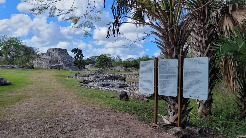
2. The entrance to the Mayapan Archaeological Site and Marker
Mayapan's residential zone is mainly concentrated in the southeastern section of the civic center. Patios of dwellings are bordered by walls localy know as albarradas or "defensive walls".
Mayan:
Le noj kaajil Mayapan yaan u tulumo', beeta'ab tu ka'a táanchumukil le siiglo XIIo', ku chukik u nojochil 4 kilometros tu tséelilo'ob, te'ela' yaan naats' ti' 4 000 ak'ililo'ob. U k'aaba'e' u k áat u ya'ale' "la bandera de los mayas" yéetel ku tukla'al yaanchaj 12 000 u kajnáalilo'ob.
Ku tukla'al u maas k'a'ana'anil ti' le maaya kaajo'obil le Postclasicoo' (1200-1441 ts'o'okol u k'uchul ki'ichkelem yuum), ku jach k'aaba'ata'al ti' áanalte'ob yéetel ts'íiba'an ju'uno'ob ich káastlan.
Ti' le k'iinilo'oba' tu chukaj u nojochil
Photographed by James Hulse, February 1, 2023
3. The view of the Central Plaza
Te' chúumuk k'íiwiko' tya'an le k'a'ana'an pak ililo'obo' je'ex bey xan u yotoch le jalach w'iniko'obo'. Lelo'oba' pak ililo'ob beeta'ano'ob yook ol táaxkuna'an lu'um yaan tu'ux u máan máak yéetel yaan u ka'anal tsola'an tuunicho'ob, ku beetiko'ob k uyem najo'ob yéetel kúuchil payal chi'ob, yéetel ka'anche'ob yéetel tu'ux u kutal máak tséelilo'ob. Bey xane yaan le chan k uyem najo'ob yéetel wóolis bak'pachta'an najo'ob, k'ajóola'an je'ex u kúuchilil u yila'al ka'ane'.
Le kúuchil kuxtalo' tya'an tu nojol-lak'in le k'íiwiko, u táankabil le otocho'obo' ku ja'atsalo'ob yéetel ka' anal pak'o'ob k'ajóola'an je'ex kooto'obe'.
Erected by Instituto Nacional de Antropología e Historia (INAH).
Topics. This historical marker is listed in these topic lists: Anthropology & Archaeology • Architecture • Indigenous Peoples and Communities.
Location. 20° 37.834′ N,
Photographed by James Hulse, February 1, 2023
4. Kukulcan Castle

Regionally, this marker is in the Mexican Gulf Coast, in the Maya Heartland, and on the Yucatán Peninsula. Globally, it is in North America, Mesoamerica, a Gulf of Mexico state, and the Western Hemisphere. Historically, it finds itself in what was once New Spain and also a Spanish colony.
Other nearby markers. At least 8 other markers are within walking distance of this marker: The Temple of the Painted Niches (within shouting distance of this marker); The Temple of the Mask and the Room of the Turtles (about 120 meters away, measured in a direct line); Straw House, The Oratory and Turtle Man (about 120 meters away); Shrines Altars and Platforms (about 120 meters away); Kukulcan Castle (about 150 meters away); The Round Temple (about 150 meters away); The Room of the Frescoes
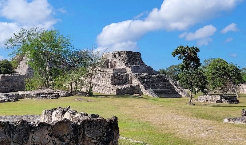
Photographed by James Hulse, February 1, 2023
5. The Temple of the Painted Niches
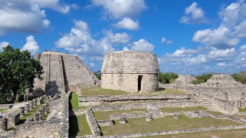
Photographed by James Hulse, February 1, 2023
6. The Round Temple
Credits. This page was last revised on February 6, 2023. It was originally submitted on February 3, 2023, by James Hulse of Medina, Texas. This page has been viewed 145 times since then and 28 times this year. Photos: 1, 2, 3, 4, 5, 6. submitted on February 3, 2023, by James Hulse of Medina, Texas.
