Shade Township near Stoystown in Somerset County, Pennsylvania — The American Northeast (Mid-Atlantic)
Forbes Road
Edmund's Swamp
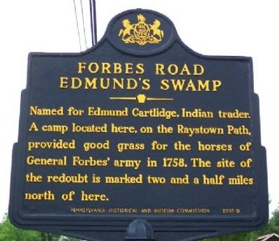
Photographed by William Fischer, Jr., June 26, 2009
1. Forbes Road Marker
Erected 2005 by Pennsylvania Historical and Museum Commission.
Topics and series. This historical marker is listed in these topic lists: Colonial Era • Heroes • War, French and Indian. In addition, it is included in the Forbes Road, and the Pennsylvania Historical and Museum Commission (PHMC) series lists. A significant historical year for this entry is 1758.
Location. 40° 4.247′ N, 78° 51.586′ W. Marker is near Stoystown, Pennsylvania, in Somerset County. It is in Shade Township. It is on Lincoln Highway (U.S. 30) 0.2 miles east of Buckstown Road. Touch for map. Marker is at or near this postal address: 6904 Lincoln Hwy, Stoystown PA 15563, United States of America. Touch for directions.

Regionally, this marker is in Pennsylvania’s Laurel Highlands. It is also in the American Northeast, in the Mid-Atlantic, in Appalachia, and specifically in Northern Appalachia. Globally, it
this page online
Other nearby markers. At least 8 other markers are within 2 miles of this marker, measured as the crow flies: Heroes of Flight 93 (approx. 1.1 miles away); The Kavod Garden (approx. 1.1 miles away); The Compass Rose (approx. 1.1 miles away); Wildflower Meadow (approx. 1.2 miles away); Ryan's Trail (approx. 1.2 miles away); The Cross (approx. 1.2 miles away); Tower of Voices (approx. 1½ miles away); Flight 93 National Memorial (approx. 1.6 miles away). Touch for a list and map of all markers in Stoystown.
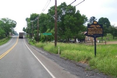
Photographed by William Fischer, Jr., June 26, 2009
2. Forbes Road Marker
Looking west on US 30.
Credits. This page was last revised on February 7, 2023. It was originally submitted on August 12, 2009, by William Fischer, Jr. of Reynoldsburg, Ohio. This page has been viewed 2,734 times since then and 146 times this year. Photos: 1, 2. submitted on August 12, 2009, by William Fischer, Jr. of Reynoldsburg, Ohio. • Bill Pfingsten was the editor who published this page.
