East Boston in Suffolk County, Massachusetts — The American Northeast (New England)
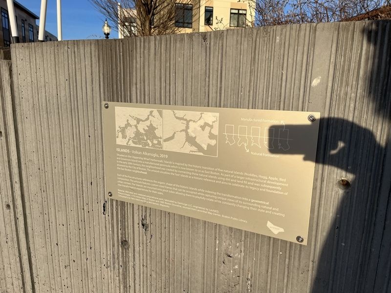
Islands - Volkan Alkanoglu, 2019
Situated on the Clippership Wharf Harborwalk, 'Islands' is inspired by the historic transition of five natural islands (Noddles, Hogg, Apple, Bird and Governors Island) into a manufactured peninsula which is now known to us as East Boston. As part of a larger infrastructural development in the early 20th Century, the neighborhood was created by connecting these natural islands using dirt and land fill and was subsequently annexed by the City of Boston. The artwork visualizes the 'lost' islands as a historic reference and aims to celebrate its legacy and foundation of the East Boston neighborhood.
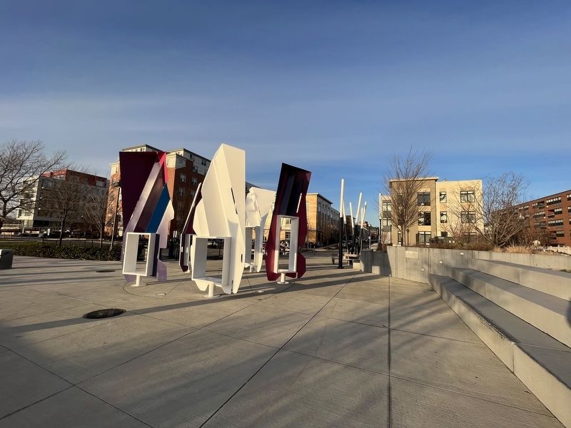
Each of the five structures references the organic shape of the historic islands while indexing the transformation into a geometrical composition. The artwork features custom sized frames that can be occupied while capturing unique views of its surrounding natural and urban context. The 'Islands' are mounted onto pivot tubes allowing them to playfully rotate while constantly changing their state and creating new transformative experiences for their users.
Material: Mild steel and catalyzed polyurethane paint, fabricated by Demiurge LLC, engineered by LaufsED.
Plaque Images: 1774 Hinton Map of Boston and 1995 Boston Shoreline, sourced from Leventhal Map Center, Boston Public Library.
Cartography by Herb Heidt and Eliza McClennen, Mapworks
Erected 2019 by Volkan Alkanoglu, sculptor.
Topics. This historical marker is listed in these topic lists: Man-Made Features • Political Subdivisions • Settlements & Settlers • Waterways & Vessels. A significant historical year for this entry is 1774.
Location. 42° 22.118′ N, 71° 2.511′ W. Marker is in Boston, Massachusetts, in Suffolk County. It is in East Boston. Marker is at the intersection of Father Jacobbe Road and Lisbon Street, on the right when traveling east on Father Jacobbe Road. Touch for map. Marker is at or near this postal address: 24 Clipper Ship Ln, Boston MA 02128, United States of America. Touch for directions.
Other nearby markers. At least 8 other markers are within walking distance of this marker. East Boston (a few steps from this marker); Carlton's Wharf (within shouting distance of this marker); a different marker also named East Boston (within shouting distance of this marker); From Boilers to Biotech (about 300 feet away, measured in a direct line); Harbor Vessels - What Do You See? (about 400 feet away); Commemorative Relief of Noddle's Island (about 400 feet away); Prolific Inventor: Otis Tufts (about 500 feet away); Exploring the Living Shoreline (about 500 feet away). Touch for a list and map of all markers in Boston.
Credits. This page was last revised on February 6, 2023. It was originally submitted on February 6, 2023, by Devry Becker Jones of Washington, District of Columbia. This page has been viewed 88 times since then and 9 times this year. Photos: 1, 2. submitted on February 6, 2023, by Devry Becker Jones of Washington, District of Columbia.

