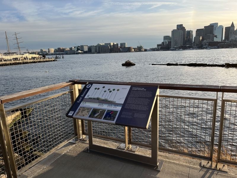
East Boston in Suffolk County, Massachusetts — The American Northeast (New England)
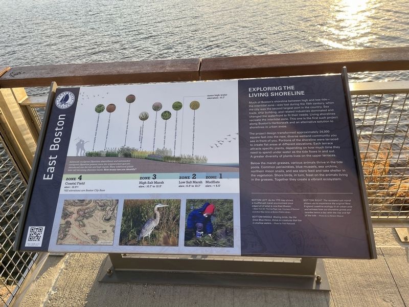
Exploring the Living Shoreline
East Boston
— Harborwalk Boston —
Much of Boston's shoreline between high and low tide — the intertidal zone — was lost during the 19th century, when the city was the second largest port in the country. Sea trade, ship building, and related industries dominated and changed the waterfront to fit their needs. Living shorelines recreate the intertidal zone. This one is the first such project along Boston's Harborwalk and an alternative solution to shorelines in urban areas.
The project design transformed approximately 24,000 square feet into the new, diverse wetland community you see in front of you. Portions of the shoreline were terraced to create the flat areas at different elevations. Each terrace attracts specific plants, depending on how much time they need to spend under the water as the tide flows in and out. A greater diversity of plants lives on the upper terraces.
Below the marsh grasses, various animals thrive in the tide pools. Common periwinkles, blue mussels, sea urchins, northern moon snails, and sea stars feed and take shelter in the vegetation. Shore birds, in turn, feast on the animals living in the grasses. Together they create a vibrant ecosystem.
[Captions:]
Bottom Left As the 1775 map shows, a mudflat-salt marsh environment once edged all of what is now East Boston.
Bottom Middle Wading birds, like the Great Blue Heron, thrive on creatures that live in shallow waters.
Bottom Right The recreated salt marsh allows you to experience the original New England coastline ecology in an urban area and witness how our shoreline grows and recedes twice a day with the rise and fall of the tide.
Saltmarsh cordgrass (Spartina alterniflora) and saltmeadow cordgrass (Spartina patens) were the original plant species introduced into the low and high marsh. Many additional plants now call the Living Shoreline home. How many can you identify?
Zone 4
Costal Field
elev.: 12.5'+
Zone 3
High Salt Marsh
elev.: 10.7' to 12.5'
Zone 2
Low Salt Marsh
elev.: 6.5' to 10.7'
Zone 1
Mudflats
elev.: < 6.5'
*All elevations are Boston City Base
Erected by Harborwalk Boston.
Topics. This historical marker is listed in these topic lists: Animals • Environment • Industry & Commerce • Parks & Recreational Areas • Waterways & Vessels. A significant historical year for this entry is 1775.
Location. 42° 22.04′ N, 71°
Other nearby markers. At least 8 other markers are within walking distance of this marker. Harbor Vessels - What Do You See? (within shouting distance of this marker); Prolific Inventor: Otis Tufts (within shouting distance of this marker); View of Boston in 1848. (about 300 feet away, measured in a direct line); Crossing the Harbor (about 400 feet away); East Boston (about 400 feet away); "Extraordinary Passage of the Flying Cloud" (about 400 feet away); a different marker also named East Boston (about 500 feet away); Islands - Volkan Alkanoglu, 2019 (about 500 feet away). Touch for a list and map of all markers in Boston.
Credits. This page was last revised on February 6, 2023. It was originally submitted on February 6, 2023, by Devry Becker Jones of Washington, District of Columbia. This page has been viewed 91 times since then and 23 times this year. Photos: 1, 2. submitted on February 6, 2023, by Devry Becker Jones of Washington, District of Columbia.

