Downtown in Boston in Suffolk County, Massachusetts — The American Northeast (New England)
Historical Development of Park Square
Water, Land & Early Development / Railroad & Urban Revival
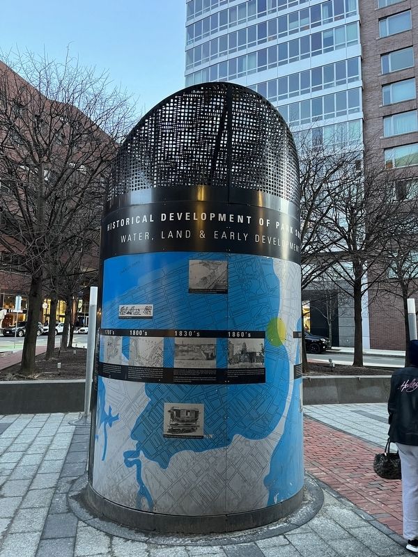
Water, Land & Early Development
1700's
At Boston's founding in 1630 and well into the 1700s, this site was occupied by tidal marshes and flats of the Charles River. This 1777 map depicts Frog Lane (Boylston Street) and Pleasant Street (a portion of which survives — now named Broadway — on the east side of the Motor Mart Garage).
1800's
By 1794, the site was filled for construction of ropewalks for the manufacture of ropes and rigging. This 1814 map also depicts dense new residential development along Pleasant Street, Elliot Street, Boylston Street, and Carver Street. A segment of Carver Street survives today as Townsend Street, an alley providing delivery access to the State Transportation Building.
1830's
In 1835, the Boston & Providence Railroad was extended to Boston and a depot (the first of three) was constructed in 1836 at the present location of the Boston Park Plaza Hotel.
1860's
The area was now referred to as Park Square on city maps, but Columbus Avenue had not yet been extended into the square from the South End. This circa 1860 view shows the second Boston & Providence Depot on Pleasant Street.
1870's
By 1872 the second depot was demolished, Columbus Avenue was extended across the site to connect with Charles Street and Boylston Street, and the first and final Park Square depot was erected in the new wedge formed by the intersection of Columbus Avenue with Providence Street. The new monumental passenger station, designed by Peabody and Stearns, was at the time of its construction the world's longest railroad station (850 feet) and featured rooms for billiards, reading, smoking, and dining. With construction of the depot came increased commercial development in the form of hotels, restaurants, and shops.
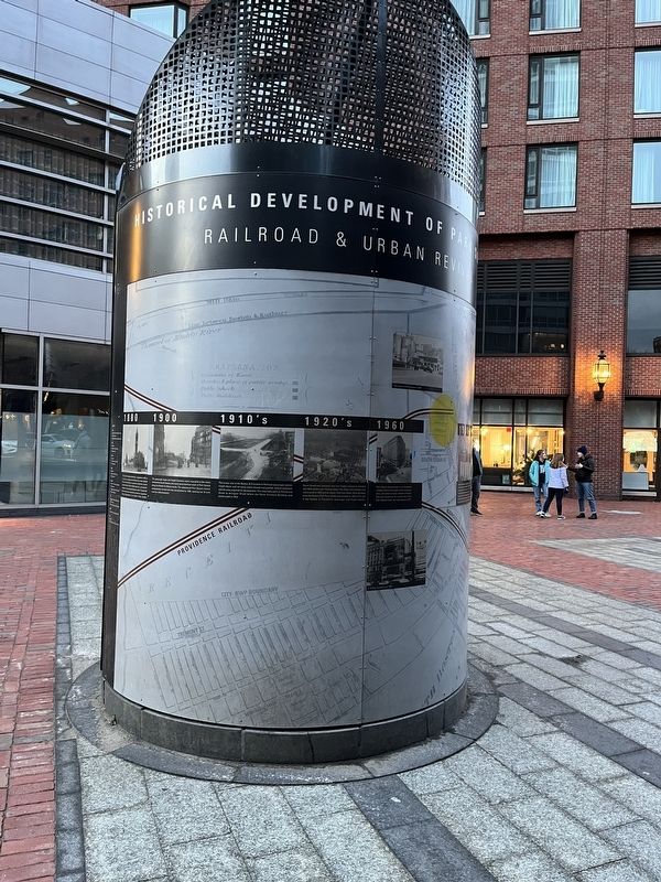
Railroad & Urban Revival
1880
The Lincoln Freedmen Memorial, completed in 1879, is a replica of a statue commissioned by emancipated African Americans as a memorial to Abraham Lincoln and dedicated in 1876 in Washington, D.C. by Frederick Douglass. It was sculpted by Boston native Thomas Ball whose best known monuments include the equestrian George Washington in the Boston Public Garden.
1900
The passenger depot and freight functions were relocated to the newly constructed South Station and trains were diverted south of Park Square along the Boston & Albany tracks. The abandoned Park Square station subsequently burned and was demolished by 1909, opening the 16 acre tract for redevelopment.
1910's
The former site of the Boston & Providence Railroad passenger station, freight depot, and
1920's
Stuart Street was extended east from Copley Square to intersect with Elliot Street near Tremont Street. The Motor Mart Garage was constructed in 1925 and the Statler Hotel and Statler Office Building (now the Boston Park Plaza Hotel) was erected in 1926 on the site of the Boston & Providence passenger and freight depots.
1960
Park Square became home to an increasing number of bars and lounges, music clubs, pool halls, and pinball arcades. Boston's Playboy Club was located on the current site of the Four Seasons Hotel. The club closed in 1977.
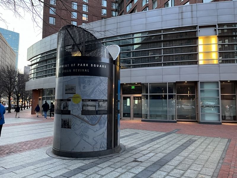
1980's
The Boston Redevelopment Authority (BRA) targeted the now seedy Park Square for private redevelopment. A massive project, Park Plaza was defeated following an outcry by residents and environmentalists concerned by impacts on neighborhoods and the Public Garden. A smaller-scaled project, combining a hotel, condominiums, retailers, restaurants, and the state transportation building, was approved. Buildings were demolished, and streets reconfigured for construction of the Four Seasons Hotel (1982-185), the State Transportation Building (1983), and the
2004
The last remaining urban renewal parcels, once the location of a lively block of commercial buildings, clubs and lounges, and the Union Bus Terminal, was completed with construction of One Charles Street South condominium and the Bristol/Courtyard Addition to the Four Seasons Hotel.
Topics. This historical marker is listed in these topic lists: African Americans • Arts, Letters, Music • Colonial Era • Industry & Commerce • Railroads & Streetcars • Roads & Vehicles • Settlements & Settlers • War, US Civil. A significant historical year for this entry is 1630.
Location. 42° 21.126′ N, 71° 4.057′ W. Marker is in Boston, Massachusetts, in Suffolk County. It is in Downtown. Marker is at the intersection of Park Plaza and Charles Street South, on the right when traveling east on Park Plaza. Touch for map. Marker is at or near this postal address: 192 Boylston St, Boston MA 02116, United States of America. Touch for directions.
Other nearby markers. At least 8 other markers are within walking distance of this marker. 1893 (a few steps from this marker); Poe Returning to Boston (within shouting distance of this marker); Edgar Allan Poe (within shouting distance of this marker); Emancipation Memorial (within shouting distance of this marker); Edward A. Filene (about 300 feet away, measured in a direct line); Wendell Phillips (about 300 feet away); Gilbert Stuart (about 300 feet away); Colonel Thomas Cass and the Ninth Massachusetts Infantry (about 400 feet away). Touch for a list and map of all markers in Boston.
Credits. This page was last revised on February 6, 2023. It was originally submitted on February 6, 2023, by Devry Becker Jones of Washington, District of Columbia. This page has been viewed 109 times since then and 46 times this year. Photos: 1, 2, 3. submitted on February 6, 2023, by Devry Becker Jones of Washington, District of Columbia.


