Pie Del Cerro in Cartagena de Indias in Municipio de Cartagena, Bolívar, Colombia — Northwestern South America
Don Blas de Lezo
Photographed by James Hulse, February 4, 2023
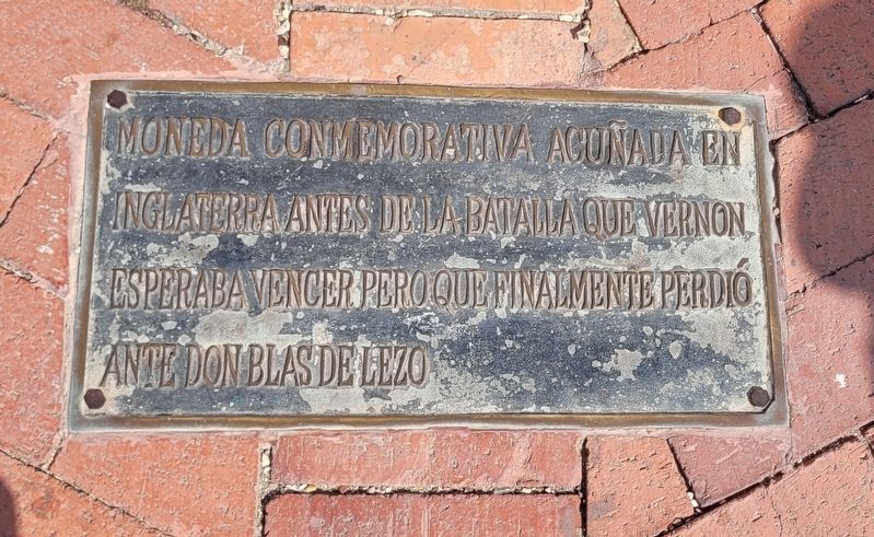
1. The Don Blas de Lezo Marker is located on the ground

English translation:
Commemorative British Medal: True British Heros Took Cartagena April 1741
Topics. This historical marker is listed in these topic lists: Colonial Era • Forts and Castles • Wars, Non-US. A significant historical month for this entry is April 1741.
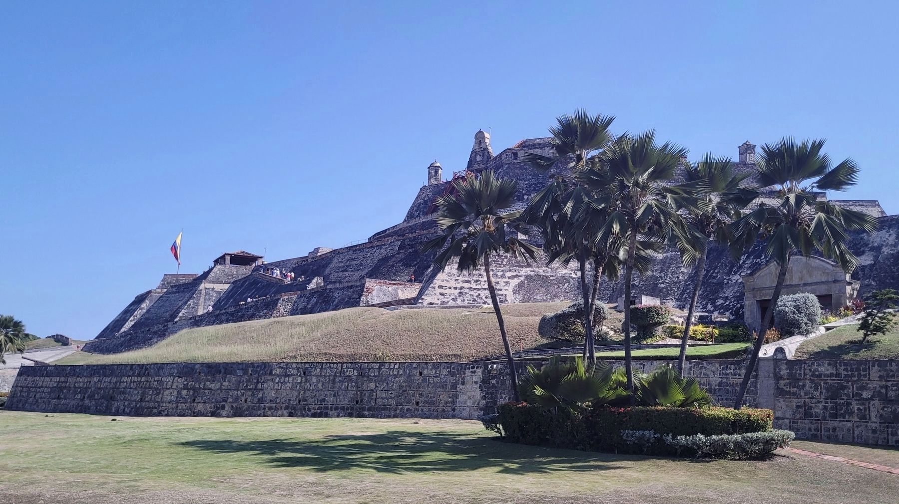
Location. 10° 25.293′ N, 75° 32.396′ W. Marker is in Cartagena de Indias, Bolívar, in Municipio de Cartagena. It is in Pie Del Cerro. It can be reached from the intersection of Carrera 17 and Avenida Antonio de Arévalo. The marker is located on the ground at the Don Blas de Lezo statue near the entrance to the Castillo San Felipe de Barajas. Touch for map. Marker is at or near this postal address: Carrera 17. Cl 32 #17-85, Cartagena de Indias, Bolívar 130001, Colombia. Touch for directions.

Regionally, it is on the Caribbean Sea, in South America, in a Andean South America country, on the Pacific
this page online
Other nearby markers. At least 8 other markers are within walking distance of this marker: Redemption Battery (about 120 meters away, measured in a direct line); Powder Kegs Warehouses for Artillery (about 150 meters away); Hornabeque Battery (about 150 meters away); Aduana Square (approx. 1.1 kilometers away); San Juan Bosco (approx. 1.2 kilometers away); Vaults Barracks (approx. 1.2 kilometers away); Proclamation Square (approx. 1.2 kilometers away); San Pedro Claver Square (approx. 1.2 kilometers away). Touch for a list and map of all markers in Cartagena de Indias.
Regarding Don Blas de Lezo. Don Blas de Lezo coordinated the defense of Cartagena against the failed British invasion of 1741.
Also see . . .
1. Battle of Cartagena de Indias. Wikipedia
The Battle of Cartagena de Indias (Spanish: Sitio de Cartagena de Indias, lit. 'Siege of Cartagena de Indias') took place during the 1739 to 1748 War of Jenkins' Ear between Spain and Britain. The result of long-standing commercial tensions, the war was primarily(Submitted on February 10, 2023, by James Hulse of Medina, Texas.)fought in the Caribbean; the British tried to capture key Spanish ports in the region, including Porto Bello and Chagres in Panama, Havana, and Cartagena de Indias in present-day Colombia.Photographed by James Hulse, February 4, 20232. Commemorative British medal of the supposed "victory"The British minted several commemorative medals ahead of the battle celebrating a British win but they actually lost the battle.
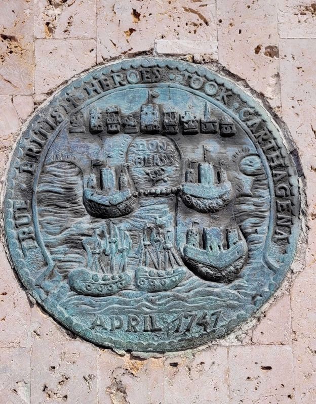
2. Blas de Lezo. Wikipedia
Admiral Blas de Lezo y Olavarrieta (3 February 1689 – 7 September 1741) was a Spanish navy officer best remembered for the Battle of Cartagena de Indias (1741) in the Viceroyalty of New Granada, where Spanish imperial forces under his command decisively defeated a large British invasion fleet under Admiral Edward Vernon.(Submitted on February 10, 2023, by James Hulse of Medina, Texas.)

Photographed by James Hulse, February 4, 2023
3. The view of the Don Blas de Lezo Statue, British Commemorative Medal and Marker
Photographed by James Hulse, February 4, 2023
4. The view of the Castillo de San Felipe de Barajas from the marker
Credits. This page was last revised on February 10, 2023. It was originally submitted on February 9, 2023, by James Hulse of Medina, Texas. This page has been viewed 588 times since then and 97 times this year. Photos: 1, 2, 3, 4. submitted on February 10, 2023, by James Hulse of Medina, Texas.
