North Bay in Nipissing District, Ontario — Central Canada (North America)
Manitou Islands
— North Bay Heritage Site —
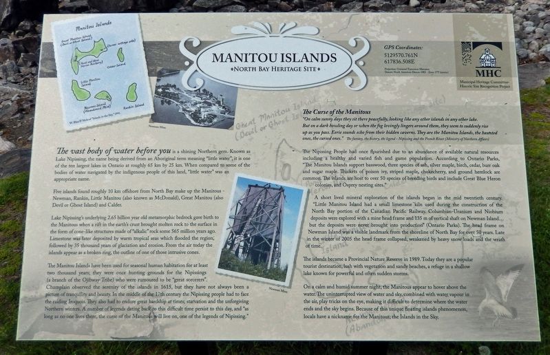
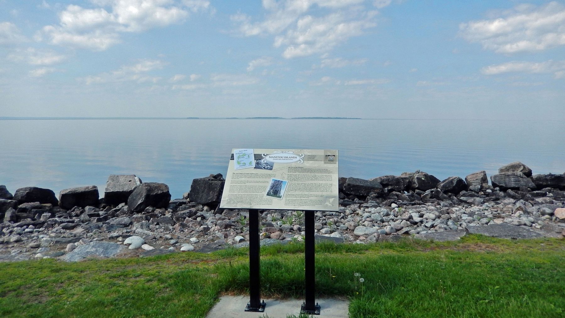
The vast body of water before you is a shining Northern gem. Known as Lake Nipissing, the name being derived from an Aboriginal term meaning "little water", it is one of the ten largest lakes in Ontario at roughly 65 km by 25 km. When compared to some of the bodies of water navigated by the indigenous people of this land, "little water" was an appropriate name.
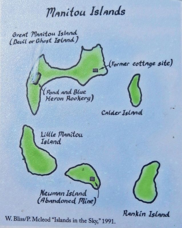
Five islands found roughly 10 km offshore from North Bay make up the Manitous — Newman, Rankin, Little Manitou (also known as McDonald), Great Manitou (also Devil or Ghost Island) and Calder.
Lake Nipissing's underlying 2.65 billion year old metamorphic bedrock gave birth to the Manitous when a rift in the earth's crust brought molten rock to the surface in the form of cone-like structures made of "alkalic" rock some 565 million years ago. Limestone was later deposited by warm tropical seas which flooded the region; followed by 35 thousand years of glaciation and erosion. From the air today the islands appear as a broken ring, the outline of one of those intrusive cones.
The Manitou Islands have been used for seasonal human habitation for at least two thousand years; they were once hunting grounds for the Nipissings (a branch of the Ojibway Tribe) who were rumoured to be "great sorcerers". Champlain observed the serenity of the islands in 1615, but they have not always been a picture of tranquility and beauty. In the middle of the 17th century the Nipissing people had to face the raiding Iroquois. They also had to endure great hardship at times; starvation and the unforgiving Northern winters. A number of legends dating back to this difficult time persist to this day, and "as long as no one lives there, the curse of the Manitous will live on, one of the legends of Nipissing."
The Curse of the Manitous
"On calm sunny days they sit there peacefully, looking like any other islands in any other lake. But on a dark howling day or when the fog lovingly lingers around them, they seem to suddenly rise up as you pass. Eerie sounds echo from their hidden caverns. They are the Manitou Islands, the haunted ones, the cursed ones."
The fantasy, the history, the legend — Nipissing and the French River (Ministry of Northern Affairs)
The Nipissing People had once flourished due to an abundance of available natural resources including a healthy and varied fish and game population. According to Ontario Parks, "The Manitou Islands support basswood, three species of ash, silver maple, birch, cedar, burr oak and sugar maple. Thickets of poison ivy, striped maple, chokecherry, and ground hemlock are common. The islands are host to over 50 species of breeding birds and include Great Blue Heron colonies, and Osprey nesting sites."
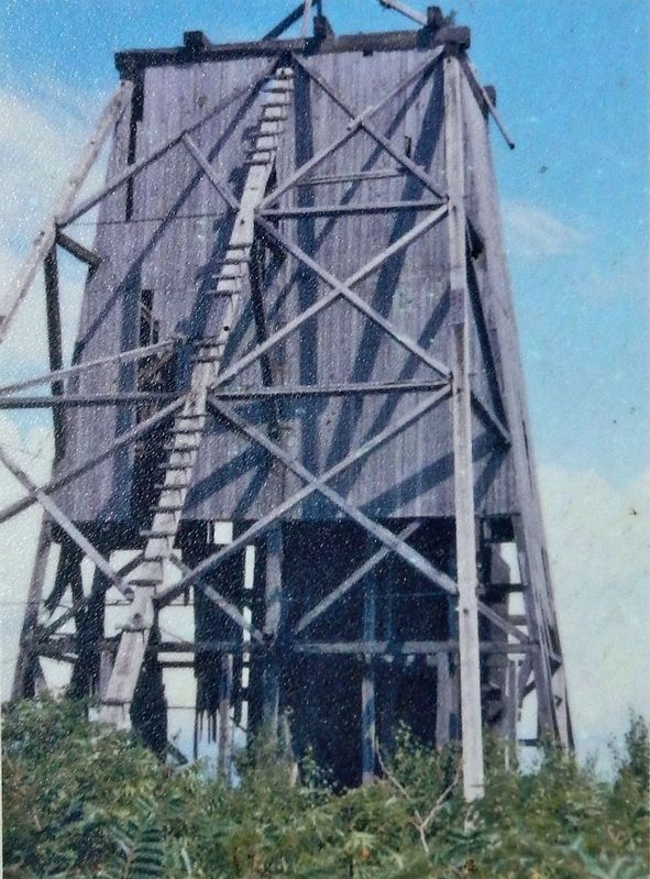
A short lived mineral exploration of the islands began in the mid twentieth century. "Little Manitou Island had a small limestone kiln used during the construction of the North Bay portion of the Canadian Pacific Railway. Columbian-Uranium and Niobium deposits were explored with a mine head frame and 135 m of vertical shaft on Newman Island... but the deposits were never brought into production" (Ontario Parks). The head frame on Newman Island was a visible landmark from the shoreline of North Bay for over 50 years. Late in the winter of 2005 the head frame collapsed, weakened by heavy snow loads and the wrath of time.
The islands became a Provincial Nature Reserve in 1989. Today they are a popular tourist destination, lush with vegetation and sandy beaches, a refuge in a shallow lake known for powerful and often sudden storms.
On a calm and humid summer night, the Manitous appear to hover above the water. The uninterrupted view of water and sky, combined with water vapour in the air, play tricks on the eye, making it difficult to determine where the water ends and the sky begins. Because of this unique floating islands phenomenon, locals have a nickname for the Manitous; the Islands in the Sky.
Erected by Municipal Heritage Committee — Historic Site Recognition Project. (Marker Number P8.)
Topics. This historical marker is listed in these topic lists: Exploration • Native Americans • Parks & Recreational Areas • Waterways & Vessels. A significant historical year for this entry is 1615.
Location. 46° 18.567′ N, 79° 28.178′ W. Marker is in North Bay, Ontario, in Nipissing District. Marker can be reached from Memorial Drive, 0.8 kilometers south of Main Street West, on the right when traveling south. Marker is located along the shoreline walkway near the south end of the Waterfront Marina parking lot. Touch for map. Marker is in this post office area: North Bay ON P1B 4G6, Canada. Touch for directions.
Other nearby markers. At least 8 other markers are within walking distance of this marker. Commerce on Lake Nipissing (about 120 meters away, measured in a direct line); Winter Wonderland Carousel History (about 150 meters away); North Bay Heritage Carousel History (about 150 meters away); CPR Yards (approx. 0.3 kilometers away); Jack Burrows Place (approx. 0.4 kilometers away); Mackey House (approx. 0.4 kilometers away); Donald E. King (approx. 0.4 kilometers away); Old Post Office (approx. 0.4 kilometers away). Touch for a list and map of all markers in North Bay.
Related markers. Click here for a list of markers that are related to this marker. North Bay Heritage Sites
Also see . . .
1. Manitou Islands.
Samuel de Champlain visited the islands in 1613. Fur traders found the island a handy resting spot, and often would camp overnight. Lime was quarried on the islands in the 1880s when the Canadian Pacific Railway was built, and a lime kiln was operated to create lime for mortar. Great Manitou Island, the largest of the islands, once held a dance hall and hotel, but it burned to the ground. Uranium mining was conducted on Newman Island in the 1950s. In 1972 the wreck of the steamship John B. Fraser was found between Goose Island and the Manitou Islands, in 46 ft of water.(Submitted on February 13, 2023, by Cosmos Mariner of Cape Canaveral, Florida.)
2. Manitou Islands Provincial Park.
Four islands in Lake Nipissing, 10 kilometres southwest of North Bay, make up the park. The islands represent the island ecology in Lake Nipissing with warmer than normal regional temperatures.(Submitted on February 13, 2023, by Cosmos Mariner of Cape Canaveral, Florida.)
Credits. This page was last revised on February 14, 2023. It was originally submitted on February 11, 2023, by Cosmos Mariner of Cape Canaveral, Florida. This page has been viewed 194 times since then and 39 times this year. Photos: 1, 2, 3, 4. submitted on February 13, 2023, by Cosmos Mariner of Cape Canaveral, Florida.


