McNair near Herndon in Fairfax County, Virginia — The American South (Mid-Atlantic)
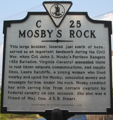
Mosby’s Rock
Erected 2000 by Department of Historic Resources. (Marker Number C-25.)
Topics and series. This historical marker is listed in these topic lists: Communications • Natural Features • War, US Civil. In addition, it is included in the Virginia Department of Historic Resources (DHR) series list.
Location. 38° 56.789′ N, 77° 24.955′ W. Marker is near Herndon, Virginia, in Fairfax County. It is in McNair. Marker is at the intersection of McNair Farms Road and Squirrel Hill Road, on the right when traveling east on McNair Farms Road. Near the entrance to Mount Pleasant Baptist Church. Touch for map. Marker is in this post office area: Herndon VA 20171, United States of America. Touch for directions.
Other nearby markers. At least 8 other markers are within walking distance of this marker. Historical Site of Mount Pleasant Baptist Church (approx. 0.3 miles away); Frying Pan Meeting House (approx. half a mile away); Pin Oak (approx. half a mile away); a different marker also named Frying Pan Meeting House (approx. half a mile away); a different marker also named Frying Pan Meeting House (approx. half a mile away); Civil War at Frying Pan Spring Meeting House (approx. half a mile away); The Story of Arrowhead Farm (approx. 0.6 miles away); Laura Ratcliffe (approx. 0.7 miles away). Touch for a list and map of all markers in Herndon.

Photographed By Craig Swain, August 17, 2007
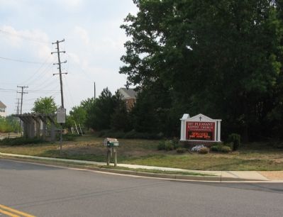
2. The Meeting Place with the Marker Beside the Road
The stand of trees to the right of the picture was the general location of the rock. Just to the north of Frying Pan Creek, and conveniently in a quiet corner close to several of the historic roads, the site was a perfect meeting spot for Mosby's clandestine operations.
Credits. This page was last revised on September 21, 2023. It was originally submitted on August 24, 2007, by Craig Swain of Leesburg, Virginia. This page has been viewed 3,214 times since then and 62 times this year. Photos: 1, 2. submitted on August 24, 2007, by Craig Swain of Leesburg, Virginia. • J. J. Prats was the editor who published this page.
