Bigelow Township in Holt County, Missouri — The American Midwest (Upper Plains)
The Missouri River
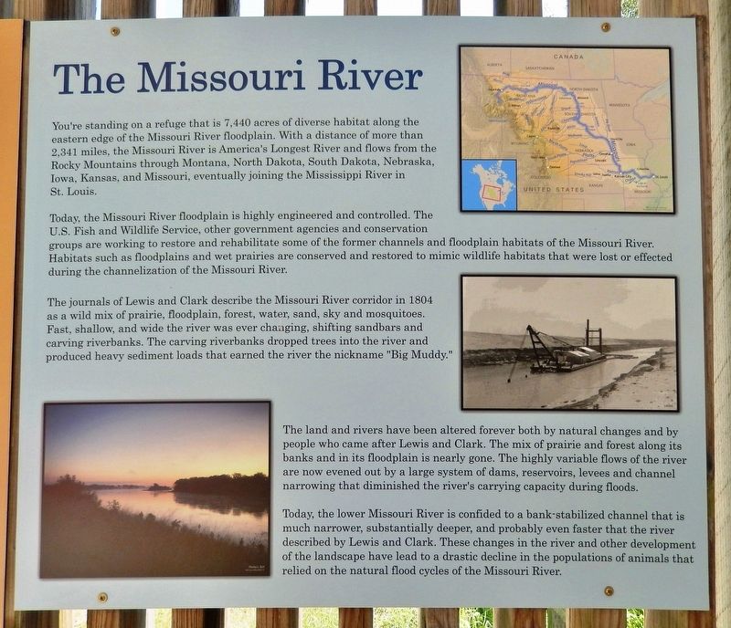
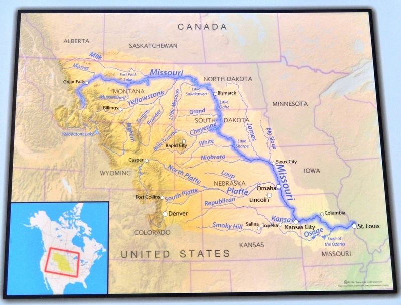
You're standing on a refuge that is 7,440 acres of diverse habitat along the eastern edge of the Missouri River floodplain. With a distance of more than 2,341 miles, the Missouri River is America's Longest River and flows from the Rocky Mountains through Montana, North Dakota, South Dakota, Nebraska, Iowa, Kansas, and Missouri, eventually joining the Mississippi River in St. Louis.
Today, the Missouri River floodplain is highly engineered and controlled. The U.S. Fish and Wildlife Service, other government agencies and conservation groups are working to restore and rehabilitate some of the former channels and floodplain habitats of the Missouri River. Habitats such as floodplains and wet prairies are conserved and restored to mimic wildlife habitats that were lost or affected during the channelization of the Missouri River.
The journals of Lewis and Clark describe the Missouri River corridor in 1804 as a wild mix of prairie, floodplain, forest, water, sand, sky and mosquitoes. Fast, shallow, and wide the river was ever changing, shifting sandbars and carving riverbanks. The carving riverbanks dropped trees into the river and produced heavy sediment loads that earned the river the nickname "Big Muddy."
The land and rivers have been altered forever both by natural changes and by people who came after Lewis and Clark. The mix of prairie and forest along its banks and in its floodplain is nearly gone. The highly variable flows of the river are now evened out by a large system of dams, reservoirs, levees and channel narrowing that diminished the river's carrying capacity during floods.
Today, the lower Missouri River is confined to a bank-stabilized channel that is much narrower, substantially deeper, and probably even faster that the river described by Lewis and Clark. These changes in the river and other development of the landscape have led to a drastic decline in the populations of animals that relied on the natural flood cycles of the Missouri River.
Topics and series. This historical marker is listed in these topic lists: Environment • Exploration • Parks & Recreational Areas • Waterways & Vessels. In addition, it is included in the Lewis & Clark Expedition series list. A significant historical year for this entry is 1804.
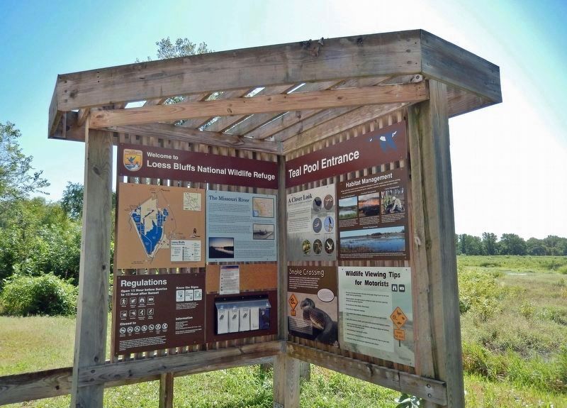
Location. 40° 6.777′ N, 95° 16.299′ W. Marker is near Bigelow, Missouri, in Holt County. It is in Bigelow Township. Marker is on Insbrook Road just south of State Highway 118 when traveling south. Marker is mounted in a Loess Bluffs National Wildlife Refuge interpretive kiosk, overlooking the Teal Pool wildlife habitat site. Touch for map. Marker is in this post office area: Craig MO 64437, United States of America. Touch for directions.
Other nearby markers. At least 7 other markers are within 11 miles of this marker, measured as the crow flies. July 10, 1804 (approx. 9.4 miles away in Kansas); The Lewis and Clark Expedition (approx. 9.4 miles away in Kansas); "the water…contains a half…Glass of ooze" (approx. 9.4 miles away in Kansas); Homeland of the Kanza Indians (approx. 9.4 miles away in Kansas); Wilbur Chapman (approx. 9.4 miles away in Kansas); Louisiana Purchase / Lewis and Clark Expedition / They Passed This Way / Old Trail Road (approx. 11 miles away); Holt County (approx. 11 miles away).
Also see . . . Loess Bluffs National Wildlife Refuge.
In early July 1804, the westbound Lewis & Clark expedition camped for two nights near what is now Loess Bluffs National Wildlife Refuge, about 90 miles north of Kansas City. Clark noted in his journal that the prairies along the Missouri River were beautiful and that “the lands are low Subject to overflow.”(Submitted on February 21, 2023, by Cosmos Mariner of Cape Canaveral, Florida.)Today, the refuge’s wetlands attract millions of snow geese during spring and fall migration. More than 300 bird species have been documented at the refuge, including those seen by Lewis and Clark, such as American white pelicans, common egrets, American bitterns, Canada geese and wood ducks. Each year, the refuge celebrates the arrival of migrating bald eagles with Eagle Days on the first full weekend of December.
A 10-mile auto tour loop allows visitors to see wildlife in a natural setting year-round.
Credits. This page was last revised on February 21, 2023. It was originally submitted on February 21, 2023, by Cosmos Mariner of Cape Canaveral, Florida. This page has been viewed 83 times since then and 12 times this year. Photos: 1, 2, 3. submitted on February 21, 2023, by Cosmos Mariner of Cape Canaveral, Florida.


