Oscoda in Iosco County, Michigan — The American Midwest (Great Lakes)
Mio Hydro
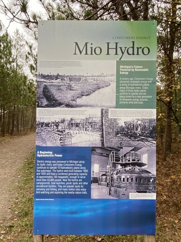
Michigan's Future: Powered by Renewable Energy
A century ago, Consumers Energy pioneered renewable energy with a string of hydroelectric plants along Michigan rivers. Today, many of those hydro plants continue to operate, and are being joined by a new generation of renewable energy sources, primarily wind power. There also are plans to tap the renewable energy potential of biomass, landfill gas and solar
A Beginning: Hydroelectric Power
Electric power was pioneered in Michigan along its idyllic rivers, and today Consumers Energy continues to operate 13 hydroelectric plants along five waterways. The hydros were built between 1906 and 1935 and have a combined generating capacity of approximately 130 megawatts, enough to serve more than 55,000 people. Near the hydros are campgrounds, boat launches, picnic spots and other recreational facilities They are popular spots for canoeing and fishing, and many visitors also enjoy bird watching and exploring the nearby nature trails.
nset photo (top left) caption: The Mio Dam powerhouse was constructed adjacent to the original river channel and the river was diverted so completion of the embankments could take place. This photograph shows the construction of the Mio Dam powerhouse, as well as left-side trestle, which was constructed to transport materials and became a key structural component of the embankment. Note the original river channel is on the north side of the powerhouse.
Inset photo (middle left) caption: Mio Dam was designed with a conduit or under-sluice spillway, which was designed and patented by engineer William W. Tefft. The spillway was constructed within and under the powerhouse instead of the traditional design where the spillway is located adjacent to the powerhouse, as seen in earlier constructed dams on the Au Sable River such as Five Channels Dam. This photograph shows the construction of the under sluice conduit, as well as the turbine pits.
Inset photo (middle right) caption: Transportation in northern Michigan was very limited at the time of construction due to a lack of development. The railroad, including the narrow gauge rail used during the lumber era, never reached the town of Mio. The turbines were shipped to Mio via the Robinson Lumber Company narrow gauge rail starting in South Branch to the end of the line southwest of Mio. From there, the turbines were transported by horse-drawn sleigh to the dam site as shown in the photograph.
Inset photo (bottom right) caption: Mio Dam uses two Francis vertical turbines and two Allis-Chalmers generators as shown shortly after construction.
Erected by Consumers Energy.
Topics. This historical marker is listed in these topic lists: Parks & Recreational Areas • Waterways & Vessels. A significant historical year for this entry is 1906.
Location. 44° 26.157′ N, 83° 37.36′ W. Marker is in Oscoda, Michigan, in Iosco County. Marker can be reached from Monument Road, 0.2 miles north of West River Road. Marker is at the trailhead of the Highbanks Trail near the Lumberman's Monument Visitor Center. Touch for map. Marker is at or near this postal address: 5401 Monument Road, Oscoda MI 48750, United States of America. Touch for directions.
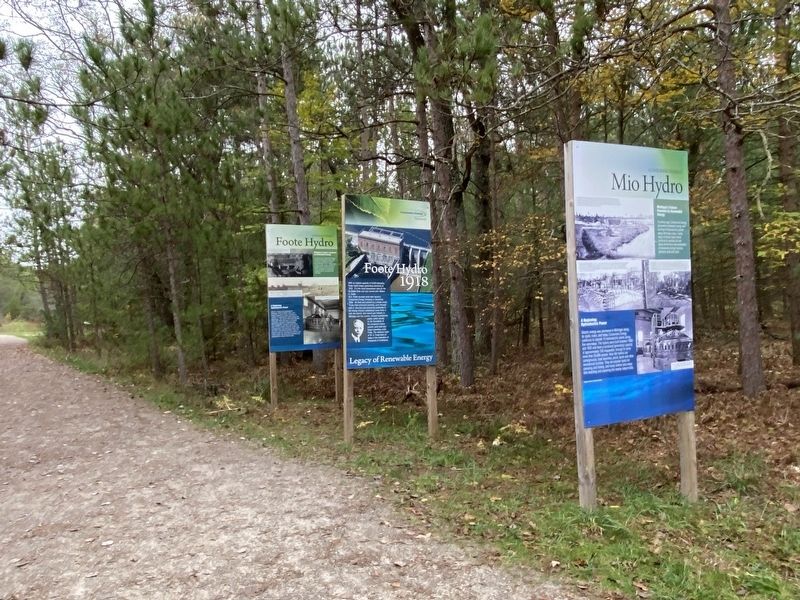
Other nearby markers. At least 8 other markers are within walking distance of this marker. Foote Hydro (here, next to this marker); a different marker also named Mio Hydro (here, next to this marker); a different marker also named Foote Hydro (here, next to this marker); Five Channels & Loud Hydros (here, next to this marker); Loud Hydro (a few steps from this marker); Five Channels Hydro (a few steps from this marker); Cooke Hydro (a few steps from this marker); a different marker also named Cooke Hydro (within shouting distance of this marker). Touch for a list and map of all markers in Oscoda.
Credits. This page was last revised on February 26, 2023. It was originally submitted on February 22, 2023, by J.T. Lambrou of New Boston, Michigan. This page has been viewed 48 times since then and 7 times this year. Photos: 1, 2, 3, 4. submitted on February 22, 2023, by J.T. Lambrou of New Boston, Michigan. • J. Makali Bruton was the editor who published this page.


