Noble Township in Defiance in Defiance County, Ohio — The American Midwest (Great Lakes)
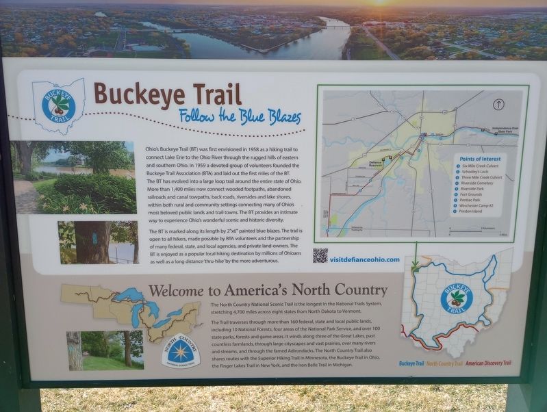
Buckeye Trail
Ohio's Buckeye Trail (BT) was first envisioned in 1958 as a hiking trail to connect Lake Erie to the Ohio River through the rugged hills of eastern and southern Ohio. In 1959 a devoted group of volunteers founded the Buckeye Trail Association (BTA) and laid out the first miles of the BT. The BT has evolved into a large loop trail around the entire state of Ohio More than 1,400 miles now connect wooded footpaths, abandoned railroads and canal towpaths, back roads, riversides and lake shores. within both rural and community settings connecting many of Ohio's most beloved public lands and trail towns. The BT provides an intimate way to experience Ohio's wonderful scenic and historic diversity.
Welcome to America's North Country
The North Country National Scenic Trail is the longest in the National Trails System, stretching 4,700 miles across eight states from North Dakota to Vermont.
The Trail traverses through more than 160 federal, state and local public lands including 10 National Forests, four areas of the National Park Service, and over 100 state parks, forests and game areas. It winds along three of the Great Lakes, past countless farmlands, through large cityscapes and vast prairies, over many rivers and streams, and through the famed Adirondacks. The North Country Trail also shares routes with the Superior Hiking Trail in Minnesota, the Buckeye Trail in Ohio the Finger Lakes Trail in New York, and the iron Belle Trail in Michigan.
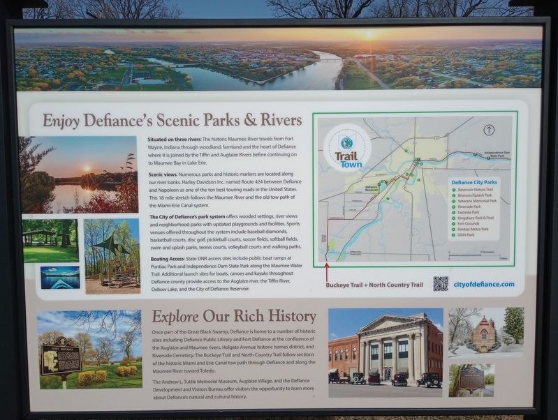
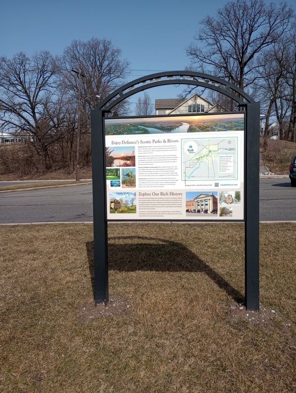
Enjoy Defiance's Scenic Parks & Rivers
Situated on three rivers: The historic Maumee River travels from Fort Wayne, Indiana through woodland, farmland and the heart of Defiance where it is joined by the Tiffin and Auglaize Rivers before continuing on to Maumee Bay in Lake Erie.
Scenic views: Numerous parks and historic markers are located along our river banks. Harley Davidson Inc. named Route 424 between Defiance and Napoleon as one of the ten best touring roads in the United States. This 18 mille stretch follows the Maumee River and the old tow path of the Miami-Erie Canal system.
The City of Defiance's park system offers wooded settings, river views and neighborhood parks with updated playgrounds and facilities. Sports venues offered throughout the system include baseball diamonds, basketball courts, disc golf, pickleball courts, soccer fields, softball fields, swim and splash parks, tennis courts, volleyball courts and walking paths.
Boating Access: State DNR access sites include public boat ramps at Pontiac Park and Independence Dam State Park along the Maume Water Trail. Additional launch sites for boats, canoes and kayaks throughout Defiance county provide access to the Auglaze river, the Tiffin River Oxbow Lake, and the City of Defiance Reservoir.
Explore Our Rich History
Once part of the Great Black Swamp, Defiance is home to a number of historic sites including Defiance Public Library and Fort Defiance at the confluence of the Auglaize and Maumee rivers, Holgate Avenue historic homes district, and Riverside Cemetery, The Buckeye Trail and North Country Trail follow sections of the historic Miami and Erie Canal tow path through Defiance and along the Maumee River toward Toledo.
The Andrew L. Tuttle Memorial Museum, Auglaize Village, and the Defiance Development and Visitors Bureau offer visitors the opportunity to learn more about Defiance's natural and cultural history.
Topics. This historical marker is listed in these topic lists: Forts and Castles • Parks & Recreational Areas • Waterways & Vessels. A significant historical year for this entry is 1958.
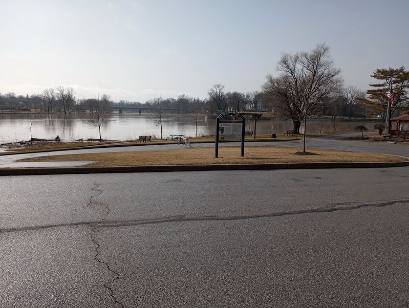
Location. 41° 17.35′ N, 84° 21.325′ W. Marker is in Defiance, Ohio, in Defiance County. It is in Noble Township. Marker is on East High Street, on the right when traveling east. Touch for map. Marker is at or near this postal address: 515 E High St, Defiance OH 43512, United States of America. Touch for directions.
Other nearby markers. At least 8 other markers are within walking distance of this marker. Flood Poles (within shouting distance of this marker); Chief Pontiac (within shouting distance of this marker); Pontiac Birthplace (about 500 feet away, measured in a direct line); French Indian Apple Tree (about 500 feet away); Bark Cabin Home of Coohcoohe (about 500 feet away); Johnny Appleseed (about 600 feet away); Civil War Cannons (about 700 feet away); Fort Defiance, 1794 (about 700 feet away). Touch for a list and map of all markers in Defiance.
Credits. This page was last revised on February 26, 2023. It was originally submitted on February 24, 2023, by Craig Doda of Napoleon, Ohio. This page has been viewed 102 times since then and 16 times this year. Photos: 1, 2, 3, 4. submitted on February 24, 2023, by Craig Doda of Napoleon, Ohio. • J. Makali Bruton was the editor who published this page.


