Chariton Township in Glasgow in Howard County, Missouri — The American Midwest (Upper Plains)
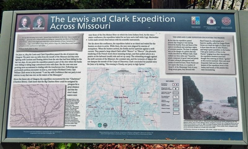
The Lewis & Clark Expedition Across Missouri
Inscription.
"... Set out this morning verry early passed Some bad placies in the river Saw a number of Goslings... pass[ed] near a Bank which was falling in...passed the two River of Charletons [Charitons] ...above Some high land which has a great quantity of Stone Calculated for whetstons... Capt. Lewis Killed a large Buck, passed a large Isd. Called Shecco and Camped in a Prairie on the L[arboard or left] S[ide]..."
—William Clark, June 10, 1804
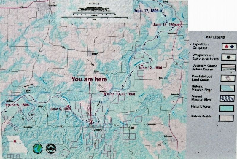
On June 10, 1804 the Lewis and Clark Expedition passed the site of present-day Glasgow. The party was 225 miles from the mouth of the Missouri and they were fighting swift currents and floating debris from the rain that had been falling for the last two days. At one point the expedition passed a part of the river where the banks were falling in taking large cottonwood trees with them. But the crew was now growing more accustomed to dealing with the treacherous river. Following one particularly perilous encounter on June 9, near today's Richland Creek, Capt. William Clark wrote in his journal: "I can Say with Confidence that our party is not inferior to any that was ever on the waters of the Missoppie."
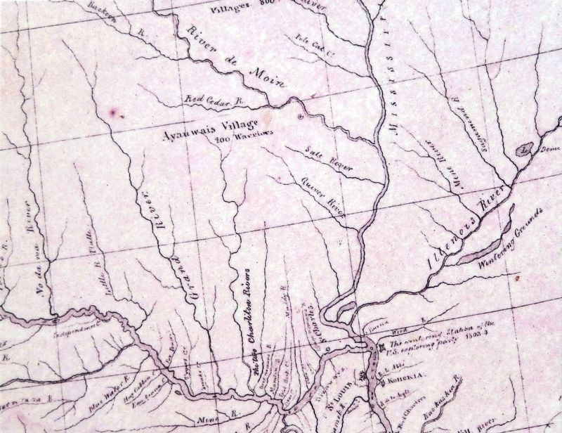
Above the future site of Glasgow, the expedition encountered the two "Charletons" (Chariton Rivers). Clark knew that the Big Chariton River could be navigated by pirogues for a great distance and that the river's headwaters were near those of the Des Moines River on which the Iowa Indians lived. As this was a major confluence, the expedition halted for an hour and a half while Capt. Meriwether Lewis made several observations with his scientific instruments.
Not far above this confluence, the expedition halted at an island and waited for the hunters on shore to arrive. While there, the men were plagued by swarms of mosquitoes. When the hunters arrived, the flotilla moved upstream against a swift current. They passed a large island Clark called "Sheeco" or "Shecco" (his phonetic rendering of the French word chicot meaning stump), and then pulled ashore at a prairie on the larboard (south) side and set up camp. The exhausting struggle against the swift currents of the Missouri, the constant rain, and the torments of insects did not dampen the morale of the Corps of Discovery. Clark concluded his journal entry for June 10 by stating, "the evening is Cloudy, our party in high Spirits."
The Lewis and Clark Expedition Encounters the Prairies
By the time the expedition passed present-day Glasgow, it was leaving behind the familiar flora and fauna of the eastern woodlands and entering a region of extensive prairies. The June 10 campsite was on the margin of a prairie that was vividly described by William Clark. Clark walked out three
Library of Congress
2. Marker detail: William Clark Chariton Rivers Map
This detail from a map copied by Nicholas King in 1805 from an original map by William Clark shows the two "Charleton" [Chariton] Rivers. This map shows William Clark's odd spelling for the Chariton Rivers and also provides an insight into how well Clark comprehended the extent of the two Chariton river systems and their potential as an avenue of commerce with the Iowa Indian Tribe.
Erected by Lewis & Clark National Historic Trail; Missouri Department of Natural Resources; Missouri Lewis & Clark Bicentennial Commission; City of Glasgow.
Topics and series. This historical marker is listed in these topic lists: Animals • Exploration • Waterways & Vessels. In addition, it is included in the Lewis & Clark Expedition series list. A significant historical date for this entry is June 10, 1804.
Location. 39° 13.586′ N, 92° 50.86′ W. Marker is in Glasgow, Missouri, in Howard County. It is in Chariton
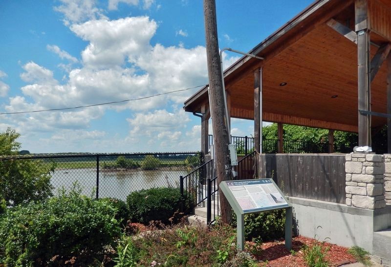
Township. Marker is at the intersection of Water Street and Market Street, on the left when traveling north on Water Street. Marker is on the south side of the Water Street Stage, overlooking the Missouri River. Touch for map. Marker is in this post office area: Glasgow MO 65254, United States of America. Touch for directions.
Other nearby markers. At least 8 other markers are within walking distance of this marker. Glasgow War Memorial (a few steps from this marker); The Minnie (a few steps from this marker); Worlds First Large All-Steel Bridge (a few steps from this marker); History of Glasgow (within shouting distance of this marker); Saint Mary's Catholic Church (approx. 0.2 miles away); Lewis Library (approx. 0.2 miles away); Evangelical United Brethren Church (approx. 0.2 miles away); First Methodist Church / Glasgow Methodist Church (approx. 0.2 miles away). Touch for a list and map of all markers in Glasgow.
Also see . . . Lewis & Clark, Corps of Discovery Expedition: June 10, 1804.
The expedition passes the Chariton River. They find rock suitable for whetstones and also prairies with wild plums, hazelnuts, and grapes. They move from their original campsite to get away from the mosquitoes.(Submitted on February 25, 2023, by Cosmos Mariner of Cape Canaveral, Florida.)
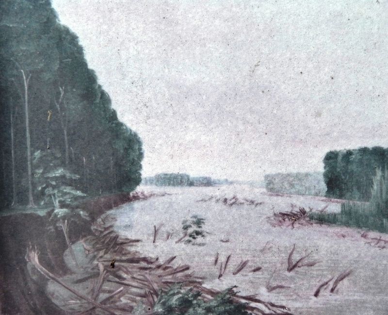
Courtesy Smithsonian American Art Museum
4. Marker detail: Missouri River Banks
This painting by George Catlin in 1832 shows tree-lined alluvial banks collapsing into the Missouri River. One of many Missouri River navigation hazards was collapsing banks such as those encountered on June 10, 1804. On those occasions when the expedition's boats had to be maneuvered close to shore to avoid fast current, these sudden bank collapses could prove extremely dangerous to boats and crews alike. Smithsonian American Art Museum, Gift of Mrs. Joseph Harrison, Jr.
Credits. This page was last revised on February 25, 2023. It was originally submitted on February 25, 2023, by Cosmos Mariner of Cape Canaveral, Florida. This page has been viewed 110 times since then and 25 times this year. Photos: 1, 2, 3, 4, 5. submitted on February 25, 2023, by Cosmos Mariner of Cape Canaveral, Florida.
