Bradenton in Manatee County, Florida — The American South (South Atlantic)
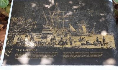
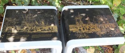
The Landing
Late in the afternoon of May 29, 1539, DeSoto's armada of nine ships rode at anchor in a deep Florida bay. Decks and holds were heavily burdened with 700 men, 350 horses, packs of bloodhounds and Irish greyhounds, a herd of pigs and a profusion of arms and equipment necessary to sustain the expedition of conquest.
The following day, indifferent to plumes of Indian signal smoke rising from the dense thickets, the men disembarked with high expectations. They had heard rumors that these lands would yield even more gold, silver, precious gems and slaves than all of Mexico and Peru.
Erected by National Park Service, Department of the Interior.
Topics. This historical marker is listed in these topic lists: Colonial Era • Exploration • Hispanic Americans • Native Americans. A significant historical date for this entry is May 29, 1539.
Location. 27° 31.433′ N, 82° 38.673′ W. Marker is in Bradenton, Florida, in Manatee County. Marker can be reached from Desoto Memorial Highway, 0.3 miles north of 24th Avenue Northwest when traveling north. Located at the De Soto National Memorial. Touch for map. Marker is at or near this postal address: 8300 Desoto Memorial Hwy, Bradenton FL 34209, United States of America. Touch for directions.
Other nearby markers. At least 8 other markers are within walking distance of this marker. The Spanish Crown (here, next to this marker); Knight of Santiago (here, next to this marker); De Soto Trail Monument (a few steps from this marker); DeSoto Trail (within shouting distance of this marker); La Florida's Early Peoples (within shouting distance of this marker); Camp Uzita (within shouting distance of this marker); Hernando de Soto (within shouting distance of this marker); Tabby House Ruins (approx. 0.2 miles away). Touch for a list and map of all markers in Bradenton.
Also see . . . De Soto National Memorial. National Park Service (Submitted on February 26, 2023.)
Credits. This page was last revised on February 26, 2023. It was originally submitted on February 26, 2023, by Dave W of Co, Colorado. This page has been viewed 77 times since then and 11 times this year. Photos: 1, 2, 3. submitted on February 26, 2023, by Dave W of Co, Colorado. • Bernard Fisher was the editor who published this page.


