Pleasanton in Alameda County, California — The American West (Pacific Coastal)
Changing Landscape
Photographed by Joseph Alvarado
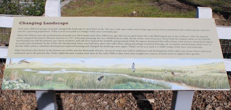
1. Changing Landscape Marker
When the Ohlone were the predominant stewards over these lands more than 5000 years ago, this was as open land with a tule filled lagoon just to the southeast. After the Spanish crown assigned the land to Mission San Jose in 1797, it became pasturage for over 30,000 head of cattle. By the 1850s, when Francisco Alviso built the original adobe on this hillside, stockraising was still the primary use. Open meadows and oak trees framed the foothills and grassland while the lagoon dominated the valley below. Later farmers drained the lagoon to create more farmland. In the 1920s, the Meadowlark Dairy was built here above the valley floor, taking advantage of natural drainage, air circulation and abundant shade trees. In the late 20th century, suburban development replaced farming and changed the landscape once again. Today’s seven-acre park is a small vestige
this page online
Water has been a key factor in the human use of this area for thousands of years. Access to water was vital to settlement and development of the valley area, from Native American settlement up to present day. Water rights became a major issue here in the early 1900s as Bay Area cities sought new sources of fresh water to support their growth.
Topics. This historical marker is listed in these topic lists: Environment • Exploration • Indigenous Peoples and Communities • Industry & Commerce. A significant historical year for this entry is 1797.
Location. 37° 39.662′ N, 121° 54.768′ W. Marker is in Pleasanton, California, in Alameda County. It can be reached from Old Foothill Road near Foothill Road. The resin marker is in the courtyard across from the Adobe at the Alviso Adobe Community Park. Touch for map. Marker is at or near this postal address: 3465 Old Foothill Road, Pleasanton CA 94588, United States of America. Touch for directions.

Regionally, this marker is in the San Francisco Bay Area and on the Coast Ranges. It is also on the American Pacific Coast. Globally, it is in North America,
Photographed by Joseph Alvarado, February 17, 2023
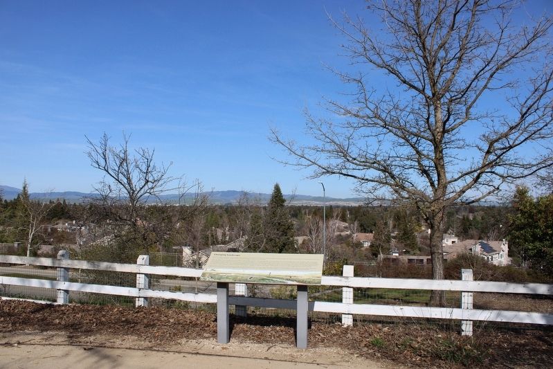
2. Marker and Partial View of Valley Below
Other nearby markers. At least 8 other markers are within 2 miles of this marker, measured as the crow flies: Meadowlark Dairy (here, next to this marker); Meadowlark Dairy - The Dairy Silo (a few steps from this marker); Meadowlark Dairy – Dairy Manager’s House (within shouting distance of this marker); Meadowlark Dairy – Dairy Bunkhouse (within shouting distance of this marker); Meadowlark Dairy - Historic Orchard (within shouting distance of this marker); Alviso Adobe (within shouting distance of this marker); Alviso Adobe Community Park (about 400 feet away, measured in a direct line); The Heritage House (approx. 1½ miles away). Touch for a list and map of all markers in Pleasanton.
Another marker is no longer nearby. Francisco Solano Alviso Adobe (was within shouting distance of this marker but has been confirmed missing).

Photographed by Joseph Alvarado, February 17, 2023
3. Marker and Reproduction of the Meadowlark Dairy Barn
Credits. This page was last revised on February 26, 2023. It was originally submitted on February 26, 2023, by Joseph Alvarado of Livermore, California. This page has been viewed 190 times since then and 15 times this year. Photos: 1, 2, 3. submitted on February 26, 2023, by Joseph Alvarado of Livermore, California.
