Near Talking Rock in Pickens County, Georgia — The American South (South Atlantic)
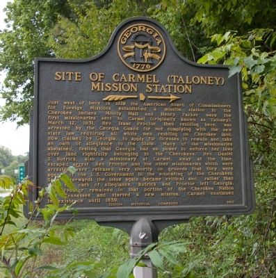
Site of Carmel (Taloney) Mission Station
»—→
Photographed by David Seibert, August 13, 2009
1. Site of Carmel (Taloney) Mission Station Marker
Rev. Proctor remained in that portion of the Cherokee Nation now Tennessee and
this page online
Erected 1962 by Georgia Historical Commission. (Marker Number 112-5.)
Topics and series. This historical marker is listed in these topic lists: Indigenous Peoples and Communities • Settlements & Settlers • Wars, US Indian. In addition, it is included in the Georgia Historical Society series list. A significant historical date for this entry is March 12, 1831.
Location. 34° 31.15′ N, 84° 31.417′ W. Marker is near Talking Rock, Georgia, in Pickens County. It is at the intersection of Georgia Route 136 and Ellijay Road ( Route 382), on the right when traveling east on Georgia Route 136. Touch for map. Marker is in this post office area: Talking Rock GA 30175, United States of America. Touch for directions.

Regionally, this marker is in the Mountains. It is also in the American South, specifically in the Deep South, in Appalachia, and specifically in Southern Appalachia. Globally, it is in North America, the Western Hemisphere, the Western World, and the Anglosphere. Historically, it finds itself in what was once the original Cherokee Nation, the territory of
Photographed by David Seibert, August 13, 2009
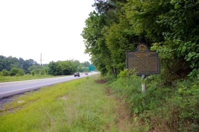
2. Site of Carmel (Taloney) Mission Station Marker
Looking southeast on Georgia Highway 136 toward the intersection with Georgia 515/Georgia 5, the Zell Miller Parkway
Other nearby markers. At least 8 other markers are within 8 miles of this marker, measured as the crow flies: The Zell Miller Mountain Parkway (approx. 1.6 miles away); The Kirby-Quinton Cabin (approx. 6.3 miles away); Oglethorpe Monument (approx. 6.3 miles away); The Old Pickens County Jail (approx. 6.3 miles away); a different marker also named Old Pickens County Jail (approx. 6.3 miles away); Pickens County (approx. 6.3 miles away); a different marker also named Old Federal Road (approx. 6.4 miles away); a different marker also named Old Federal Road (approx. 7.9 miles away). Touch for a list and map of all markers in Talking Rock.
Other markers no longer nearby. Old Federal Road (was within shouting distance of this marker but has been confirmed missing); Federal Road Cisca St. Augustine Trail (was approx. 2.7 miles away but has been confirmed missing).
Photographed by David Seibert, August 13, 2009
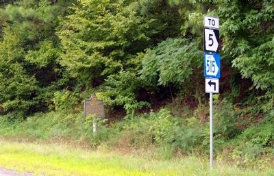
3. Site of Carmel (Taloney) Mission Station Marker
Credits. This page was last revised on October 30, 2024. It was originally submitted on August 16, 2009, by David Seibert of Sandy Springs, Georgia. This page has been viewed 2,522 times since then and 107 times this year. Photos: 1, 2, 3. submitted on August 16, 2009, by David Seibert of Sandy Springs, Georgia. • Craig Swain was the editor who published this page.
