
Tzintzuntzan, Michoacán, Mexico — The Pacific Coast (and Central Highlands)
The Atrium of the Convent of Santa Ana
Photographed by J. Makali Bruton, September 23, 2022
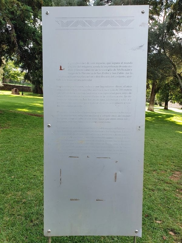
1. The Atrium of the Convent of Santa Ana Marker

Sombreado por fresnos, cedros y por legendarios olivos, el atrio amurallado alberga las capillas del Via Crucis y mide 200 metros por 140, es decir, casi tres hectareas, con capacidad para miles de fieles. Para satisfacer las necesidades de la cristianización, las órdenes mendicantes usaron los atrios para adoctrinar y educar a los indigenas, así como para realizar diversas actividades artisticas vinculadas al culto.
Elemento clave de la vida novohispana, el atrio retomó soluciones de la arquitectura religiosa medieval y adoptó otras del mundo indigena, como el culto al aire libre. Igual que otros atrios novohispanos, este también se usó como cementerio.
La cruz atrial, al centro, constituye el emblema que utilizaron conquistadores y misioneros para cristianizar a los indigenas. La cruz atrial es simbolo
this page online
The grandeur of this space, which separates the pagan world from the religious, reveals the importance of this city, first headquarters for the Custody of Michoacán and then of the Province of San Pedro and San Pablo. This is confirmed by the rigorous planning and distribution of spaces in the area, adjusted to the reticular urban layout.
Shaded by ash, cedar and the legendary olive trees, the walled atrium houses the chapels of the Via Crucis and measures 200 by 140 meters, that is, almost three hectares, with capacity for thousands of faithful. To meet the needs of Christianization, the mendicant orders used the atriums to indoctrinate and educate the indigenous,
Photographed by J. Makali Bruton, September 23, 2022
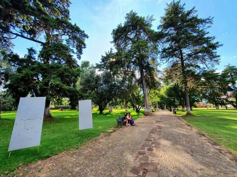
2. The Atrium of the Convent of Santa Ana Marker
The marker is on the right in this view near the eastern entrance to the atrium.
A key element of New Spanish life, the atrium took up solutions from medieval religious architecture and adopted others from the indigenous world, like the worship of the outdoors. Like other New Spanish atriums, this one was also used as a cemetery.
The atrial cross, in the center, is the emblem used by conquerors and missionaries to Christianize the indigenous. The atrial cross is symbolic of physical and metaphorical centrality within the Christian sacred space, the point of connection between earth and heaven ... of the world. Initially made of wood, they soon made them of stone. The one we see, placed on a base and dated with the year 1764, shows carved into the shaft the instruments of the Passion of Christ, with the nails, the tongs, the hammer, the ladder and the crown of thorns, but the absence of the normally-placed INRI sign is notable.
Topics. This historical marker is listed in these topic lists: Architecture • Colonial Era • Indigenous Peoples and Communities • Religion & Religious Structures. A significant historical year for this entry is 1764.
Location. 19° 37.551′ N,

Photographed by J. Makali Bruton, September 23, 2022
3. The Atrial Cross mentioned in the marker text
The marker text is not completely clear, but the cross does indeed include the INRI at its top.

Regionally, this marker is in Western Mexico, in the Bajío, and on the Pacific Coast. Globally, it is in North America, specifically in Mesoamerica, on the Ring of Fire, on the Pacific Rim, and in the Western Hemisphere. Historically, it finds itself in what was once New Spain, a Spanish colony, and the Aztec Empire.
Other nearby markers. At least 8 other markers are within walking distance of this marker: Franciscan Monastery of Tzintzuntzan (a few steps from this marker); Tzintzuntzan Named as Municipality (within shouting distance of this marker); Hospital (about 120 meters away, measured in a direct line); First Mass in Michoacán (about 150 meters away); Entryway of the Convent of Santa Ana (about 150 meters away); Lake Patzcuaro (approx. 0.4 kilometers away); Imparting Justice (approx. half a kilometer away);
Photographed by J. Makali Bruton, September 23, 2022
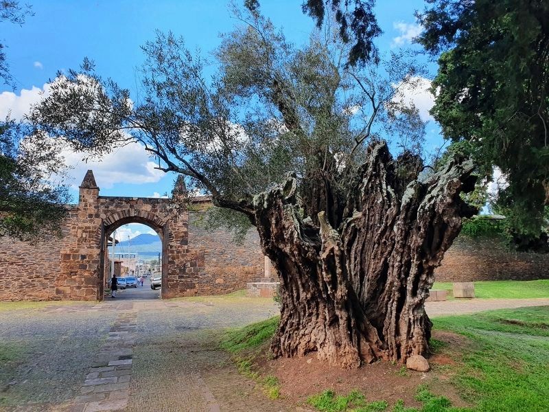
4. One of the 'legendary olive trees' in the atrium
Legend says that the olive trees were planted by the first Spanish to arrive in the 16th century.
Photographed by J. Makali Bruton, September 23, 2022
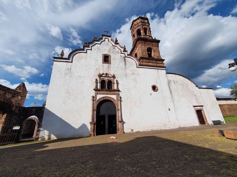
5. Templo de la Soledad y ex-Hospital de Indios
This additional temple (The Temple of Solitude) was part of a Hospital for the Indigenous. It is near the northwest corner of the atrium.
Credits. This page was last revised on April 4, 2025. It was originally submitted on March 1, 2023, by J. Makali Bruton of Washington, District of Columbia. This page has been viewed 209 times since then and 25 times this year. Photos: 1, 2, 3, 4, 5. submitted on March 1, 2023, by J. Makali Bruton of Washington, District of Columbia.
