San Antón in Santo Domingo, Distrito Nacional, Dominican Republic — Caribbean Region of the Americas (Hispaniola, Greater Antilles, West Indies)
General Pedro Santana
Photographed by J. Makali Bruton, October 15, 2022
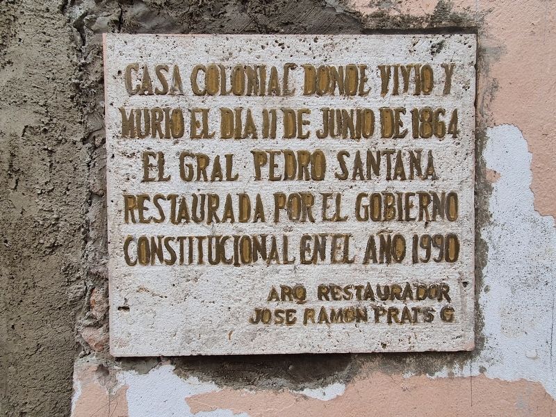
1. General Pedro Santana Marker

Restaurada por el gobierno constitucional en el año 1990
Arq Restaurador Jose Ramon Prats G
Colonial house where General Pedro Santana lived and died on June 11, 1864
Restored by the Constitutional Government in 1990
Restoration Architect Jose Ramon Prats G.
Erected 1990.
Topics. This historical marker is listed in these topic lists: Architecture • Colonial Era • Wars, Non-US. A significant historical date for this entry is June 11, 1864.
Location. 18° 28.468′ N, 69° 53.135′ W. Marker is in San Antón, Distrito Nacional, in Santo Domingo. It is at the intersection of Calle Hostos and Calle Luperon, on the right when traveling south on Calle Hostos. Touch for map. Marker is at or near this postal address: C Hostos 414, San Antón, Distrito Nacional 10212, Dominican Republic. Touch for directions.

Regionally, it is one of the Greater Antilles on the Caribbean Sea, on in the Atlantic Ocean, in North America, and in the Western Hemisphere. Historically, it finds itself in what was once New Spain and also
this page online
Other nearby markers. At least 8 other markers are within walking distance of this marker: Hospital San Nicolas de Bari (within shouting distance of this marker); Ruins of the Temple and Hospital of San Nicolas de Bari (within shouting distance of this marker); Santa Maria, Virgin of Altagracia (within shouting distance of this marker); José Martí in Santo Domingo (about 90 meters away, measured in a direct line); Manuel Aurelio Tavarez Justo (about 120 meters away); First Municipal Council in the Americas (about 150 meters away); First Neighbors of Santo Domingo (about 150 meters away); First City Hall in the Americas (about 180 meters away).
Also see . . . General Pedro Santana at Wikipedia. (Submitted on March 4, 2023, by J. Makali Bruton of Washington, District of Columbia.)
Photographed by J. Makali Bruton, October 15, 2022
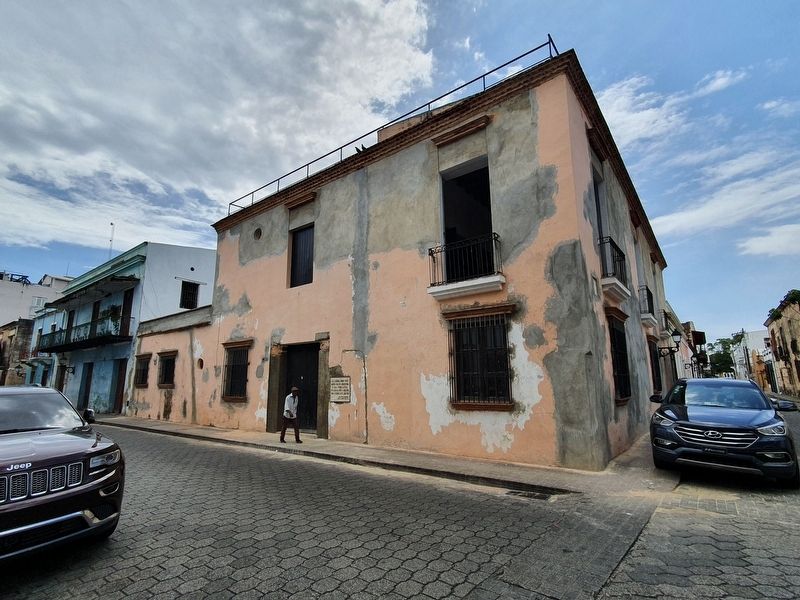
2. General Pedro Santana Marker
The marker is on a building once known as "Casa Italia".
Credits. This page was last revised on November 1, 2025. It was originally submitted on March 4, 2023, by J. Makali Bruton of Washington, District of Columbia. This page has been viewed 144 times since then and 32 times this year. Photos: 1, 2. submitted on March 4, 2023, by J. Makali Bruton of Washington, District of Columbia.
