
Hodgmans Daytona in Daytona Beach in Volusia County, Florida — The American South (South Atlantic)
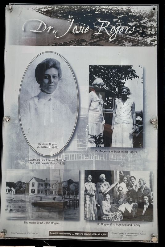
Dr. Josie Rogers
The City of Daytona Beach and DJ Moyer’s Electrical Service, Inc.
Photographed by Brandon D Cross, October 13, 2022
1. Dr. Josie Rogers Marker
(b. 1886 - d. 1975)
Daytona’s First Female Physician and First Female Mayor (1922)
The House of Dr. Josie Rogers
Dr. Rogers and Sister Mabel Rogers
Dr. Rogers (2nd from left) and Family
Photos provided by Halifax Historical Museum and Dr. Roger's Family
Erected by The City of Daytona Beach and DJ Moyer’s Electrical Service, Inc.
Topics. This historical marker is listed in these topic lists: Science & Medicine • Women. A significant historical year for this entry is 1922.
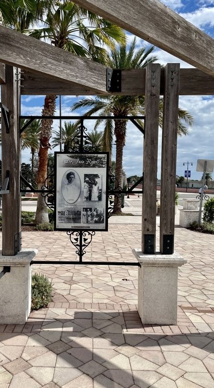
Location. 29° 12.742′ N, 81° 1.187′ W. Marker is in Daytona Beach, Florida, in Volusia County. It is in Hodgmans Daytona. It is at the intersection of North Beach Street and West International Speedway Boulevard (U.S. 92), on the right when traveling south on North Beach Street. The marker is located within the Downtown Daytona Beach Plaza. Touch for map. Marker is at or near this postal address: 108 North Beach Street, Daytona Beach FL 32114, United States of America. Touch for directions.

Regionally, this marker is in Florida’s First Coast. It is also in the American South. Globally, it is in the North Atlantic Region, North America, a Gulf of Mexico state, the Western Hemisphere, the Western World, and the Anglosphere. Historically, it finds itself in what was once New Spain, the territory of the Mississippian Culture, one of the Confederate States of America, and the Antebellum South.
Other nearby markers. At least 8 other markers are within walking distance of this marker: Halifax Harbor District (here, next to this marker); Esplanade District (here, next to this marker); Nature District (here, next to this marker); City Docks District (here, next to this marker); Arts District (here, next to this marker); 132 North Beach Street (within shouting distance of this marker);
this page online
More about this marker. The Riverfront Park Master Plan, developed as a collaborative effort involving the citizens and business community of Daytona Beach is divided into five districts representing Nature, the Arts, the historic Esplanade, the City Docks and the Halifax Harbor.
Also see . . .
1. Riverfront Master Plan. (Submitted on March 6, 2023, by Brandon D Cross of Flagler Beach, Florida.)
2. Domestic history & daily life in the Sunshine State's pioneer days. (Submitted on March 6, 2023, by Brandon D Cross of Flagler Beach, Florida.)
Photographed by Brandon D Cross, October 13, 2022
2. Dr. Josie Rogers Marker
Credits. This page was last revised on March 6, 2023. It was originally submitted on March 6, 2023, by Brandon D Cross of Flagler Beach, Florida. This page has been viewed 285 times since then and 28 times this year. Photos: 1, 2. submitted on March 6, 2023, by Brandon D Cross of Flagler Beach, Florida. • Bernard Fisher was the editor who published this page.
