Middletown in Frederick County, Virginia — The American South (Mid-Atlantic)
The Enslaved Burial Ground
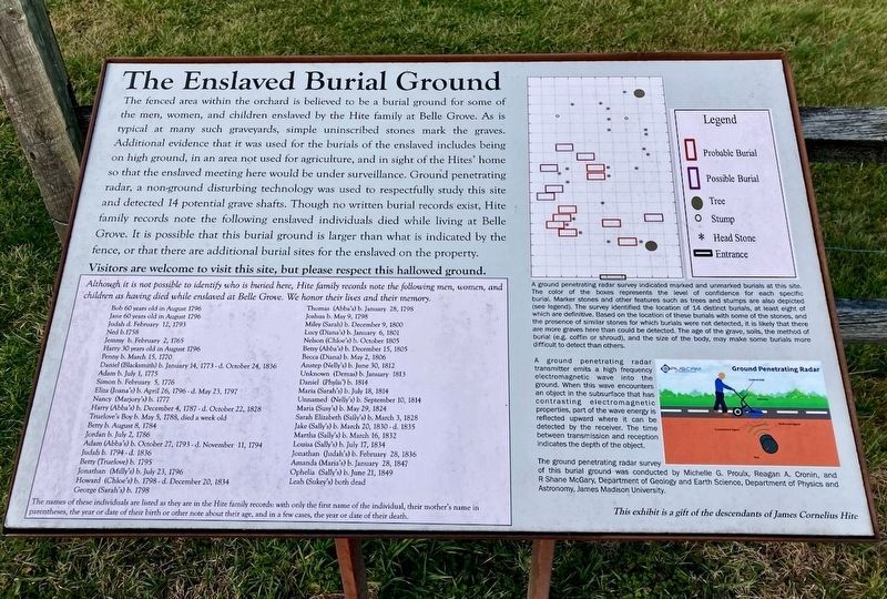
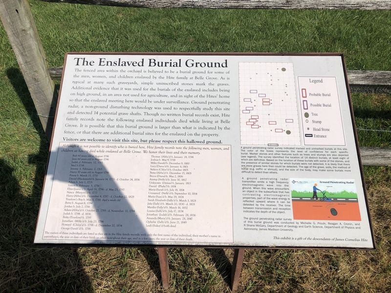
The fenced area within the orchard is believed to be a burial ground for some of the men, women, and children enslaved by the Hite family at Belle Grove. As is typical at many such graveyards, simple uninscribed stones mark the graves. Additional evidence that it was used for the burials of the enslaved includes being on high ground, in an area not used for agriculture, and in sight of the Hites' home so that the enslaved meeting here would be under surveillance. Ground penetrating radar, a non-ground disturbing technology was used to respectfully study this site and detected 14 potential grave shafts. Though no written burial records exist, Hite family records note the following enslaved individuals died while living at Belle Grove. It is possible that this burial ground is larger than what is indicated by the fence, or that there are additional burial sites for the enslaved on the property.
Visitors are welcome to visit this site, but please respect this hallowed ground.
Although it is not possible to identify who is buried here, Hite family records note the following men, women, and children as having died while enslaved at Belle Grove. We honor their lives and their memory.
Bob 60 years old in August 1796 Jane 60 years old in August 1796 Juda d. February 12, 1793 Ned b. 1758 Jemmy b February 2, 1765 Harry 30 years old in August 1796 Penny b. March 15, 1770 Daniel (Blacksmith) b. January 14, 1773 - d. October 24, 1836 Adam b. July 1, 1775 Simon b. February 5, 1776 Eliza (Joana's) b. April 26, 1796 - d. May 23, 1797 Nancy (Marjory's) b. 1777 Harry (Abba's) b. December 4, 1787 - d. October 22, 1828 Truelove's Boy b. May 5, 1788, died a week old Betty b. August 8, 1784 Jordan b. July 2, 1786 Betty (Truelove) b. 1795 Jonathan (Milly's) b. July 23, 1796 Howard (Chloe's) b. 1798 - d. December 20, 1834 George (Sarah's) b. 1798
Thomas (Abba's) b. January 28, 1798 Joshua b. May 9, 1798 Miley (Sarah) b. December 9, 1800 Lucy (Diana's) b. July 6, 1801 Nelson (Chloe's) b. October 1805 Betsy (Abba's) b. December 15, 1805 Becca (Diana) b. May 2, 1806 Antsep (Nelly's) b. June 30, 1812 Unknown (Demas) b. January 1813 Daniel (Phylis') b. 1814 Maria (Sarah's) b. July 18, 1814 Unnamed (Nelly's) b. September 10, 1814 Maria (Susy's) b. May 29, 1824 Sara Elizabeth (Sally's) b. March 3, 1828 Jake (Sally's) b. March 20, 1830 - d. 1835 Martha (Sally's) b. March 16, 1832 Louisa (Sally's) b. July 17, 1834 Jonathan (Judah's) b. February 28, 1836 Amanda (Maria's) b. January 28, 1847 Ophelia (Sally's) b. June21, 1849 Lea (Sukey's) both dead
The names of these individuals are listed as they are in the Hite family records: with only the first name of the individual, their mother's name in parentheses, the year or date of their birth or other note about their age, and in a few cases, the year or date of their death.
[Captions:]
A ground penetrating radar survey indicated marked and unmarked burials at this site. The color of the boxes represents the level of confidence for each specific burial. Marker stones and other features such as trees and stumps are also depicted (see legend). The survey identified the location of 14 distinct burials, at least eight of which are definitive. Based on the location of these burials with some of the stones, and the presence of similar stones for which burials were not detected, it is likely that there are more graves here than could be detected. The age of the grave, soils, the method of burial (e.g. coffin or shroud), and the size of the body, may make some burials more difficult to detect than others.
A ground penetrating radar transmitter emits a high frequency electromagnetic wave into the ground. When this wave encounters an object in the subsurface that has contrasting electromagnetic properties, part of the wave energy is reflected upward where it can be detected by the receiver.

Photographed By Devry Becker Jones (CC0), October 23, 2020
3. The Enslaved Burial Ground Marker
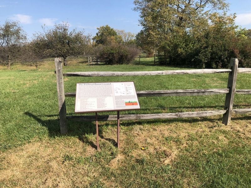
The burial ground is inside the fencing.
The ground penetrating radar survey of this burial ground was conducted by Michelle G. Proulx, Reagan A. Cronin, and R Shane McGary, Department of Geology and Earth Science, Department of Physics and Astronomy, James Madison University.
This exhibit is a gift of the descendants of James Cornelius Hite
Erected by the descendants of James Cornelius Hite.
Topics. This historical marker is listed in these topic lists: African Americans • Cemeteries & Burial Sites • Colonial Era. A significant historical date for this entry is January 14, 1773.
Location. 39° 1.323′ N, 78° 18.231′ W. Marker is in Middletown, Virginia, in Frederick County. Marker is on Belle Grove Road (Virginia Route 727) 0.2 miles south of Meadow Mills Road (Virginia Route 624), on the right when traveling north. Touch for map. Marker is at or near this postal address: 336 Belle Grove Rd, Middletown VA 22645, United States of America. Touch for directions.
Other nearby markers. At least 8 other markers are within walking distance of this marker. Plantation Slavery (within shouting distance of this marker); The Shenandoah Valley / Battle of Cedar Creek, October 19, 1864 (about 400 feet away, measured in a direct line); A Rich Prize (about 400 feet away); Outflanked! (about 400 feet away); Old Hall at Belle Grove (about 400 feet away); In Honor of Joist Hite (1685-1761) (about 500 feet away); Enslaved Quarter Site (about 500 feet away); Cedar Creek Battlefield and Belle Grove (about 500 feet away). Touch for a list and map of all markers in Middletown.
Additional commentary.
1. Reason for documenting the mother's name
Prior to the abolition of slavery, whether a person was enslaved or free mirrored the mother's status.
— Submitted October 24, 2020, by Devry Becker Jones of Washington, District of Columbia.
Additional keywords. enslaved persons, slave labor, human trafficking, slavery
Credits. This page was last revised on March 8, 2023. It was originally submitted on October 24, 2020, by Devry Becker Jones of Washington, District of Columbia. This page has been viewed 167 times since then and 13 times this year. Last updated on March 7, 2023, by Linda Walcroft of Woodstock, Virginia. Photos: 1. submitted on March 7, 2023, by Linda Walcroft of Woodstock, Virginia. 2, 3. submitted on October 24, 2020, by Devry Becker Jones of Washington, District of Columbia. • J. Makali Bruton was the editor who published this page.

