
Richmond in Madison County, Kentucky — The American South (East South Central)
Site of Fort Twetty
March 25-April 1, 1775
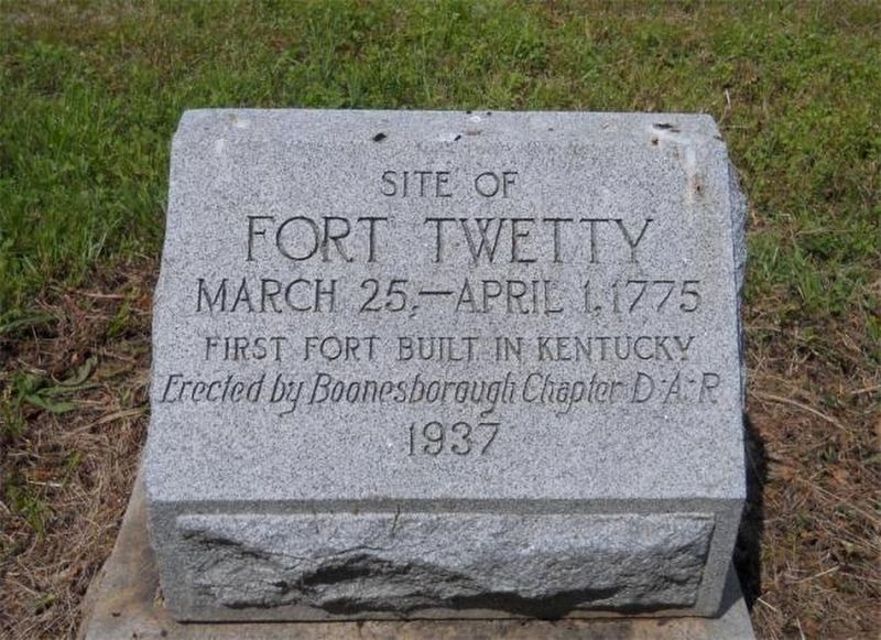
Photograph from Boonesbough Chapter DAR
1. Fort Twetty (Fort Twitty) Marker
Erected 1937 by Boonesborough Chapter DAR.
Topics and series. This historical marker is listed in these topic lists: Colonial Era • Exploration • Forts and Castles • Indigenous Peoples and Communities. In addition, it is included in the Daughters of the American Revolution (DAR) series list. A significant historical date for this entry is March 25, 1775.
Location. 37° 42.437′ N, 84° 16.807′ W. Marker is in Richmond, Kentucky, in Madison County. It can be reached from the intersection of Golden Leaf Boulevard and Cady Drive. Turn right into the Golden Leaf subdivision. Go north about one half mile to the intersection of Golden Leaf Boulevard and Cady Drive. Touch for map. Marker is in this post office area: Richmond KY 40475, United States of America. Touch for directions.

Regionally, this marker is in the American South, specifically in the Upper South, in Appalachia, and specifically in Southern Appalachia. Globally, it is in North America, the Western Hemisphere, the Western World, and the Anglosphere. Historically, it finds itself in what was once the territory of the Mississippian
this page online
Other nearby markers. At least 8 other markers are within walking distance of this marker: Race to Richmond (approx. 0.7 miles away); Battle of Richmond, Ky. (approx. 0.7 miles away); Twitty's or Little Fort (approx. 0.7 miles away); Fort Estill (approx. 0.7 miles away); Daniel Boone's Trace (approx. 0.7 miles away); Daniel Boone's Trail (approx. 0.7 miles away); "Defeat and Destruction Seemed Inevitable" (approx. one mile away); "Rally, boys! Rally to the Colors!" (approx. one mile away). Touch for a list and map of all markers in Richmond.
More about this marker. First fort built in Kentucky by Boone’s trailblazing party while they constructed Boone Trace in the spring of 1775.
Regarding Site of Fort Twetty. Native American attack Daniel Boone’s trailblazing party while they constructed Boone Trace in the spring of 1775.
Boone and his men camped at this location on Taylor’s Fork of Silver Creek on the night of March 24, 1775. The party mistakenly believed the potential for attack was minimal at this point in their journey. Therefore, they failed to post guards around their bivouac. In the early morning hours of March 25, while the party slept, shots were fired into the camp.
One shot went through the knees of Captain William Twitty (sometimes spelled Twetty). Although grievously wounded, he did not die immediately. However, Twitty’s slave, Sam, was killed instantly and fell into the campfire. Twitty was then rushed by an attacker who attempted to take his scalp. Twitty was temporarily saved by his bulldog, which was tomahawked to death in the process. Another member of the party, Felix Walker, was severely injured but eventually survived. Fearing for their lives, Boone and the other campers made an escape by fleeing into the dark wilderness. The surprise attack ended as suddenly as it had begun. After taking a couple of horses the Native Americans disappeared into the woods and the road cutters cautiously returned to the campsite at first light.
The injuries to Twitty and Walker were so severe that they could not be transported safely. A temporary log shelter was constructed for their comfort and as a protective defensive position for the rest of the party. Within a few days, Twitty died and was buried along with Sam at the site. The temporary structure became known as “Twitty’s Fort” or “The Little Fort” and continued to exist for many years. The location appeared on period court documents and early surveys and was used as a directional reference point.
Additional keywords. DAR
Credits. This page was last revised on September 11, 2025. It was originally submitted on March 8, 2023. This page has been viewed 850 times since then and 83 times this year. Photo 1. submitted on March 8, 2023. • James Hulse was the editor who published this page.
Editor’s want-list for this marker. A photo of the marker and the surrounding area in context. • Can you help?
