
Fredericksburg, Virginia — The American South (Mid-Atlantic)
Germania Mill: Recovering from the Civil War
Fredericksburg: Timeless
Photographed by Bernard Fisher, June 19, 2016
1. Germania Mill: Recovering from the Civil War Marker
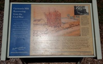
In front of you stood the Germania Mill, built in 1866 by Myer and Frederick Brulle. Both men were immigrant German confectioners who teamed up after the Civil War to became millers.
Fredericksburg’s upper canal powered this enterprise and Germania Mills Brand Flour was shipped as far as New York, Philadelphia, Baltimore, Richmond, and South America.
Business flourished well into the twentieth century and the concrete grain elevator was added in 1917. The days of water powered milling, however, were ending. More cost effective processing elsewhere relegated this once busy industrial building to use as a storage facility. A fire reduced it to a ruin in 1980 and it was fully demolished in 2010.
(sidebar)
Germania Mill, Inc
Manufacturers of High Class Brands of Flour and Meal From Choice Wheat and Corn
Choice Superlative and XXXXX
Extra Germania Flour, Family, Meal, All Water Ground.
—(Advertisement from The Daily Star, Feb. 28, 1917)
(captions)
This 1968 photo shows the old Germania Mill still intact on Caroline Street. In the foreground is the one story City Electric Light Works (inactive since 1919)
this page online
This drawing by Gustavus Erickson depicts an 1876 fire that destroyed much of the original mill. Myer and Brulle quickly rebuilt and remained in operation for several more decades. (Image courtesy of the Fredericksburg Area Museum and Cultural Center)
Erected by Fredericksburg Economic Development and Tourism Office.
Topics and series. This historical marker is listed in these topic lists: Industry & Commerce • Man-Made Features • War, US Civil • Waterways & Vessels. In addition, it is included in the Virginia, Fredericksburg: Timeless. series list.
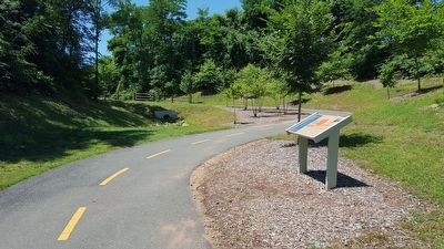
Location. 38° 18.733′ N, 77° 27.926′ W. Marker is in Fredericksburg, Virginia. It can be reached from Caroline Street west of Ford Street, on the left when traveling west. Located along the River Heritage Trail. Touch for map. Marker is in this post office area: Fredericksburg VA 22401, United States of America. Touch for directions.

Regionally, this marker is in the Washington
Photographed by Bernard Fisher, June 19, 2016
2. River Heritage Trail
Other nearby markers. At least 8 other markers are within walking distance of this marker: Hydroelectricity Brings Changes to Fredericksburg (here, next to this marker); Rappahannock River Heritage Trail (about 400 feet away, measured in a direct line); Water Powered Industries (about 700 feet away); Carl's (approx. ¼ mile away); French John's Wharf (approx. ¼ mile away); Walker-Grant High School Class of 1950 Stages Graduation Protest at Fredericksburg Community Center (approx. ¼ mile away); A Canal Defines Its Neighborhood (approx. ¼ mile away); Elmhurst (approx. 0.3 miles away). Touch for a list and map of all markers in Fredericksburg.
Other markers no longer nearby. A Walking Tour of Fredericksburg’s Historic Old Mill District (was within shouting distance of this marker but has been permanently removed); A Canal Defines its Neighborhood (was approx. ¼ mile away but has been replaced with another marker now near it).
Credits. This page was last revised on March 15, 2023. It was originally submitted on June 20, 2016, by Bernard Fisher of Richmond, Virginia. This page has been viewed 1,533 times since then and 137 times this year. Last updated on March 15, 2023, by Carl Gordon Moore Jr. of North East, Maryland. Photos: 1, 2. submitted on June 20, 2016, by Bernard Fisher of Richmond, Virginia.
