Fort Davis in Jeff Davis County, Texas — The American South (West South Central)
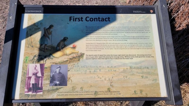
First Contact
Fort Davis National Historic Site
March 18 & 19 - Encamped among the Apache villages and on the lookout for attack all night, we learned from a Mexican captive that a war talk had been held by the Indians. Gomez was only prevented by the refusal of the chiefs Cigarito and Chino Guero from attacking us as we lay in camp...We set out from this village.
Tuesday March 20 - Along the Indian trail, which wild roses grew luxuriantly, we reached a brook I named the Limpia. Indian signals became frequent in the direction we had come I had no doubt Gomez was moving his other bands. Our animals were staked out and camp fires lit as if we intended to camp. About eight at night we saddled up and headed west instead of on the southern trail toward Presidio. No man spoke. I may live a long time yet, but I shall never forget the still and oppressive hours of that somber march.
The Apache spies lit signal fires when the troops night march was discovered. All evening more fires were lit upon other signal hills passing the message along. Whiting's party made good their escape, they traveled eighteen miles that night for fear of attack from the Indian chief.
The text is paraphrased from the Journal of William Henry Chase Whiting, Exploring Southwestern Trails 1846-1854, edited by Ralph Bieber in collaboration with Averam B. Bender, 1938. pp 270-280.
Photos
Left: Lieutenant William H. C. Whiting
2nd Left: Lieutenant William Smith
Erected by National Park Service - US Department of the Interior.
Topics. This historical marker is listed in these topic lists: Forts and Castles • Native Americans • Wars, US Indian. A significant historical date for this entry is March 17, 1849.
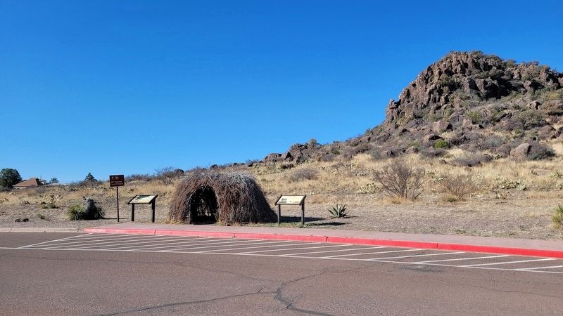
Location. 30° 35.791′ N, 103° 53.504′ W. Marker is in Fort Davis, Texas, in Jeff Davis County. Marker can be reached from the intersection of Lt. Henry Flipper Drive and State Street (State Highway 17). The marker is located in the parking lot near thr entrance to the historic Fort Davis. Touch for map. Marker is at or near this postal address: 101 Lt Henry Flipper Drive, Fort Davis TX 79734, United States of America. Touch for directions.
Other nearby markers. At least 8
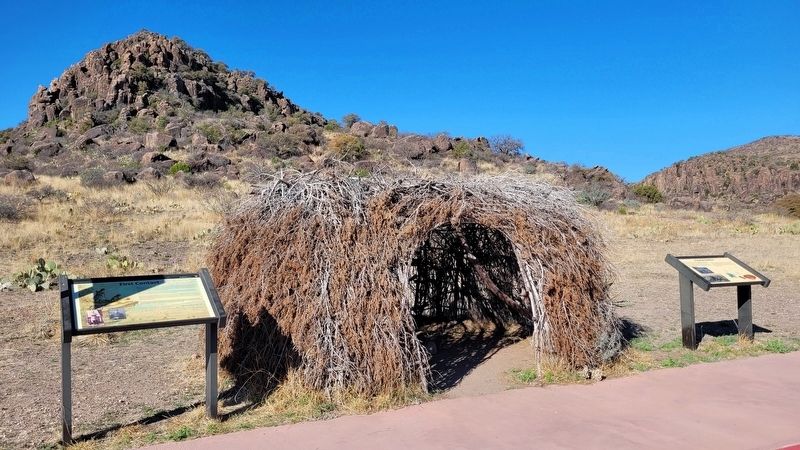
other markers are within walking distance of this marker. Food & Shelter (here, next to this marker); Fort Davis (within shouting distance of this marker); Legend - Fort Davis (about 600 feet away, measured in a direct line); The First Fort Davis (about 700 feet away); Sick Call (about 700 feet away); a different marker also named Fort Davis (approx. 0.2 miles away); a different marker also named Fort Davis (approx. 0.2 miles away); Commanding Officer's Quarters (approx. 0.2 miles away). Touch for a list and map of all markers in Fort Davis.
More about this marker. The fort and the markers are located on the grounds of the Fort Davis National Historic Site which requires a small entrance fee to access.
Also see . . . Fort Davis: Frontier Post. National Park Service
A key post in the defense system of western Texas, Fort Davis played a major role in the history of the Southwest. From 1854 until 1891, troops stationed at the post protected emigrants, freighters, mail coaches, and travelers on the San Antonio-El Paso Road hoping to reach the gold fields of California. Today, Fort Davis is considered one of the best remaining examples of a frontier military post in the American Southwest. It is a vivid reminder of the significant role played by the military in the settlement and development of the western frontier. Named for Secretary of War Jefferson Davis, the fort was first garrisoned by Lieutenant Colonel Washington Seawell and six companies of the Eighth U.S. Infantry. The post was located in a box canyon near Limpia Creek on the eastern side of the Davis Mountains--where wood, water, and grass were plentiful. From 1854 to 1861, troops of the Eighth Infantry spent much of their time in the field pursuing Comanches, Kiowas, and Apaches.(Submitted on March 18, 2023, by James Hulse of Medina, Texas.)
Credits. This page was last revised on March 18, 2023. It was originally submitted on March 18, 2023, by James Hulse of Medina, Texas. This page has been viewed 100 times since then and 24 times this year. Photos: 1, 2, 3. submitted on March 18, 2023, by James Hulse of Medina, Texas.


